Agulsky District

Last updated • 1 min readFrom Wikipedia, The Free Encyclopedia
Agulsky District
Агульский район
Other transcription(s)
   Aghul Агъул район
   Dargwa Агъулла къатI
Agul'skii raion.jpg
Mountains in Agulsky District
Flag of Aghuls.svg
Agulsky District
Location of Agulsky District in the Republic of Dagestan
Coordinates: 41°47′N47°36′E / 41.783°N 47.600°E / 41.783; 47.600
CountryRussia
Federal subject Republic of Dagestan [1]
Established1934 OOjs UI icon edit-ltr-progressive.svg
Administrative center Tpig [1]
Area
  Total
793.5 km2 (306.4 sq mi)
Population
  Total
11,204
  Density14/km2 (37/sq mi)
   Urban
0%
   Rural
100%
Administrative structure
   Administrative divisions 6 Selsoviets
   Inhabited localities [3] 19 rural localities
Municipal structure
   Municipally incorporated asAgulsky Municipal District [4]
   Municipal divisions [4] 0 urban settlements, 10 rural settlements
Time zone UTC+3 (MSK   OOjs UI icon edit-ltr-progressive.svg [5] )
OKTMO ID82601000
Website http://www.mo-agul.ru
Population of Agulsky District
2010 Census 11,204 [2]
2002 Census 11,290 [6]
1989 Census 7,315 [7]
1979 Census 9,721 [8]

Agulsky District (Russian : Агу́льский райо́н) is an administrative [1] and municipal [4] district (raion), one of the forty-one in the Republic of Dagestan, Russia. It is located in the south of the republic. The area of the district is 793.5 square kilometers (306.4 sq mi).[ citation needed ] Its administrative center is the rural locality (a selo ) of Tpig. [1] As of the 2010 Census, the total population of the district was 11,204, with the population of Tpig accounting for 24.4% of that number. [2]

Contents

Administrative and municipal status

Within the framework of administrative divisions, Agulsky District is one of the forty-one in the Republic of Dagestan. [1] The district is divided into six selsoviets which comprise nineteen rural localities. [3] As a municipal division, the district is incorporated as Agulsky Municipal District. [4] Its six selsoviets are incorporated as ten rural settlements within the municipal district. [4] The selo of Tpig serves as the administrative center of both the administrative [1] and municipal [9] district.

Related Research Articles

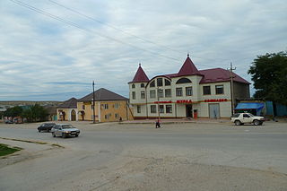
Yuzhno-Sukhokumsk is a town in the Republic of Dagestan, Russia, located on the Sukhaya Kuma River, 295 kilometers (183 mi) northwest of Makhachkala. Population: 10,035 (2010 Census); 9,777 (2002 Census); 12,246 (1989 Soviet census).

<span class="mw-page-title-main">Akhtynsky District</span> District in Republic of Dagestan, Russia

Akhtynsky District is an administrative and municipal district (raion), one of the forty-one in the Republic of Dagestan, Russia. It is located in the south of the republic and borders with Rutulsky, Kurakhsky, Magaramkentsky, and Dokuzparinsky Districts; in the southwest it has a 62-kilometer (39 mi) long border with Azerbaijan. The area of the district is 1,120 square kilometers (430 sq mi). Its administrative center is the rural locality of Akhty. As of the 2010 Census, the total population of the district was 32,604, with the population of Akhty accounting for 41.1% of that number.

<span class="mw-page-title-main">Babayurtovsky District</span> District in Republic of Dagestan, Russia

Babayurtovsky District is an administrative and municipal district (raion), one of the forty-one in the Republic of Dagestan, Russia. It is located in the northern central part of the republic. The area of the district is 3,262.3 square kilometers (1,259.6 sq mi). Its administrative center is the rural locality of Babayurt. As of the 2010 Census, the total population of the district was 45,701, with the population of Babayurt accounting for 33.3% of that number.

<span class="mw-page-title-main">Botlikhsky District</span> District in Republic of Dagestan, Russia

Botlikhsky District is an administrative and municipal district (raion), one of the forty-one in the Republic of Dagestan, Russia. It is located in the west of the republic. The area of the district is 500 square kilometers (190 sq mi). Its administrative center is the rural locality of Botlikh. As of the 2010 Census, the total population of the district was 54,322, with the population of Botlikh accounting for 22.4% of that number.

<span class="mw-page-title-main">Buynaksky District</span> District in Republic of Dagestan, Russia

Buynaksky District is an administrative and municipal district (raion), one of the forty-one in the Republic of Dagestan, Russia. It is located in the center of the republic. The area of the district is 1,842.09 square kilometers (711.23 sq mi). Its administrative center is the town of Buynaksk. As of the 2010 Census, the total population of the district was 73,402.

<span class="mw-page-title-main">Charodinsky District</span> District in Republic of Dagestan, Russia

Charodinsky District is an administrative and municipal district (raion), one of the forty-one in the Republic of Dagestan, Russia. It is located in the south of the republic. The area of the district is 1,010 square kilometers (390 sq mi). Its administrative center is the rural locality of Tsurib. As of the 2010 Census, the total population of the district was 11,777, with the population of Tsurib accounting for 19.0% of that number.

<span class="mw-page-title-main">Dakhadayevsky District</span> District in Republic of Dagestan, Russia

Dakhadayevsky District is an administrative and municipal district (raion), one of the forty-one in the Republic of Dagestan, Russia. It is located in the southern central part of the republic. The area of the district is 1,450 square kilometers (560 sq mi). Its administrative center is the rural locality of Urkarakh. As of the 2010 Census, the total population of the district was 36,709, with the population of Urkarakh accounting for 12.0% of that number.

<span class="mw-page-title-main">Gergebilsky District</span> District in Republic of Dagestan, Russia

Gergebilsky District is an administrative and municipal district (raion), one of the forty-one in the Republic of Dagestan, Russia. It is located in the center of the republic. The area of the district is 341.9 square kilometers (132.0 sq mi). Its administrative center is the rural locality of Gergebil. As of the 2010 Census, the total population of the district was 19,910, with the population of Gergebil accounting for 26.1% of that number.

<span class="mw-page-title-main">Kaytagsky District</span> District in Republic of Dagestan, Russia

Kaytagsky District is an administrative and municipal district (raion), one of the forty-one in the Republic of Dagestan, Russia. It is located in the southeast of the republic. The area of the district is 678.24 square kilometers (261.87 sq mi). Its administrative center is the rural locality of Madzhalis. As of the 2010 Census, the total population of the district was 31,368, with the population of Madzhalis accounting for 21.7% of that number.

<span class="mw-page-title-main">Khunzakhsky District</span> District in Republic of Dagestan, Russia

Khunzakhsky District is an administrative and municipal district (raion), one of the forty-one in the Republic of Dagestan, Russia. It is located in the western central part of the republic. The area of the district is 551.91 square kilometers (213.09 sq mi). Its administrative center is the rural locality of Khunzakh. As of the 2010 Census, the total population of the district was 31,691, with the population of Khunzakh accounting for 13.4% of that number.

<span class="mw-page-title-main">Kulinsky District</span> District in Republic of Dagestan, Russia

Kulinsky District is an administrative and municipal district (raion), one of the forty-one in the Republic of Dagestan, Russia. It is located in the south of the republic. The area of the district is 649 square kilometers (251 sq mi). Its administrative center is the rural locality of Vachi. As of the 2010 Census, the total population of the district was 11,174, with the population of Vachi accounting for 7.3% of that number.

<span class="mw-page-title-main">Rutulsky District</span> District in Republic of Dagestan, Russia

Rutulsky District is an administrative and municipal district (raion), one of the forty-one in the Republic of Dagestan, Russia. It is located in the south of the republic. The area of the district is 2,170 square kilometers (840 sq mi). Its administrative center is the rural locality of Rutul. As of the 2010 Census, the total population of the district was 22,926, with the population of Rutul accounting for 18.0% of that number.

<span class="mw-page-title-main">Levashinsky District</span> District in Republic of Dagestan, Russia

Levashinsky District is an administrative and municipal district (raion), one of the forty-one in the Republic of Dagestan, Russia. It is located in the center of the republic. The area of the district is 830 square kilometers (320 sq mi). Its administrative center is the rural locality of Levashi. As of the 2010 Census, the total population of the district was 70,704, with the population of Levashi accounting for 14.2% of that number.

Belidzhi is an urban locality in Derbentsky District of the Republic of Dagestan, Russia. As of the 2010 Census, its population was 12,236.

<span class="mw-page-title-main">Mamedkala</span> Urban-type settlement in Dagestan, Russia

Mamedkala is an urban locality in Derbentsky District of the Republic of Dagestan, Russia. As of the 2010 Census, its population was 11,029.

Tpig is a rural locality and the administrative center of Agulsky District of the Republic of Dagestan, Russia. Population: 2,730 (2010 Census); 2,637 (2002 Census); 1,689 (1989 Soviet census).

Karata is a rural locality and the administrative center of Akhvakhsky District of the Republic of Dagestan, Russia. Population: 4,153 (2010 Census); 4,519 (2002 Census); 2,591 (1989 Soviet census).

<span class="mw-page-title-main">Babayurt</span> Rural locality in Dagestan, Russia

Babayurt is a rural locality and the administrative center of Babayurtovsky District of the Republic of Dagestan, Russia. Population: 15,227 (2010 Census); 12,943 (2002 Census); 12,737 (1989 Soviet census).

<span class="mw-page-title-main">Rutul (rural locality)</span> Rural locality in Dagestan, Russia

Rutul is a rural locality and the administrative center of Rutulsky District of the Republic of Dagestan, Russia. Population: 4,132 (2010 Census); 3,958 (2002 Census); 2,957 (1989 Soviet census).

<span class="mw-page-title-main">Sergokala</span> Rural locality in Dagestan, Russia

Sergokala is a rural locality and the administrative center of Sergokalinsky District of the Republic of Dagestan, Russia. Population: 8,143 (2010 Census); 7,627 (2002 Census); 5,591 (1989 Soviet census).

References

Notes

  1. 1 2 3 4 5 6 Law #16
  2. 1 2 3 Russian Federal State Statistics Service (2011). Всероссийская перепись населения 2010 года. Том 1 [2010 All-Russian Population Census, vol. 1]. Всероссийская перепись населения 2010 года [2010 All-Russia Population Census] (in Russian). Federal State Statistics Service.
  3. 1 2 Государственный комитет Российской Федерации по статистике. Комитет Российской Федерации по стандартизации, метрологии и сертификации. №ОК 019-95 1 января 1997 г. «Общероссийский классификатор объектов административно-территориального деления. Код 82 201», в ред. изменения №278/2015 от 1 января 2016 г.. (State Statistics Committee of the Russian Federation. Committee of the Russian Federation on Standardization, Metrology, and Certification. #OK 019-95 January 1, 1997 Russian Classification of Objects of Administrative Division (OKATO). Code 82 201 , as amended by the Amendment #278/2015 of January 1, 2016. ).
  4. 1 2 3 4 5 Law #6
  5. "Об исчислении времени". Официальный интернет-портал правовой информации (in Russian). June 3, 2011. Retrieved January 19, 2019.
  6. Federal State Statistics Service (May 21, 2004). Численность населения России, субъектов Российской Федерации в составе федеральных округов, районов, городских поселений, сельских населённых пунктов – районных центров и сельских населённых пунктов с населением 3 тысячи и более человек [Population of Russia, Its Federal Districts, Federal Subjects, Districts, Urban Localities, Rural Localities—Administrative Centers, and Rural Localities with Population of Over 3,000](XLS). Всероссийская перепись населения 2002 года [All-Russia Population Census of 2002] (in Russian).
  7. Всесоюзная перепись населения 1989 г. Численность наличного населения союзных и автономных республик, автономных областей и округов, краёв, областей, районов, городских поселений и сёл-райцентров [All Union Population Census of 1989: Present Population of Union and Autonomous Republics, Autonomous Oblasts and Okrugs, Krais, Oblasts, Districts, Urban Settlements, and Villages Serving as District Administrative Centers]. Всесоюзная перепись населения 1989 года [All-Union Population Census of 1989] (in Russian). Институт демографии Национального исследовательского университета: Высшая школа экономики [Institute of Demography at the National Research University: Higher School of Economics]. 1989 via Demoscope Weekly.
  8. Всесоюзная перепись населения 1979 г. Национальный состав населения по регионам России [All Union Population Census of 1979. Ethnic composition of the population by regions of Russia](XLS). Всесоюзная перепись населения 1979 года [All-Union Population Census of 1979] (in Russian). 1979 via Demoscope Weekly (website of the Institute of Demographics of the State University—Higher School of Economics.
  9. Федеральная служба государственной статистики. Федеральное агентство по технологическому регулированию и метрологии. №ОК 033-2013 1 января 2014 г. «Общероссийский классификатор территорий муниципальных образований. Код 82 601». (Federal State Statistics Service. Federal Agency on Technological Regulation and Metrology. #OK 033-2013 January 1, 2014 Russian Classification of Territories of Municipal Formations. Code 82 601. ).

Sources