Toab, Orkney

Last updated

Toab
Converted farmhouse - geograph.org.uk - 1076269.jpg
Converted farmhouse, Toab
Orkney Islands UK location map.svg
Red pog.svg
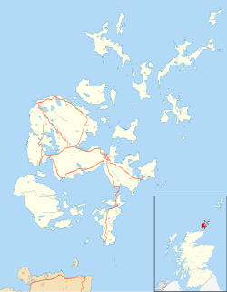
Toab
Location within Orkney
OS grid reference HY510069
Civil parish
Council area
Lieutenancy area
Country Scotland
Sovereign state United Kingdom
Post town ORKNEY
Postcode district KW17
Dialling code 01856
Police Scotland
Fire Scottish
Ambulance Scottish
UK Parliament
Scottish Parliament
List of places
UK
Scotland
58°56′49″N2°51′11″W / 58.947°N 2.853°W / 58.947; -2.853 Coordinates: 58°56′49″N2°51′11″W / 58.947°N 2.853°W / 58.947; -2.853

Toab is a parish on the Orkney Mainland, situated in the East Mainland.

Contents

Toab is located off the A960 road at the head of Deer Sound on the Mainland, Orkney Islands, Scotland. It is thought the name derives from the Norse phrase for the place where visiting ships had to pay a toll. [1]

People from Toab are known as ‘Toaboggans’, although this term is almost never used.

See also

Related Research Articles

<span class="mw-page-title-main">Orkney</span> Archipelago, county and council area in northern Scotland

Orkney, also known as the Orkney Islands, is an archipelago in the Northern Isles of Scotland, situated off the north coast of the island of Great Britain. Orkney is 10 miles (16 km) north of the coast of Caithness and has about 70 islands, of which 20 are inhabited. The largest island, the Mainland, has an area of 523 square kilometres (202 sq mi), making it the sixth-largest Scottish island and the tenth-largest island in the British Isles. Orkney's largest settlement, and also its administrative centre, is Kirkwall.

<span class="mw-page-title-main">Hoy</span> Island in the Orkney Islands group

Hoy is an island in Orkney, Scotland, measuring 143 square kilometres (55 sq mi) – the second largest in the archipelago, after Mainland. A natural causeway, the Ayre, links the island to the smaller South Walls; the two islands are treated as one entity by the UK census. Hoy lies within the parish of Stromness.

<span class="mw-page-title-main">Mainland, Orkney</span> Main island of the Orkney Islands, Scotland

The Mainland, also known as Hrossey and Pomona, is the main island of Orkney, Scotland. Both of Orkney's burghs, Kirkwall and Stromness, lie on the island, which is also the heart of Orkney's ferry and air connections.

<span class="mw-page-title-main">Flotta</span>

Flotta is a small island in Orkney, Scotland, lying in Scapa Flow. The island is known for its large oil terminal and is linked by Orkney Ferries to Houton on the Orkney Mainland, Lyness on Hoy and Longhope on South Walls. The island has a population of 80.

<span class="mw-page-title-main">South Ronaldsay</span>

South Ronaldsay is one of the Orkney Islands off the north coast of Scotland. It is linked to the Orkney Mainland by the Churchill Barriers, running via Burray, Glimps Holm and Lamb Holm.

<span class="mw-page-title-main">Wyre, Orkney</span>

Wyre is one of the Orkney Islands, lying south-east of Rousay. It is 311 hectares (1.20 sq mi) and 32 metres (105 ft) at its highest point. It is one of the smallest inhabited islands in the archipelago.

<span class="mw-page-title-main">Northern Isles</span> Pair of archipelagos near Scotland

The Northern Isles are a pair of archipelagos off the north coast of mainland Scotland, comprising Orkney and Shetland. They are part of Scotland, as are the Hebrides. The climate is cool and temperate and much influenced by the surrounding seas. There are a total of 36 inhabited islands. The landscapes of the fertile agricultural islands of Orkney contrast with the more rugged Shetland islands to the north, where the economy is more dependent on fishing and on the oil wealth of the surrounding seas. Both island groups have a developing renewable energy industry. Both have a Pictish and Norse history. Both were part of the Kingdom of Norway until they were absorbed into the Kingdom of Scotland in the 15th century. They remained part of it until the 1707 formation of the Kingdom of Great Britain and the 1801 formation of the United Kingdom. They both played a significant naval role during the world wars of the 20th century.

<span class="mw-page-title-main">Eynhallow</span>

Eynhallow is a small, presently uninhabited island, part of Orkney, off the north coast of mainland Scotland.

<span class="mw-page-title-main">Orkney (Scottish Parliament constituency)</span> Scottish parliament constituency

Orkney is a constituency of the Scottish Parliament (Holyrood) covering the council area of Orkney. It elects one Member of the Scottish Parliament (MSP) by the first past the post method of election. It is also one of eight constituencies in the Highlands and Islands electoral region, which elects seven additional members, in addition to the eight constituency MSPs, to produce a form of proportional representation for the region as a whole.

<span class="mw-page-title-main">Bishop of Orkney</span>

The Bishop of Orkney was the ecclesiastical head of the Diocese of Orkney, one of thirteen medieval bishoprics of Scotland. It included both Orkney and Shetland. It was based for almost all of its history at St Magnus Cathedral, Kirkwall.

<span class="mw-page-title-main">Orkney vole</span> Subspecies of rodent

The Orkney vole is a population of the common vole found in the Orkney Islands, off the northern coast of Scotland, as well as in the Channel Island of Guernsey. Orkney voles are about 10% larger than voles from other populations of the common vole. The common vole is absent from the rest of the British Isles.

<span class="mw-page-title-main">Orkney Ferries</span>

Orkney Ferries is a Scottish company operating inter-island ferry services in the Orkney Islands. The company operates ferry services across 15 islands.

<span class="mw-page-title-main">Toab, Shetland</span> Human settlement in Scotland

Toab is the southernmost village on Mainland, Shetland, Scotland. It is part of Virkie and overlooks Sumburgh Airport. Toab is within the parish of Dunrossness.

<span class="mw-page-title-main">Orkney Islands Council</span>

The Orkney Islands Council, is the local authority for Orkney, Scotland. It was established in 1975 by the Local Government (Scotland) Act 1973 and was largely unaffected by the Scottish local government changes of the mid-1990s.

<span class="mw-page-title-main">St Andrews, Orkney</span> Human settlement in the Orkney Islands, United Kingdom

St Andrews is a parish on Mainland, Orkney in Scotland. It is located east of the town of Kirkwall and the parish of St Ola and lies north of Holm and west of Deerness. The settlements of Tankerness, Toab and Foubister are in the parish, as is Kirkwall Airport.

Toab may refer to:

<span class="mw-page-title-main">Tankerness</span> Human settlement in Scotland

Tankerness is a district in the St Andrews parish in Mainland, Orkney, Scotland. Essentially a peninsula, it is about 13 kilometres (8 mi) south-east of Kirkwall and 1 kilometre (0.6 mi) east of Kirkwall Airport. The origin of the place name is uncertain, but it may derive from the Norse personal name "Tannskári". A "ness" is a promontory.

References

  1. "Orkney Placenames". Orkneyjar. Retrieved 27 May 2008.