
Ascrea is a comune (municipality) in the Province of Rieti in the Italian region of Latium, located about 50 kilometres (31 mi) northeast of Rome and about 25 kilometres (16 mi) southeast of Rieti.

Borbona is a comune (municipality) in the province of Rieti, in the Italian region of Latium, located about 90 kilometres (56 mi) northeast of Rome and about 25 kilometres (16 mi) northeast of Rieti.
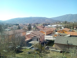
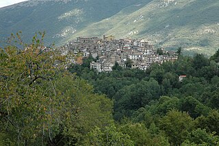
Borgorose is a comune (municipality) in the Province of Rieti in the Italian region of Lazio, located about 70 kilometres (43 mi) northeast of Rome and about 40 kilometres (25 mi) southeast of Rieti.

Casperia is a comune (municipality) in the Province of Rieti in the Italian region of Latium, located about 50 kilometres (31 mi) northeast of Rome and about 20 kilometres (12 mi) southwest of Rieti. As of 31 December 2004, it had a population of 1,164 and an area of 25.4 square kilometres (9.8 sq mi).
Castelnuovo di Farfa is a comune (municipality) in the Province of Rieti in the Italian region of Latium, located about 40 kilometres northeast of Rome and about 20 kilometres (12 mi) southwest of Rieti.

Castel Sant'Angelo is a comune (municipality) in the Province of Rieti in the Italian region of Lazio, located about 70 kilometres (43 mi) northeast of Rome and about 12 kilometres (7 mi) east of Rieti.
Colli sul Velino is a comune (municipality) in the Province of Rieti in the Italian region of Latium, located about 70 kilometres (43 mi) northeast of Rome and about 13 kilometres (8 mi) northwest of Rieti.

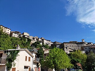
Fiamignano is a comune (municipality) in the Province of Rieti in the Italian region of Latium, located about 70 kilometres (43 mi) northeast of Rome and about 25 kilometres (16 mi) southeast of Rieti. Until 1927 it was part of the Province of L'Aquila, in Abruzzi e Molise.
Forano is a comune (municipality) in the province of Rieti, in the Italian region of Latium, located about 45 kilometres (28 mi) north of Rome and about 25 kilometres (16 mi) southwest of Rieti. As of 31 December 2004, it had a population of 2,697 and an area of 17.5 square kilometres (6.8 sq mi).
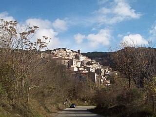
Marcetelli is a comune (municipality) in the Province of Rieti in the Italian region of Latium, located about 60 kilometres (37 mi) northeast of Rome and about 25 kilometres (16 mi) southeast of Rieti.

Paganico Sabino is a comune (municipality) in the Province of Rieti in the Italian region of Latium, located about 50 kilometres (31 mi) northeast of Rome and about 25 kilometres (16 mi) southeast of Rieti.
Poggio Moiano is a comune (municipality) in the Province of Rieti in the Italian region of Latium, located about 45 kilometres (28 mi) northeast of Rome and about 20 kilometres (12 mi) south of Rieti.
Poggio Nativo is a comune (municipality) in the Province of Rieti in the Italian region of Latium, located about 45 kilometres (28 mi) northeast of Rome and about 20 kilometres (12 mi) southwest of Rieti.
Posta is a comune (municipality) in the Province of Rieti in the Italian region of Latium, located about 80 kilometres (50 mi) northeast of Rome and about 25 kilometres (16 mi) northeast of Rieti. As of 31 December 2004, it had a population of 819 and an area of 66.5 square kilometres (25.7 sq mi).
Pozzaglia Sabina is a comune (municipality) in the Province of Rieti in the Italian region of Lazio, located about 50 kilometres (31 mi) northeast of Rome and about 25 kilometres (16 mi) southeast of Rieti.

Scandriglia is a comune (municipality) in the Province of Rieti in the Italian region of Latium, located about 40 kilometres (25 mi) northeast of Rome and about 25 kilometres (16 mi) south of Rieti.
Selci is a comune (municipality) in the Province of Rieti in the Italian region of Latium, located about 45 kilometres (28 mi) north of Rome and about 25 kilometres (16 mi) southwest of Rieti. As of 31 December 2004, it had a population of 1,038 and an area of 7.8 square kilometres (3.0 sq mi).

Stimigliano is a comune (municipality) in the Province of Rieti in the Italian region of Latium, located about 45 kilometres (28 mi) north of Rome and about 25 kilometres (16 mi) southwest of Rieti. As of 1 January 2018, it had a population of 2,321 and an area of 11.4 square kilometres (4.4 sq mi).

Tarano is a comune (municipality) in the Province of Rieti in the Italian region of Latium, located about 50 kilometres (31 mi) north of Rome and about 25 kilometres (16 mi) west of Rieti. On 31 December 2004, it had a population of 1,296 and an area of 20.1 square kilometres (7.8 sq mi).
Turania is a comune (municipality) in the Province of Rieti in the Italian region of Latium, located about 50 kilometres (31 mi) northeast of Rome and about 30 kilometres (19 mi) southeast of Rieti.


