
Amatrice is a town and comune in the province of Rieti, in northern Lazio, and the center of the food-agricultural area of Gran Sasso e Monti della Laga National Park. The town was devastated by a powerful earthquake on 24 August 2016.

Santo Stefano di Sessanio is a comune and hill town in the province of L'Aquila in the Abruzzo region of southern Italy. Located in the Gran Sasso e Monti della Laga National Park, in the highest region of the Apennines, this medieval hill town sits adjacent to the high plain of Campo Imperatore. It is most famous for the regal wedding of local royalty Allegra Boccabella and Boris Cornelissen.
Varazze is a comune (municipality) in the Province of Savona in the Italian region of Liguria, located about 30 kilometres (19 mi) west of Genoa and about 11 kilometres (7 mi) northeast of Savona in the Riviera di Ponente. Nearby in the Ligurian Apennines is the Monte Beigua with its Natural Regional Park.
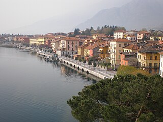
Gravedona ed Uniti is a comune (municipality) in the Province of Como in the Italian region Lombardy, located about 80 kilometres (50 mi) north of Milan and about 40 kilometres (25 mi) northeast of Como.

Matelica is a comune (municipality) of the Province of Macerata in the Italian region of Marche. Located about 60 kilometres (37 mi) southwest of Ancona and 35 kilometres (22 mi) west of Macerata, it extends over an area of 81.04 square kilometres (31.29 sq mi).

Borgo Velino is a comune (municipality) in the Province of Rieti in the region of Latium, Italy. It is located about 70 kilometres (43 mi) northeast of Rome and about 15 kilometres (9 mi) east of the town Rieti. It has an area of 17.3 square kilometres (6.7 sq mi), and as of 31 December 2010 it had a population of 1,004. Until 1927 Borgo Velino was part of the province of L'Aquila in Abruzzo. It is located near the site of a pre- or early-Roman Sabine village named Viario. Rare ruins of this ancient village, now occupied by a cultivated field, were found near a standing medieval tower. Borgo Velino is the birthplace of Giulio Pezzola, a notorious outlaw of the 17th century.

Cittareale is a comune (municipality) in the Province of Rieti in the Italian region of Latium. It is located about 100 kilometres (62 mi) northeast of Rome and 35 kilometres (22 mi) northeast of Rieti.

Collalto Sabino is a comune (municipality) in the Province of Rieti in the Italian region of Latium, located about 50 kilometres (31 mi) northeast of Rome and about 35 kilometres (22 mi) southeast of Rieti.

Fiamignano is a comune (municipality) in the Province of Rieti in the Italian region of Latium, located about 70 kilometres (43 mi) northeast of Rome and about 25 kilometres (16 mi) southeast of Rieti. Until 1927 it was part of the Province of L'Aquila, in Abruzzi e Molise.

Labro is a comune (municipality) in the Province of Rieti in the Italian region of Latium, located about 70 kilometres (43 mi) northeast of Rome and about 15 kilometres (9 mi) northwest of Rieti. It is a touristic destination and has been awarded with the orange flag.
Monteleone Sabino is a comune (municipality) in the Province of Rieti in the Latium region of Italy, located about 45 kilometres (28 mi) northeast of Rome and about 20 kilometres (12 mi) south of Rieti.

Nespolo is a comune (municipality) in the Province of Rieti in the Italian region of Lazio. It is located about 50 kilometres (31 mi) northeast of Rome and about 30 kilometres (19 mi) southeast of Rieti.

Orvinio is a comune (municipality) in the Province of Rieti in the Italian region of Latium, located about 45 kilometres (28 mi) northeast of Rome and about 30 kilometres (19 mi) south of Rieti.
Poggio Catino is a comune (municipality) in the Province of Rieti in the Italian region of Latium, located about 45 kilometres (28 mi) northeast of Rome and about 20 kilometres (12 mi) southwest of Rieti. As of 31 December 2011, it had a population of 1,335 and an area of 15.0 square kilometres (5.8 sq mi).

Poggio Mirteto is a comune (municipality) and former Catholic bishopric in Sabina in the Central Italian region of Latium. Administratively Poggio Mirteto is in the province of Rieti and geographically this municipality is about 45 kilometres (28 mi) northeast of Rome and about 20 kilometres (12 mi) southwest of Rieti.
Rivodutri is a comune (municipality) in the Province of Rieti in the Italian region of Lazio, located about 70 kilometres (43 mi) northeast of Rome and about 13 kilometres (8 mi) north of Rieti.

Rocca Sinibalda is a comune (municipality) in the Province of Rieti in the Italian region Lazio, located about 50 kilometres (31 mi) northeast of Rome and about 15 kilometres (9 mi) southeast of Rieti.

Scandriglia is a comune (municipality) in the Province of Rieti in the Italian region of Latium, located about 40 kilometres (25 mi) northeast of Rome and about 25 kilometres (16 mi) south of Rieti.

Polistena is a comune (municipality) in the Metropolitan City of Reggio Calabria in the Italian region Calabria, located about 70 kilometres (43 mi) southwest of Catanzaro and about 50 kilometres (31 mi) northeast of Reggio Calabria.
Santa Margherita di Belice is a town in the Province of Agrigento in the Italian region of Sicily. It lies in southwest Sicily, 400 metres (1,300 ft) above sea level, near where the borders of the Province of Agrigento, Province of Trapani and Province of Palermo meet. It is approximately 60 kilometres (37 mi) southwest of the city of Palermo, 60 kilometres (37 mi) northwest of the city of Agrigento and sits in the Belice valley among the rivers Belice, Senore and Carboj.


