
Markham is a city in York Region, Ontario, Canada. It is approximately 30 km (19 mi) northeast of Downtown Toronto. In the 2021 Census, Markham had a population of 338,503, which ranked it the largest in York Region, fourth largest in the Greater Toronto Area (GTA), and 16th largest in Canada.

Thornhill is a suburban district in the Regional Municipality of York in Ontario, Canada. The western portion of Thornhill is within the City of Vaughan and its eastern portion is within the City of Markham, with Yonge Street forming the boundary between Vaughan and Markham. Thornhill is situated along the northern border of Toronto, centred on Yonge, and is also immediately south of the City of Richmond Hill. Once a police village, Thornhill is still a postal designation. As of 2016, its total population, including both its Vaughan and Markham sections, was 112,719.

The Don River is a watercourse in southern Ontario that empties into Lake Ontario, at Toronto Harbour. Its mouth was just east of the street grid of the town of York, Upper Canada, the municipality that evolved into Toronto, Ontario. The Don is one of the major watercourses draining Toronto that have headwaters in the Oak Ridges Moraine.

Whitchurch-Stouffville is a town in the Greater Toronto Area of Ontario, Canada, approximately 50 km (31 mi) north of downtown Toronto, and 55 km (34 mi) north-east of Toronto Pearson International Airport. It is 206.22 km2 (79.62 sq mi) in area, and located in the mid-eastern area of the Regional Municipality of York on the ecologically-sensitive Oak Ridges Moraine. Its motto since 1993 is "country close to the city".

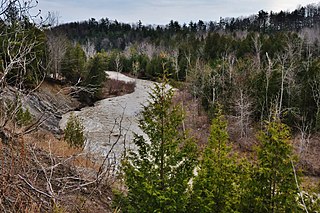
The Rouge River is a river in Markham, Pickering, Richmond Hill and Toronto in the Greater Toronto Area of Ontario, Canada. The river flows from the Oak Ridges Moraine to Lake Ontario at the eastern border of Toronto, and is the location of Rouge Park, the only national park in Canada within a municipality. At its southern end, the Rouge River is the boundary between Toronto and southwestern Pickering in the Regional Municipality of Durham.

Unionville is a suburban district and former village in Markham, Ontario, Canada, 2 km (2.5 mi) northeast of Downtown Markham, 2 km (2.5 mi) west of Markham Village, and 33 km (20.5 mi) northeast of Downtown Toronto, centred around the intersection of Highway 7 and Kennedy Road. The boundaries of Unionville are not well-defined. Several nearby neighbourhoods are claimed to be part of it however, this has been disputed between the various wards. The Unionville Ratepayers Association designates Rodick Road as its western boundary.

The York Region District School Board (YRDSB), until 1999, English-language Public District School Board No. 16 is the English-language public school board for the Regional Municipality of York in Ontario, Canada. The York Region District School Board is the province's third-largest school board after Toronto's TDSB and Peel's PDSB, with an enrolment of over 122,000 students. It is in the fastest-growing census division in Ontario and the third-fastest growing in Canada.
Erindale is an historical neighbourhood located within the central part of the city of Mississauga, west of Toronto, Ontario, Canada. Erindale is named in honour of the birthplace of the first rector of the village, Reverend James Magrath from Erin (Ireland).
German Mills is a community within the city of Markham in Ontario, Canada. The easternmost community in the historic town of Thornhill, German Mills was named for the early German settlers in the area.
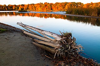
Rouge National Urban Park is a national urban park in Ontario, Canada. The park is centred around the Rouge River and its tributaries in the Greater Toronto Area. The southern portion of the park is situated around the mouth of the river in Toronto, and extends northwards into Markham, Pickering, Uxbridge, and Whitchurch-Stouffville.
Box Grove(Census Tract 5350400.01) is an original community in Markham, Ontario.
Cedar Grove is a community in Markham, Ontario on the Little Rouge River. It is centred on 14th Avenue and Reesor Road and within the boundaries of the future national Rouge Park.
Vinegar Hill is an unincorporated community in Markham, Ontario, Canada bounded by Highway 7 to the north, Highway 407 to the south, and streets just west and east of Main Street South, bordered by the Rouge River. The name of the community is believed to be linked to a cider mill on the east side of the river valley or barrel makers that filled them with vinegar to test their straightness when rolling down Markham Road.

Main Street Unionville is a collector route that runs through the historical suburban community of Unionville, in Markham, Ontario, Canada. Like most other Main Streets, the street serves as an important road for local tourism development. All along the road, the street has structures that are virtually unchanged from its founding in 1794. Renowned for its pubs, parks, restaurants, and its historical European view, the road also hosts the annual Unionville Festival, which draws several thousand visitors to the neighbourhood.
The Toronto ravine system is a distinctive feature of the city's geography, consisting of a network of deep ravines, which forms a large urban forest that runs through most of Toronto. The ravine system is the largest in any city in the world, with the Ravine and Natural Feature Protection Bylaw protecting approximately 110 square kilometres (42 sq mi) of public and privately-owned land. The ravine system has been presented as a central characteristic of the city, with the size of the ravine system leading Toronto to be described as "a city within a park".
The Markham Civic Centre is the city hall of the city of Markham, Ontario. The brick and glass Civic Centre was designed by architect Arthur Erickson with Richard Stevens Architects Limited and was opened on May 25, 1990. The entrances, except for the great hall entrance, are named after communities in Markham. The building is adjacent to an 11.5-hectare park with a large pond reflecting the south façade.
Twelve Mile Creek is a waterway located on the Niagara Peninsula in the Regional Municipality of Niagara in Southern Ontario, Canada. Its headwaters are located in the town of Pelham, encompassing some of the most unspoiled and natural areas of Niagara area. The creek's lower reaches flow through urban areas of Thorold and St. Catharines and has been heavily altered by human activity for almost two centuries. The creek was first known as "Ashquasing" by the Mississaugas Indigenous people, the name meaning "that which lies at the end" in the Anishinaabe language.
Wendigo Creek was a short watercourse in Toronto, Ontario, that drained into Grenadier Pond. It was spring fed, like nearby Spring Creek. Its headwaters were north of Bloor Street, near Dundas Street and Laws Street.


