San Marino, officially the Republic of San Marino and also known as the Most Serene Republic of San Marino, is a European microstate and country enclaved by Italy. Located on the northeastern side of the Apennine Mountains, San Marino is the fifth-smallest country in the world and covers a land area of just over 61 km2, with a population of 33,660 as of 2022.

San Marino is located in Southern Europe, an enclave (landlocked) in central Italy, which it borders for 39 km. The third smallest independent state by area in Europe after the Vatican City and Monaco, San Marino is dominated by the Apennines. Located at 43.94°N 12.46°E, it covers an area of 61.2 km2 (23.6 sq mi). Completely mountainous, only 17% of its territory is arable. Several rivers flow through the country, the largest being the Ausa, the Marano, and the San Marino River.

The Republic of San Marino's public transport network consists of a local bus network and the Funivia di San Marino, an aerial cablecar system between Borgo Maggiore and the City of San Marino. Both means are operated by the Azienda Autonoma di Stato per i Servizi Pubblici, the Sammarinese state company for public transport.
The flag of San Marino is formed by two equal horizontal bands of white (top) and light blue with the national coat of arms superimposed in the center; the coat of arms has a shield with a closed crown on top, flanked by an oak and laurel wreath, with a scroll below bearing the word LIBERTAS (Freedom). The two colors of the flag represent peace (white) and liberty.

Serravalle is a castello in northern San Marino. It has a population of 10,878 inhabitants and an area of 10.53 km2. It is the most densely populated municipality in San Marino, and contains its largest settlement (Dogana). Serravalle is located on the edge of the Apennine Mountains.

Borgo Maggiore is one of the 9 communes or castelli of San Marino. It lies at the foot of Monte Titano and has a population of 6,871, making it the second largest town of San Marino, after Dogana.

Domagnano is a municipality in San Marino. It has 3,565 inhabitants in an area of 6.62 km2.

The Catholic Church in San Marino is part of the worldwide Catholic Church, under the leadership of the Pope in Rome.

Faetano is one of the 9 communes or castelli of San Marino. It has 1,177 inhabitants in an area of 7.75 km2.

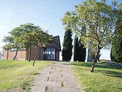
Fiorina is a curacy located in San Marino. It belongs to the municipality (castello) of Domagnano and it is its most populated parish (curazia).

Poste San Marino or Poste Sammarinesi is the company responsible for postal service in the Republic of San Marino.

Valgiurata, also known as Le Tane, is a small village (curazia) located in San Marino. It belongs to the municipality (castello) of Serravalle.

Torraccia Airfield, also known as Toraccia Helipad and Airfield or Toraccia Airport, is a small general aviation aerodrome in Torraccia, a village east of the castello of Domagnano, Republic of San Marino, less than 200 metres from the Italian border. It's the only airfield in San Marino.

Italy and San Marino have had diplomatic relations since Italian unification. Bilateral relations between Italy and San Marino have gone through various phases and have their official beginning after the Unification of Italy proclaimed in the Subalpine Parliament by Vittorio Emanuele II on 17 March 1861.
Cà Giannino is a small village (curazia) of San Marino. It belongs to the municipality of Domagnano.
Piandivello is a small village (curazia) of San Marino. It belongs to the municipality of Domagnano.
Spaccio Giannoni is a small village (curazia) of San Marino. It belongs to the municipality of Domagnano.

The Rimini–San Marino railway was a 31.5-kilometre (19.6-mile) electrified narrow gauge railway that connected Rimini, Italy, with the City of San Marino, Republic of San Marino.
The 1999 San Marino local elections were held on 13 June to elect the mayors and the councils of Chiesanuova, the City of San Marino and Domagnano, in San Marino. Overall turnout was 66.1%.