Monte Pulito

Last updated

Monte Pulito
San Marino Faetano.png
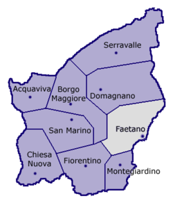
Location of Faetano within San Marino
San Marino location map.svg
Red pog.svg
Monte Pulito
Location within San Marino
Coordinates: 43°55′31.26″N12°29′0.72″E / 43.9253500°N 12.4835333°E / 43.9253500; 12.4835333
CountryFlag of San Marino.svg San Marino
Castello Faetano.JPG Faetano
Elevation
250 m (820 ft)
Demonym montesi
Time zone UTC+1 (CET)
  Summer (DST) UTC+2 (CEST)
Postal code
47896
Area code +378 (0549)

Monte Pulito is a curazia of San Marino, in the castello of Faetano. [1] [2]

Contents

History

During the Second World War, between 17 and 20 September 1944, the hill around Monte Pulito was the site of a battle between the 4th Indian Division (British India) and the 278th Infantry Division (Nazi Germany). The engagement is known as "Battle of San Marino" or "Battle of Monte Pulito".

Geography

Monte Pulito is located under the same named hill, on the road between Faetano and the city of San Marino.

References

  1. Rattini, Maurizio; Venturini, Gian Carlo; Volpinari, Antonio L. (21 March 1997). "Regolamento per la disciplina della campagna elttorale". Elezioni (in Italian). Archived from the original on 5 August 2009. Retrieved 14 February 2020.
  2. "Faetano". San Marino Web (in Italian). Retrieved 9 February 2024.