The Nightcap National Park is a national park situated within the Nightcap Range in the Northern Rivers region of New South Wales, Australia. The 8,080-hectare (20,000-acre) park was created in April 1983 and is situated 35 kilometres (22 mi) north of Lismore. The park was established following campaigns and blockades against logging at Terania Creek, Grier's Scrub and Mount Nardi between 1979 and 1982. Sections of the Whian Whian state forest were added to it following blockading and campaigning in 1998. The national park is classed by the IUCN World Commission on Protected Areas as Category II and is part of the Shield Volcano Group of the World Heritage Site Gondwana Rainforests of Australia inscribed in 1986 and added to the Australian National Heritage List in 2007.

Fitzgerald River National Park is a national park in the Shires of Ravensthorpe and the Jerramungup in Western Australia, 419 kilometres (260 mi) southeast of Perth. The park is recognised on Australia's National Heritage List for its outstanding diversity of native plant species, including many plants which are unique to the local area.

Conondale National Park is 130 km north of Brisbane in the Sunshine Coast Hinterland near the town of Conondale in the south east Queensland bioregion. The park covers an area of 35,648 hectares protecting large areas of subtropical rainforest, woodlands, wet and dry sclerophyll forest including Queensland's tallest tree. The park contains areas of regenerating forest which have been previously logged; areas of forest plantations also border the park. The park is currently managed by the Queensland Government under the Nature Conservation Act 1992.
Eudlo Creek is a national park in the south of Palmwoods in the Sunshine Coast Region local government area of South East Queensland, Australia, 85 km north of Brisbane.

The eastern bettong, also known as the southern or Tasmanian bettong, is a small, hopping, rat-like mammal native to grassy forests of southeastern Australia and Tasmania. A member of the rat-kangaroo family (Potoroidae), it is active at night and feeds on fungi and plant roots. Like most marsupials, it carries its young in a pouch. The eastern bettong is under pressure by introduced predators and habitat loss. The subspecies on mainland Australia is extinct, but populations of the Tasmanian subspecies have been reintroduced there.

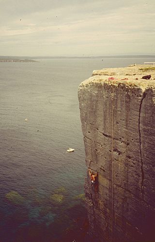
Beecroft Peninsula is the northern headland of Jervis Bay, on Australia's east coast. On the western and southern sides of the peninsula steep sandstone cliffs rise out of the ocean, up to 91 metres at its southernmost point, Point Perpendicular. White sandy beaches are found along the northern, eastern and southern sides interspersed with numerous intertidal reefs.

The Kangaroo Island dunnart is a dark sooty-grey coloured dunnart species first described in 1969, with paler underparts of its body. It has an average body length of 170–198 mm, a snout to anus length of 80–93 mm, a tail measurement of 90–105 mm, a hind foot of 17.5 mm, ear length of 18 mm and a weight of 20–25 grams. The thin tail is also gray, but lighter on the bottom. The tail is longer than the body. Kangaroo Island dunnarts are dimorphic, with males larger than females.

The western swamp turtle or western swamp tortoise is a critically endangered species of freshwater turtle endemic to a small portion of Western Australia. It is the only member of the genus Pseudemydura in the monotypic subfamily Pseudemydurinae.

The Threatened Species Protection Act 1995, is an act of the Parliament of Tasmania that provides the statute relating to conservation of flora and fauna. Its long title is An Act to provide for the protection and management of threatened native flora and fauna and to enable and promote the conservation of native flora and fauna. It received the royal assent on 14 November 1995.

Trachydora pygaea is a species of moth of the family Cosmopterigidae. It is found in Australia.

Macrobathra chrysotoxa is a species of moth of the family Cosmopterigidae. It is found in Australia.

Macrobathra desmotoma is a species of moth of the family Cosmopterigidae. It is found in Australia.

Macrobathra heminephela is a species of moth of the family Cosmopterigidae. It is found in Australia.

Mulligans Flat Woodland Sanctuary is a protected area situated in the Gungahlin district in north Canberra in the Australian Capital Territory. It has several trails for walking, running and cycling. The sanctuary functions as a fieldwork site for researchers studying native ecology.

The Torridincolidae are a small family of beetles in the suborder Myxophaga. It contains these genera:
The Australian Faunal Directory (AFD) is an online catalogue of taxonomic and biological information on all animal species known to occur within Australia. It is a program of the Department of Climate Change, Energy, the Environment and Water of the Government of Australia. By May 12, 2021, the Australian Faunal Directory has collected information about 126,442 species and subspecies. It includes the data from the discontinued Zoological Catalogue of Australia and is regularly updated. Started in the 1980s, it set a goal to compile a "list of all Australian fauna including terrestrial vertebrates, ants and marine fauna" and create an "Australian biotaxonomic information system". This important electronic key and educative package enables faster and orderly identification of Australian centipede species.
Roadside conservation is a conservation strategy in Australia and other countries where Road verge flora and habitats are protected or improved. The general aim is to conserve or increase the amount of native flora species; especially where that work will lead to higher conservation value, for example providing food or habitat for rare or endangered native fauna.

Stingray Swamp Flora Reserve (SWFR) is located immediately north of Penrose township in the south-western region of Wingecarribee Shire. The reserve is primarily surrounded by the Penrose State Forest, which is a commercially active plantation forest administered by the Forest Corporation NSW. Pine species dominate the state forest with a mix of native vegetation types in isolated pockets and adjacent areas. Stingray Swamp Flora Reserve belongs to a larger wetland complex known as the Paddy's River Wetland Complex (PRWC). These wetlands also form part of the Paddy's River sub-catchment, which belong to the larger Hawkesbury-Nepean catchment. Historic use of this area has mainly been that of pine plantation, agriculture and mining activities. The forest is publicly accessible and therefore is a site of mixed recreational activities.

The Port Cygnet Conservation Area is located in Cygnet, Tasmania, approximately 65 km (40 mi) southwest of the state's capital city, Hobart. The reserve has an area of 103 ha. It is an open estuary environment including a listed wetland of state significance, being the only Marine Protected Area (MPA) in the Bruny Bioregion representing the Open Estuaries Biounit.
The Lord Howe Marine Park is an Australian marine park located about 550 km (340 mi) offshore of New South Wales, near Lord Howe Island. The marine park covers an area of 110,126 km2 (42,520 sq mi), encompassing the smaller Lord Howe Island Marine Park, and is assigned IUCN category IV. It is one of 8 parks managed under the Temperate East Marine Parks Network.


