Trengereid | |
|---|---|
Village | |
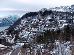 View of Trengereid | |
 Interactive map of Trengereid | |
| Coordinates: 60°25′40″N5°37′24″E / 60.42766°N 5.62339°E | |
| Country | Norway |
| Region | Western Norway |
| County | Vestland |
| District | Midhordland |
| Municipality | Bergen Municipality |
| Borough | Arna |
| Elevation | 63 m (207 ft) |
| Time zone | UTC+01:00 (CET) |
| • Summer (DST) | UTC+02:00 (CEST) |
| Post Code | 5263 Trengereid |
Trengereid [2] is a village in the borough of Arna in Bergen Municipality in Hordaland county, Norway. [3]


