Trexler Run

Last updated
Trexler Run

Trexler Run looking upstream.JPG

Trexler Run looking upstream from Pine Swamp Road
Physical characteristics
Main source valley on Little Mountain in Roaring Creek Township, Columbia County, Pennsylvania
1,560 ft (480 m)
River mouth Little Catawissa Creek in Union Township, Schuylkill County, Pennsylvania
1,000 ft (300 m)
40°51′51″N76°15′13″W / 40.86423°N 76.25360°W / 40.86423; -76.25360 Coordinates: 40°51′51″N76°15′13″W / 40.86423°N 76.25360°W / 40.86423; -76.25360
Length 3.4 mi (5.5 km)
Discharge
  • Average rate:
    0.60 cu ft/s (0.017 m3/s)
Basin features
Progression Little Catawissa Creek → Catawissa CreekSusquehanna RiverChesapeake Bay
Basin size 3.4 sq mi (8.8 km2)

Trexler Run is a tributary of Little Catawissa Creek in Columbia County and Schuylkill County, in Pennsylvania, in the United States. It is approximately 3.4 miles (5.5 km) long and flows through Roaring Creek Township in Columbia County and Union Township in Schuylkill County. [1] The watershed of the stream has an area of 3.81 square miles (9.9 km2). The stream is considered to be a High-Quality Coldwater Fishery and Class A Wild Trout Waters. The main rock formations in the stream's watershed are the Mauch Chunk Formation, the Pocono Formation, and the Pottsville Formation and the main soil is the Leck Kill soil. Both brook trout and brown trout inhabit the stream, as do several other species of fish.

Little Catawissa Creek tributary of Catawissa Creek in Columbia and Schuylkill Counties, Pennsylvania

Little Catawissa Creek is a tributary of Catawissa Creek in Columbia County and Schuylkill County, in Pennsylvania, in the United States. It is approximately 10.8 miles (17.4 km) long and flows through Conyngham Township in Columbia County and Union Township and North Union Township in Schuylkill County. The named tributaries of the creek include Stony Run and Trexler Run. The creek has some alkalinity and is slightly acidic. The main rock formations in the watershed of it are the Mauch Chunk Formation, the Pocono Formation, and the Pottsville Formation. A number of other rock formations occur in small areas of the watershed as well. The main soils in the watershed are the Leck Kill soil and the Hazleton soil.

Columbia County, Pennsylvania County in the United States

Columbia County is a county located in the U.S. state of Pennsylvania. As of the 2010 census, the population was 67,295. Its county seat is Bloomsburg. The county was created on March 22, 1813, from part of Northumberland County and named for Columbia, a poetic name for the United States that alludes to Christopher Columbus.

Pennsylvania State of the United States of America

Pennsylvania, officially the Commonwealth of Pennsylvania, is a state located in the northeastern and Mid-Atlantic regions of the United States. The Appalachian Mountains run through its middle. The Commonwealth is bordered by Delaware to the southeast, Maryland to the south, West Virginia to the southwest, Ohio to the west, Lake Erie and the Canadian province of Ontario to the northwest, New York to the north, and New Jersey to the east.

Contents

Course

Trexler Run looking downstream from Pine Swamp Road Trexler Run looking downstraem.JPG
Trexler Run looking downstream from Pine Swamp Road

Trexler Run begins in a valley on Little Mountain in Roaring Creek Township, Columbia County. It flows south-southeast for several tenths of a mile, exiting Roaring Creek Township and Columbia County. [1]

Roaring Creek Township, Columbia County, Pennsylvania Township in Pennsylvania, United States

Roaring Creek Township is a township in Columbia County, Pennsylvania, United States. The population was 545 at the 2010 census. The township office is located at 666 Bear Gap Road, Elysburg, Pennsylvania, outside the township.

Upon exiting Columbia County, Trexler Run enters Union Township, Schuylkill County. It continues south-southeast, crossing State Route 4036, for a short distance before receiving an unnamed tributary and turning east in a valley. After some distance, it crosses State Route 4036 again and continues east and slightly north. The stream eventually turns north for a short distance before turning east-northeast. After slightly more than a mile, it reaches its confluence with Little Catawissa Creek. [1]

Union Township, Schuylkill County, Pennsylvania Township in Pennsylvania, United States

Union Township is in Schuylkill County, Pennsylvania, United States. The population was 1,308 at the 2000 census.

Trexler Run joins Little Catawissa Creek 4.24 miles (6.82 km) upstream of its mouth. [2]

Hydrology

Trexler Run is infertile and slightly acidic. It has the potential to be affected by acid precipitation. [3]

Acid type of chemical substance that reacts with a base

An acid is a molecule or ion capable of donating a hydron (proton or hydrogen ion H+), or, alternatively, capable of forming a covalent bond with an electron pair (a Lewis acid).

The concentration of alkalinity in Trexler Run was measured to be 4 milligrams per liter in 1985. More recently, in 1997, it was measured to be 10 milligrams per liter. The pH of the stream was measured to be 6.4 in 1985 and 6.6 in 1997. The water hardness of the stream is 15 milligrams per liter. [3]

Alkalinity The capacity of water to resist changes in pH that would make the water more acidic

Alkalinity is the capacity of water to resist changes in pH that would make the water more acidic. Alkalinity is the strength of a buffer solution composed of weak acids and their conjugate bases. It is measured by titrating the solution with a monoprotic acid such as HCl until its pH changes abruptly, or it reaches a known endpoint where that happens. Alkalinity is expressed in units of meq/L, which corresponds to the amount of monoprotic acid added as a titrant in millimoles per liter.

pH measure of the acidity or basicity of an aqueous solution

In chemistry, pH is a logarithmic scale used to specify the acidity or basicity of an aqueous solution. It is approximately the negative of the base 10 logarithm of the molar concentration, measured in units of moles per liter, of hydrogen ions. More precisely it is the negative of the base 10 logarithm of the activity of the hydrogen ion. At 25 °C, solutions with a pH less than 7 are acidic and solutions with a pH greater than 7 are basic. The neutral value of the pH depends on the temperature, being lower than 7 if the temperature increases. Pure water is neutral, pH 7 at (25 °C), being neither an acid nor a base. Contrary to popular belief, the pH value can be less than 0 or greater than 14 for very strong acids and bases respectively.

At 1:10 P.M. on June 30, 1997, the air temperature in the vicinity of Trexler Run 0.80 miles (1.29 km) upstream of its mouth was 28 °C (82 °F). The water temperature of the stream at this location was 16.3 °C (61.3 °F). The specific conductivity of the stream's waters is 43 umhos. [3]

The discharge of Trexler Run near Ringtown has been measured by the United States Geological Survey several times. The discharge of the stream ranged from 0.210 to 1.70 cubic feet per second in these measurements. The average discharge was 0.60 cubic feet per second. [4] The peak annual discharge of the stream between 1959 and 1980 ranged from 8.80 cubic feet per second in 1965 to 487 cubic feet per second in 1972. The gauge height during the peak annual discharges ranged from 1.83 feet (0.56 m) in 1967 to 5.15 feet (1.57 m) in 1972. [5]

Geography and geology

The elevation near the mouth of Trexler Run is 1,000 feet (300 m) above sea level. [6] The elevation of the creek's source is approximately 1,560 feet (480 m) above sea level. [1]

Most of the length of Trexler Run is on rock of the Mauch Chunk Formation. However, the headwaters of the stream are on rock of the Pocono Formation. The Pottsville Formation is in the southern part of the watershed and the Spechty Kopf Formation and the Buddys Run Member of the Catskill Formation occur in the northwestern part of the watershed. The southern and central parts of the watershed, including most of the stream's length, are on Leck Kill soil. The northern part of the watershed, including the stream's headwaters, are on Hazleton soil. [7]

The headwaters of Trexler Run are on a mountain known as Little Mountain. The watershed is surrounded by ridges. It also contains valleys. [3] A till-capped deposit of sand known as the Hill runs from the flank of Little Mountain to Trexler Run. The Hill has forced the stream southwards and the stream makes a wide loop around it. Near this geographical feature, the stream has a narrow channel that cuts 40 feet (12 m) into bedrock. The Hill was formed by glacial activity. [8]

There are a few small areas that are prone to flooding scattered throughout the watershed of Trexler Run. [7]

Trexler Run is a small stream, with a width of 3.7 metres (12 ft). It has a low gradient of 12.6 meters per kilometer. [3]

Watershed

The watershed of Trexler Run has an area of 3.81 square miles (9.9 km2). [2] The watershed of mostly in Union Township, Schuylkill County, but a substantial portion of it is in Roaring Creek Township, Columbia County. [7]

Trexler Run flows through agricultural lands throughout much of its length. [7] These lands are mostly on the valley floors of the watershed. Forests are found on the ridges that surround the watershed. [3] There is some land belonging to Nature Conservancy Priority Forest Hubs found in the northern part of the watershed. [7]

Major roads in the watershed of Trexler Run include Little Mountain Road. [7] 64 percent of the stream's length is within 100 metres (330 ft) of road. 89 percent of its length is within 300 metres (980 ft) of a road and the entire length of the stream is within 500 metres (1,600 ft) of a road. The population density of the watershed in 1990 was 23 people per square kilometer. [3]

50 percent of the length of Trexler Run is on private land that is open to fishing. The remaining 50 percent is on private land that is closed to fishing. [9]

Trexler Run is in the United States Geological Survey quadrangle of Ashland. [3]

History

Trexler Run has been surveyed by the Pennsylvania Fish and Boat Commission three times. The first was performed by Shoemaker in 1932 and advised against stocking the stream on account of its small size. A second survey was carried out in 1939 by Lech. This survey also suggested not stocking the stream because public access was restricted by posting. However, it was stocked with fingerling brown trout and brook trout by the Pennsylvania Fish and Boat Commission five times between 1940 and 1957. The third survey was carried out by Daniels in 1985. [3]

A prestressed slab bridge was built over Trexler Run in 1989. It is 23.0 feet (7.0 m) long and carries Pine Swamp Road. [10]

Biology

Trexler Run is considered by the Pennsylvania Department of Environmental Protection to be a High-Quality Coldwater Fishery, although it was historically a Coldwater Fishery instead. [3] [7] Additionally, it is considered by the Pennsylvania Fish and Boat Commission to be Class A Wild Trout Waters. [7] A 1997 report advised against stocking the stream. [3]

There are seven species of fish inhabiting Trexler Run. These species include brook trout, brown trout, pumpkinseeds, and largemouth bass. However, the largemouth bass originate from nearby farm ponds. Six of the seven species of fish living in the stream were present before 1997. [3]

In 1984, the biomass of wild trout was 85.19 kilograms per hectare. This included 81.18 kilograms per hectare of brown trout and 4.01 kilograms per hectare of brook trout. By 1997, the wild trout biomass decreased to 50.85 kilograms per hectare. This included 39.66 kilograms per hectare of brown trout (including 5.72 kilograms per hectare of brown trout less than 175 millimeters long and 33.94 kilograms per hectare of brown trout that are more than 175 millimeters long) and 11.19 kilograms per hectare of brook trout (including 4.45 kilograms per hectare of brook trout that are less than 175 millimeters long and 6.74 kilograms per hectare of brook trout that are less than 175 millimeters long. [3]

The brook trout inhabiting Trexler Run range from 50 to 249 millimeters in length. The brown trout inhabiting the stream range from 25 to 349 millimeters in length. There are 354 wild trout per kilometer that are less than 175 millimeters long, including 254 brook trout and 100 brown trout. There are 97 wild trout per kilometer that are more than 175 millimeters long, including 27 brook trout and 70 brown trout. The stream has 1143 wild trout per hectare that are less than 175 millimeters long, including 820 brook trout and 323 brown trout. It has 312 wild trout per hectare that are more than 175 millimeters long, including 86 brook trout and 226 brown trout. [3]

A 1997 report stated that Trexler Run was an excellent site for angling. [3]

Trexler Run is one of two streams in the watershed of Catawissa Creek with a significant population of brown trout. [3]

See also

Related Research Articles

Scotch Run (Catawissa Creek tributary) tributary of Catawissa Creek in Columbia County, Pennsylvania

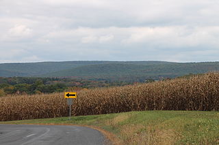
Scotch Run is one of the main tributaries of Catawissa Creek in Columbia County, Pennsylvania, in the United States. It is approximately 7.8 miles (12.6 km) long and flows through Beaver Township and Main Township. The stream's watershed has an area of 9.10 square miles (23.6 km2). The stream is infertile and acidic. It is 7.2 feet (2.2 m) wide in its upper reaches and 17.0 feet (5.2 m) wide in its lower reaches. The main rock formations in the watershed include the Mauch Chunk Formation, the Pocono Formation, the Pottsville Formation, and the Spechty Kopf Formation. The main soils include Leck Kill soil and Hazleton soil. It flows between Nescopeck Mountain and McCauley Mountain.

Furnace Run (Catawissa Creek tributary) tributary of Catawissa Creek in Columbia County, Pennsylvania

Furnace Run is a tributary of Catawissa Creek in Columbia County, Pennsylvania, in the United States. It is approximately 2.5 miles (4.0 km) long and flows through Catawissa Township and Main Township. The stream is the last named tributary to enter Catawissa Creek before its mouth. The stream's watershed has an area of 2.82 square miles (7.3 km2). The main rock formations are the Pottsville Group and the Mauch Chunk Formation. The stream itself is considered to be a high quality coldwater fishery and Class A Wild Trout Waters.

Fisher Run Tributary of Catawissa Creek in Pennsylvania

Fisher Run is a tributary of Catawissa Creek in Columbia County, Pennsylvania, in the United States. It is approximately 2.9 miles (4.7 km) long and flows through Main Township and Beaver Township. The stream is impaired by acid mine drainage. It is considered to be a high-quality coldwater fishery and Class A Wild Trout Waters. The watershed of the stream has an area of 3.03 square miles (7.8 km2).

Mine Gap Run is a tributary of Catawissa Creek in Columbia County, Pennsylvania, in the United States. It is approximately 1.5 miles (2.4 km) long and flows through Roaring Creek Township and Beaver Township. The watershed of the stream has an area of 0.92 square miles (2.4 km2). The stream is polluted and acidic. However, it is considered to be a coldwater fishery. The main rock formations in the stream's watershed are the Mauch Chunk Formation, the Spechty Kopf Formation, the Pocono Formation, and the Buddys Run Member of the Catskill Formation.

Long Hollow (Catawissa Creek tributary) tributary of Catawissa Creek in Columbia County, Pennsylvania

Long Hollow is a tributary of Catawissa Creek in Columbia County, Pennsylvania, in the United States. It is approximately 2.5 miles (4.0 km) long and flows through Roaring Creek Township and Beaver Township. The watershed of the stream has an area of 2.84 square miles (7.4 km2). The stream has a neutral pH and is considered to be a coldwater fishery. The main rock formations in the stream's watershed are the Mauch Chunk Formation, the Spechty Kopf Formation, the Pocono Formation, and the Buddys Run Member of the Catskill Formation.

Klingermans Run tributary of Catawissa Creek in Columbia County, Pennsylvania

Klingermans Run is a tributary of Catawissa Creek in Columbia County, Pennsylvania, in the United States. It is approximately 2.4 miles (3.9 km) long and flows through Roaring Creek Township and Beaver Township. The watershed of the stream has an area of 1.78 square miles (4.6 km2). The stream is considered to be a High-Quality Coldwater Fishery and Class A Wild Trout Waters. The main rock formations in the stream's watershed are the Mauch Chunk Formation and the Pocono Formation and the main soils are the Leck Kill soil and the Hazleton soil.

Cranberry Run tributary of Catawissa Creek in Columbia County, Pennsylvania

Cranberry Run is a tributary of Catawissa Creek in Columbia County, Pennsylvania, in the United States. It is approximately 2.0 miles (3.2 km) long and flows through Beaver Township. The watershed of the stream has an area of 1.83 square miles (4.7 km2). The stream is considered to be a Coldwater Fishery. The main rock formations in the stream's watershed are the Mauch Chunk Formation and the Pocono Formation and the main soils are the Leck Kill soil and the Hazleton soil.

Crooked Run (Catawissa Creek tributary) tributary of Catawissa Creek in Schuylkill County, Pennsylvania

Crooked Run is a tributary of Catawissa Creek in Schuylkill County, Pennsylvania, in the United States. It is approximately 4.4 miles (7.1 km) long and flows through North Union Township. The watershed of the stream has an area of 4.24 square miles (11.0 km2). The stream is considered to be a High-Quality Coldwater Fishery and Class A Wild Trout Waters. However, it is impaired by atmospheric deposition. The main rock formations in the stream's watershed are the Mauch Chunk Formation and the Pocono Formation and the main soils are the Leck Kill soil and the Hazleton soil.

Raccoon Creek (Tomhicken Creek tributary) tributary of Tomhicken Creek in Luzerne and Schuylkill Counties, Pennsylvania

Raccoon Creek is a tributary of Tomhicken Creek in Luzerne County and Schuylkill County, in Pennsylvania, in the United States. It is approximately 3.3 miles (5.3 km) long and flows through Black Creek Township in Luzerne County and North Union Township in Schuylkill County. The watershed of the stream has an area of 2.67 square miles (6.9 km2). The stream is considered to be a High-Quality Coldwater Fishery and Class A Wild Trout Waters. The main rock formations in the stream's watershed are the Mauch Chunk Formation and the Pottsville Formation and the main soil is the Leck Kill soil.

Little Crooked Run tributary of Tomhicken Creek in Schuylkill County, Pennsylvania

Little Crooked Run is a tributary of Tomhicken Creek in Schuylkill County, Pennsylvania, in the United States. It is approximately 1.7 miles (2.7 km) long and flows through North Union Township. The watershed of the stream has an area of 1.22 square miles (3.2 km2). The stream is considered to be a High-Quality Coldwater Fishery and Class A Wild Trout Waters. The main rock formations in the stream's watershed are the Mauch Chunk Formation and the Pottsville Formation and the main soil is the Hazleton soil.

Stony Run (Little Catawissa Creek tributary) tributary of Little Catawissa Creek in Schuylkill County, Pennsylvania

Stony Run is a tributary of Little Catawissa Creek in Schuylkill County, Pennsylvania, in the United States. It is approximately 2.2 miles (3.5 km) long and flows through Union Township. The watershed of the stream has an area of 2.24 square miles (5.8 km2). The stream is polluted and acidic. However, it is considered to be a coldwater fishery. The main rock formations in the stream's watershed are the Mauch Chunk Formation and the Pocono Formation. The main soils in the watershed are the Leck Kill soil and the Hazleton soil. No fish inhabit the stream.

Dark Run tributary of Catawissa Creek in Schuylkill County, Pennsylvania

Dark Run is a tributary of Catawissa Creek in Schuylkill County, Pennsylvania, in the United States. It is approximately 4.3 miles (6.9 km) long and flows through Union Township. The watershed of the stream has an area of 4.55 square miles (11.8 km2). The stream is considered to be a High-Quality Coldwater Fishery and Class D Wild Trout Waters. Eight species of fish inhabit the stream. The main rock formations in the stream's watershed are the Mauch Chunk Formation and the main soil is the Leck Kill soil. The stream has several unnamed tributaries.

Rattling Run (Catawissa Creek tributary) tributary of Catawissa Creek in Schuylkill County, Pennsylvania

Rattling Run is a tributary of Catawissa Creek in Schuylkill County, Pennsylvania, in the United States. It is approximately 2.4 miles (3.9 km) long and flows through East Union Township. The watershed of the stream has an area of 2.28 square miles (5.9 km2). The stream is considered to be a High-Quality Coldwater Fishery and Class A Wild Trout Waters. Three species of fish inhabit the stream. The main rock formations in the stream's watershed are the Mauch Chunk Formation and the Pottsville Formation and the main soils are the Leck Kill soil and the Hezleton soil. The stream has two unnamed tributaries.

Davis Run tributary of Catawissa Creek in Schuylkill County, Pennsylvania

Davis Run is a tributary of Catawissa Creek in Schuylkill County, Pennsylvania, in the United States. It is approximately 1.2 miles (1.9 km) long. The watershed of the stream has an area of 2.86 square miles (7.4 km2). The stream is considered to be a High-Quality Coldwater Fishery and Class A Wild Trout Waters. Six species of fish inhabit the stream, including brown trout and brook trout. The main rock formations in the stream's watershed are the Mauch Chunk Formation and the Pottsville Formation and the main soils are the Leck Kill soil and the Hezleton soil. The stream has two unnamed tributaries and a lake known as the Pumping Station Reservoir.

Messers Run tributary of Catawissa Creek in Schuylkill County, Pennsylvania

Messers Run is a tributary of Catawissa Creek in Schuylkill County, Pennsylvania, in the United States. It is approximately 5.2 miles (8.4 km) long and flows through Kline Township and East Union Township. The only named tributary of the stream is Negro Hollow, but it has two unnamed tributaries. The creek has some alkalinity, but is slightly acidic. The main rock formations in the watershed of it are the Mauch Chunk Formation and the Pottsville Formation. The main soils in the watershed are the Leck Kill soil and the Hazleton soil.

Negro Hollow tributary of Messers Run in Schuylkill County, Pennsylvania

Negro Hollow is the only named tributary of Messers Run in Schuylkill County, Pennsylvania, in the United States. It is approximately 1.7 miles (2.7 km) long and flows through Delano Township, Kline Township, and East Union Township. The watershed of the stream has an area of 1.57 square miles (4.1 km2). The stream is considered to be a High-Quality Coldwater Fishery and Class A Wild Trout Waters. Two species of fish inhabit the stream, including brook trout. The main rock formations in the stream's watershed are the Mauch Chunk Formation and the Pottsville Formation and the main soils are the Leck Kill soil and the Hezleton soil. The stream has one unnamed tributary.

Spies Run is a tributary of Catawissa Creek in Schuylkill County, Pennsylvania, in the United States. It is approximately 1.0 mile (1.6 km) long and flows through East Union Township. The stream has a pH that is fairly close to neutral. The stream is in the United States Geological Survey quadrangle of Conyngham. Trout naturally reproduce in it.

Mill Creek (Roaring Creek tributary) tributary of Roaring Creek in Columbia County, Pennsylvania

Mill Creek is a tributary of Roaring Creek in Columbia County, Pennsylvania, in the United States. It is approximately 3.1 miles (5.0 km) long and flows through Roaring Creek Township and Locust Township. The watershed of the creek has an area of 4.98 square miles (12.9 km2). The creek is considered to be a High-Quality Coldwater Fishery and Class A Wild Trout Waters. Numerous species of macroinvertebrates inhabit it. The creek was named from the presence of a mill.

References

  1. 1 2 3 4 United States Geological Survey, The National Map Viewer , retrieved October 2, 2014
  2. 1 2 Pennsylvania Gazetteer of Streams (PDF), November 2, 2001, retrieved October 2, 2014
  3. 1 2 3 4 5 6 7 8 9 10 11 12 13 14 15 16 R. Moase; T. Copeland; R. Wnuk; R. Mulberger (1997), PA FISH AND BOAT COMMISSION COMMENTS AND RECOMMENDATIONS (PDF), retrieved October 3, 2014
  4. United States Geological Survey, Streamflow Measurements for the Nation USGS 01540200 Trexler Run near Ringtown, PA , retrieved October 3, 2014
  5. United States Geological Survey, Peak Streamflow for the Nation USGS 01540200 Trexler Run near Ringtown, PA , retrieved October 3, 2014
  6. Topographic Map Stream Features in Schuylkill County, Pennsylvania , retrieved October 2, 2014
  7. 1 2 3 4 5 6 7 8 Pennsylvania Environmental Council (December 9, 2010), CATAWISSA CREEK WATERSHED RIVERS CONSERVATION PLAN (PDF), retrieved October 2, 2014
  8. Duane D. Braun; Keith Springman, "The Hill": An Unusual Glacial Feature in Schuylkill County (PDF), retrieved October 3, 2014
  9. Pennsylvania Fish and Boat Commission (December 16, 2013), Class A Wild Trout Waters (PDF), p. 18, retrieved October 3, 2014
  10. Schuylkill County , retrieved October 3, 2014