Tropical Storm Edouard was the first of eight named storms to form in September 2002,the most such storms in the North Atlantic for any month at the time.[1] The fifth tropical storm of the 2002 Atlantic hurricane season,Edouard developed into a tropical cyclone on September 1 from an area of atmospheric convection associated with a cold front east of Florida. Under weak steering currents,Edouard drifted to the north and executed a clockwise loop to the west. Despite moderate to strong levels of wind shear,the storm reached a peak intensity of 65mph (105km/h) on September 3,but quickly weakened as it tracked westward. Edouard made landfall on northeastern Florida on September 5,and after crossing the state it dissipated on September 6 while becoming absorbed into the larger circulation of Tropical Storm Fay.[2]
Florida received moderate rainfall from Edouard,with floods exceeding 7 inches (180mm) in the western portion of the state. Though Edouard was a tropical storm at landfall,wind speeds along the storm's path over land were light. The rain flooded several roads;however,there were no casualties,and damage was minimal.
Meteorological history
Map plotting the storm's track and intensity,according to the Saffir–Simpson scale
An area of convection, or thunderstorms, developed east-southeast of Bermuda on August 25, likely related to a dissipating cold front. The system moved to the southwest and interacted with an upper-level trough to the north of Puerto Rico, which increased the convection. A broad low-pressure area developed on August31 near the northern Bahamas. After the convection became better organized, the system developed into Tropical Depression Five on September 1, about 140 miles (230km) east of Daytona Beach, Florida.[2] The depression moved to the northwest at first, steered by a ridge to its northwest.[3] Despite the presence of wind shear and dry air, the depression intensified into Tropical Storm Edouard on September2, although the strongest thunderstorms were displaced from the circulation. Edouard began a small loop of Florida's east coast amid weak steering currents. On September3, the storm strengthened to reached peak winds of 65mph (105km/h).[2]
Shortly after peaking in intensity, Tropical Storm Edouard began to weaken as convection diminished from vertical shear and dry air, with its center becoming exposed from the steadily decreasing convection later on September 3. The development of a weak and narrow mid-level ridge turned the storm to the west-southwest towards northeastern Florida. Despite strong levels of wind shear, Edouard remained a tropical storm while producing sporadic amounts of deep convection,[2] with the banding structure improving on September 4.[4] Early on September 5, Edouard made landfall near Ormond Beach, Florida as a minimal tropical storm, and almost immediately weakened to a tropical depression over land. It tracked across the state for about 13hours and entered the Gulf of Mexico near Crystal River. Upon entering the Gulf of Mexico, the depression encountered strong wind shear from the outflow of developing Tropical Storm Fay.[2] Edouard generated minimal amounts of intermittent convection along the southeastern portion of its circulation, enough for it to remain a tropical cyclone.[5] The remaining convection, however, disappeared by September 6, with Edouard dissipating while becoming absorbed into the larger circulation of Tropical Storm Fay.[2]
Preparations
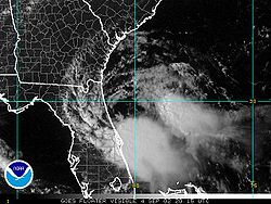
Tropical Storm Edouard near landfall in Florida on September 4
The NHC issued tropical storm watches and warnings for the southeastern United States. This included parts of Florida and Georgia that were under a tropical storm warning on two occasions.[2] The National Weather Service issued a flood watch hours before Edouard made landfall for much of eastern Florida due to the expected rainfall from the storm.[6]
Impact
Total rainfall map of Edouard in Florida
While moving erratically off the east coast of Florida, Edouard produced rough surf conditions and rip currents along many beaches. Beachgoers and visitors were advised to exercise extreme caution.[7] The storm produced water levels about 6inches above normal near Cape Canaveral, though elsewhere wave action and storm tides were not significant.[8] Ahead of the storm, wind gusts reached 39mph (63km/h) at Patrick Air Force Base.[2] Edouard dropped rainfall across the state, peaking at 7.64 inches (194mm) in DeSoto County[9] The rains caused river flooding along the St. Johns River, resulting in flooding along roads in Seminole County. Roadway, urban, and lowland flooding was also reported in the counties of Brevard and Orange. Roadway flooding was extensive in some areas, resulting in road closures in Oviedo, Cocoa Beach, and Cape Canaveral.[8] Heavy rainfall in Pinellas Park caused heavy street flooding along an intersection on U.S. Highway 19.[10]
This page is based on this Wikipedia article Text is available under the CC BY-SA 4.0 license; additional terms may apply. Images, videos and audio are available under their respective licenses.