
The Arctic Archipelago, also known as the Canadian Arctic Archipelago, is an archipelago lying to the north of the Canadian continental mainland, excluding Greenland and Iceland.
This is a list of the extreme points of the United Kingdom: the points that are farther north, south, east or west than any other location. Traditionally the extent of the island of Great Britain has stretched "from Land's End to John o' Groats".
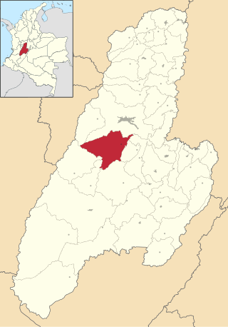
Rovira is a town and municipality in the Tolima department of Colombia. The population of the municipality was 21,822 as of the 1993 census.

The Ford Ranges are a collection of mountain groups and ranges standing east of Sulzberger Ice Shelf and Block Bay in the northwest part of Marie Byrd Land, Antarctica.
Airy Castle is a village in the Jamaican parish of Saint Thomas.

Houet is one of the 45 provinces of Burkina Faso, located in its Hauts-Bassins Region. The capital of Houet is Bobo-Dioulasso. In 2019, the province had a population of 1,509,377.

Casas de Ves is a municipality in Albacete, Castile-La Mancha, Spain. It has a population of 870.

Kutaber is one of the woredas in the Amhara Region of Ethiopia. Part of the Debub Wollo Zone, Kutaber is bordered on the south by Dessie Zuria, on the west by the Adila River which separates it from Tenta, on the north by the Walano which separates it from Ambassel, and on the east by Tehuledere; both the Adila and the Walano, as well as all rivers in this woreda are tributaries of the Bashilo River. The major town in Kutaber is Kutaber.

The Rio Grande de Loíza is a river in the island of Puerto Rico. It is the largest river in Puerto Rico by discharge volume. Situated on the north coast of the island, it originates in the northeastern Sierra de Cayey, flowing from south to north, and draining into the Atlantic Ocean, a few miles east of San Juan.
Michigan's 17th congressional district is an obsolete United States congressional district in Michigan. The first Representative to Congress elected from the 17th district, George Anthony Dondero, took office in 1933, after reapportionment due to the 1930 census. The district was dissolved following the 1990 census. The last Representative elected from the district, Sander M. Levin, was subsequently elected from the 12th district.
Gololcha is one of the woredas in the Oromia Region of Ethiopia. It was part of former Gololcha woreda what was divided for Gololcha and Gololcha woredas. Part of the East Bale Zone, Gololcha is bordered on the south by Ginir, on the southwest by Gasera, on the west by Agarfa, on the north by the Wabe Shebelle River which separates it from the Arsi Zone, on the northeast by Legehida, and on the east by Seweyna. The administrative center for the woreda is Jara.

El Cantón de San Pablo is a municipality and town in the Chocó Department, Colombia.

El Cairo is a town and municipality located in the Department of Valle del Cauca, Colombia.

Guacarí is a town and municipality located in the Department of Valle del Cauca, Colombia.
The Inglefield Mountains are a mountain range in southeastern Ellesmere Island, Nunavut, Canada. The mountain range is mostly covered by ice fields, with granitic nunataks reaching a height of 1,500 m (4,921 ft) above sea level. Rocky cliffs border the coastal areas. Like most other mountain ranges in the Canadian Arctic, the Inglefield Mountains are part of the Arctic Cordillera.
Hopewell Hall is a settlement in Saint Thomas Parish, Jamaica.
German submarine U-76 was a Type VIIB U-boat of Nazi Germany's Kriegsmarine during World War II. She played a minor role in the Battle of the Atlantic, but was destroyed south of Iceland.
Khirni is a gram panchayat in the Sawai Madhopur district of Rajasthan, India. It is located 32 km from the Sawai Madhopur town. It lies 6 km from the 4-lane Kota-Agra highway at Bhadoti. At present, Mrs. Roopsingh Gurjar is Sarpanch of Khirni gram panchayat.

Abertura is a municipality in the province of Cáceres and autonomous community of Extremadura, Spain. The municipality covers an area of 62.71 square kilometres (24.21 sq mi) and as of 2011 it had a population of 447 people.


