
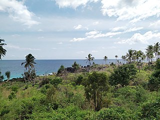
The Madagascar subhumid forests are a tropical moist broadleaf forest ecoregion that covers most of the Central Highlands of the island of Madagascar. They are included in the WWF's Global 200 list of outstanding ecoregions. Most of the original habitats have been lost due to human pressure.

The Madagascar ericoid thickets is a montane shrubland ecoregion, found at higher altitudes on Madagascar's four major mountains.

The Madagascar dry deciduous forests represent a tropical dry forest ecoregion situated in the western and northern part of Madagascar. The area has high numbers of endemic plant and animal species but has suffered large-scale clearance for agriculture. They are among the world's richest and most distinctive dry forests and included in the Global 200 ecoregions by the World Wide Fund. The area is also home to distinctive limestone karst formations known as tsingy, including the World Heritage Site of Bemaraha.

The western lesser bamboo lemur, also known as the northern bamboo lemur, western gentle lemur, or Sambirano lesser bamboo lemur, is a species of bamboo lemur endemic to Madagascar.
The Comoros forests is a terrestrial ecoregion which covers the Comoro Islands, which lie in the Mozambique Channel between Madagascar and East Africa. These include four main islands: Grande Comore, Anjouan and Mohéli, of the Union of the Comoros, and Mayotte, a department and region of France.
Rhombophryne guentherpetersi is a frog of the family Microhylidae. It is endemic to northern Madagascar and known from the Tsaratanana Massif. It inhabits high-elevation forest and, perhaps, montane grassland, at elevations of 2,000–2,600 m (6,600–8,500 ft) above sea level. It is a rare species that suffers from habitat loss and degradation. It occurs in the Tsaratanana Reserve but the reserve borders are ambiguous, complicating management of the area.

The Guinean montane forests are a tropical moist broadleaf forest ecoregion of West Africa.

The Nimba Range forms part of the southern extent of the Guinea Highlands, adjacent to the Toura Mountains. The highest peak is Mount Nimba on the border of Liberia, Côte d'Ivoire and Guinea, at 1,752 m (5,748 ft), and at the intersection of the Nimba and Toura Mountains. "Mount Nimba" may refer either to Mount Richard-Molard or to the entire range. Other peaks include Grand Rochers at 1,694 m (5,558 ft), Mont Sempéré at 1,682 m (5,518 ft), Mont Piérré Richaud at 1,670 m (5,480 ft), Mont Tô at 1,675 m (5,495 ft), and Mont LeClerc 1,577 m (5,174 ft), all of them are located in Guinea. Mount Nimba Strict Nature Reserve of Guinea and Côte d'Ivoire covers significant portions of the Nimba Range.

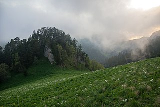
Altai Nature Reserve is a Russian zapovednik in the Altai Mountains of south Siberia, Russia. It is part of the UNESCO World Heritage Site "Golden Mountains of Altai", recognized as an area of high biodiversity and isolation from human intrusion. It is also included in the UNESCO World Network of Biosphere Reserves. The Altai Reserve includes the 30 km (19-mile) east bank of Lake Teletskoye and stretches 230 km into the high mountains to the southeast of the lake. It is situated in Ulagansky District and Turochaksky District in the north and east of the Altai Republic.

Voronezh Nature Reserve is a Russian 'zapovednik' located 40 km north of the city Voronezh and 500 km south of Moscow. One of the oldest nature reserves in Russia, Voronezh was the world's first experimental beaver nursery for breeding and studying the beaver. The reserve is situated in the Usmansky District of Voronezh Oblast, and in Lipetsk Oblast. It is part of a UNESCO-MAB Biosphere Reserve. Its official name as of 2013 is "Voronezh Peskov Nature Reserve" in honor of journalist and writer Vasily Peskov. The reserve was created in 1927, and covers an area of 31,053 ha (119.90 sq mi).
Caucasus Nature Reserve is a Russian zapovednik covering a heavily mountainous section of the Northwest Caucasus Mountains. It is the largest and oldest in the territory of specially protected natural area in the Caucasus, having been created in 1924 as the Caucasian Bison Reserve. In 1979, the site was named a UNESCO Biosphere Reserve, and in 1999 included in a UNESCO World Heritage Site. In 2008 it was officially renamed after Khachatur (Christopher) G. Shaposhnikova the biologist who founded the reserve. The area is situated in the Mostovsky District of Krasnodar Krai, covering an area of 280,335 ha (1,082.38 sq mi).

The Madagascar succulent woodlands are a xeric shrublands ecoregion in southwestern and central western Madagascar. Native plants survive in the arid climate and long dry season with adaptations like succulent leaves, water storing trunks, photosynthetic stems, and dropping leaves during the dry season. The ecoregion is threatened by various human activities.

The Altai montane forest and forest steppe ecoregion covers patches of the subalpine forest belt on the Altai Mountains, crossing the border region where Russia, Kazakhstan, Mongolia and China meet. The region has high biodiversity, as it is located in transition zones between different ecoregions, altitudes, and climate zones. It is in the Palearctic realm, with a Cold semi-arid climate. It covers 35,199,998 km2 (13,590,795 sq mi).

The Sayan montane conifer forests ecoregion covers the mid-elevation levels of the Sayan Mountains, the high mountain range between the taiga of Siberia, Russia to the north, and the steppes of Mongolia to the south. The slopes of the mountains at the mid-altitudes are covered by Temperate coniferous forest. The ecoregion is in the Palearctic realm, with a cold semi-arid climate. It covers 35,741,835 km2 (13,800,000 sq mi).
Kintrishi Strict Nature Reserve is a protected area in Kobuleti Municipality, Adjara region of Georgia in the upper part of the Kintrishi River at an altitude of 300–2,500 meters above sea level between the village of Tskhemvani (Tskhemlovana) and Khino Mountain in the Meskheti Range. It was established in 1959 to preserve relict humid forests and wetlands, in addition to its high number of endemic and threatened flora and fauna. Because of the ancient forests and high biodiversity within the nature reserve, it was inscribed on the UNESCO World Heritage List in 2021 as part of the Colchic Rainforests and Wetlands site.

Drevlians Nature Reserve is a strict nature reserve of Ukraine that follows along the Uzh River in the Polesia region of north-central Ukraine. Created to protect representative forests and wetlands of the Polesia region, the area experienced contamination from the Chernobyl disaster. The site is 80 km due west of Chernobyl. The reserve is in the administrative district of Narodychi in Zhytomyr Oblast

Polissia Nature Reserve is a protected nature reserve of Ukraine dedicated to the conservation and scientific study of representative woodland marshes of the Pinsk Marshes in the Polissia region. The reserve is in the administrative districts of Olevsk and Ovruch in Zhytomyr Oblast

The Western Congolian forest–savanna mosaic is an ecoregion of Angola, Democratic Republic of the Congo, Republic of the Congo, and Gabon.
Ephippiandra perrieri is a species of flowering plant endemic to the Northern Highlands of Madagascar.
Ephippiandra tsaratanensis is a species of flowering plant endemic to the Tsaratanana Massif of northern Madagascar.

