
The Madagascar lowland forests or Madagascar humid forests are a tropical moist broadleaf forest ecoregion found on the eastern coast of the island of Madagascar, home to a plant and animal mix that is 80 to 90% endemic, with the forests of the eastern plain being a particularly important location of this endemism. They are included in the Global 200 list of outstanding ecoregions.

The Madagascar subhumid forests are a tropical moist broadleaf forest ecoregion that covers most of the Central Highlands of the island of Madagascar. They are included in the WWF's Global 200 list of outstanding ecoregions. Most of the original habitats have been lost due to human pressure.

The Madagascar dry deciduous forests represent a tropical dry forest ecoregion situated in the western and northern part of Madagascar. The area has high numbers of endemic plant and animal species but has suffered large-scale clearance for agriculture. They are among the world's richest and most distinctive dry forests and included in the Global 200 ecoregions by the World Wide Fund. The area is also home to distinctive limestone karst formations known as tsingy, including the World Heritage Site of Bemaraha.

Andringitra National Park is a national park in the Haute Matsiatra region of Madagascar, 47 kilometres (29 mi) south of Ambalavao. The park was established in 1999 and is managed by the Madagascar National Parks Association. It was inscribed in the World Heritage Site in 2007 as part of the Rainforests of the Atsinanana.

Ankarafantsika National Park is a national park near Andranofasika in the Boeny Region of Madagascar. The closest city is Majunga 115 kilometres (71 mi) north of the park. Ankarafantsika is mostly tropical in climate type. The Sakalava people are the predominant ethnic group living and farming here. The greater big-footed mouse lives in the park and is not known anywhere else.

Montagne d'Ambre National Park is a national park in the Diana Region of northern Madagascar. The park is known for its endemic flora and fauna, water falls and crater lakes. It is 1,000 km (620 mi) north of the capital, Antananarivo and is one of the most biologically diverse places in all of Madagascar with seventy-five species of birds, twenty-five species of mammals, and fifty-nine species of reptiles known to inhabit the park.

The wildlife of Burundi is composed of its flora and fauna. The small, landlocked country is home to 2,950 species of plants, 596 birds, 163 species of mammals, 52 species of reptiles, 56 species of amphibians, and 215 fish species. The wildlife has been drastically reduced in recent years, mainly on account of intense population pressure, conversion of large areas of forest into agricultural land, and extensive livestock farming. The protected area encompasses little more than 5% of the total area of the country.
Benin has varied resources of wildlife comprising flora and fauna, which are primarily protected in its two contiguous protected areas of the Pendjari National Park and W National Park. The former is known for many species of avifauna and the latter park is rich in mammals and predators. In addition, many other forest reserves are noted in the country but are not easily accessible, well protected or adequately surveyed for its wildlife resources. The protected area of Benin which is defined as a National Protected Area System is in northern Benin, mostly with a woody savanna ecosystem. It covers 10.3 percent of the nation and is part of the three-nation W-Arly-Pendjari Complex (WAP).

The giant coua is a bird species from the coua genus in the cuckoo family that is endemic to the dry forests of western and southern Madagascar. It is suggested that couas probably originated from a particular Asian ground-cuckoo. The genus coua contains 10 species, more than any other genus in Madagascar. Although the bird is listed under least concern (LC) in the IUCN Red List of Threatened Species, it only persists in the biological hot spot of Madagascar, warranting its recognition as a species of conservation concern at the global scale.

Tsimanampetsotsa National Park also spelt Tsimanampetsotse, and known as Tsimanampetsotsa Nature Reserve is a 432 km2national park on the south-west coast of Madagascar in the region Atsimo-Andrefana. The park is 90 kilometres (56 mi) south of Toliara and 950 kilometres (590 mi) south of the capital, Antananarivo. Route Nationales (RN) 10 to Faux Cap passes the park and the nearest airport is at Toliara. The national park contains and is named after Lake Tsimanampetsotsa.

Zombitse-Vohibasia is a national park in the Atsimo-Andrefana region of south-west Madagascar. It is 147 kilometres (91 mi) north-east of the town of Toliara on the National road 7.

Andranomena Special Reserve is a wildlife reserve in Menabe Region, western Madagascar, near the city of Morondava and the rural commune of Bemanonga.
Ambatovaky Special Reserve is a tropical rainforest and wildlife reserve in the north-east of Madagascar. It is designated by Bird Life International as an Important Bird Area for the large number of endemic species of birds.
Ambohijanahary Special Reserve is a wildlife reserve in the regions of Menabe and Melaky in Madagascar. The reserve was created in 1958 to protect the sclerophyllous forest between Tsiroanomandidy and Maintirano, as well as protecting the many endemic species of plants and animals.
Bemarivo Reserve is a wildlife reserve 12 km from Besalampy in the region of Melaky in the north-west of Madagascar. It was created in 1956 and covers an area of 12,080 hectares. The reserve is known for its fauna especially endemic birds.
Bora Special Reserve is a wildlife reserve in the Sofia Region of Madagascar, between the villages of Antsohihy and Bealanana. Bora is in a transition zone between eastern humid forests and western dry forests and the reserve and has many endemic species including six lemur species, twenty birds and over 150 species of endemic plants.
Kalambatritra Special Reserve is a wildlife reserve in southern Madagascar. It is to the north of Andohahela National Park, south-west of the Manombo Special Reserve and contains many endemic species, including forty-five endemic bird species.
Maningoza Special Reserve is a 9,826 hectares wildlife reserve near Besalampy in Madagascar. It was created in 1956 to protect the many endemic plants and animals, and it also contains some of the last remaining areas of dry deciduous forest on the island.

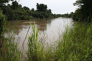
The Mahavavy Sud, also known as the Mahavavy South, is a river in western Madagascar. It flows from south to north through the regions of Melaky, Betsiboka, Bongolava and Boeny. It has a length of approximately 1000 km, and drains a basin of 16,475 km2. It is distinct from the Mahavavy Nord several hundred km to the north.

