Tuai

Last updated

Tuai
Art Deco power house in Tuai.jpg
Tuai Power Station
Tuai
Coordinates: 38°48′42″S177°08′52″E / 38.811657°S 177.147726°E / -38.811657; 177.147726
CountryNew Zealand
Region Hawke's Bay Region
Territorial authority Wairoa District
Ward
  • Wairoa General Ward
  • Wairoa Māori Ward
Electorates
Area
[1]
  Total21.99 km2 (8.49 sq mi)
Population
 (June 2023) [2]
  Total240
  Density11/km2 (28/sq mi)

Tuai is a village and rural community located around Lake Whakamarino, in the Wairoa District of the Hawke's Bay Region, on New Zealand's North Island. [3]

Contents

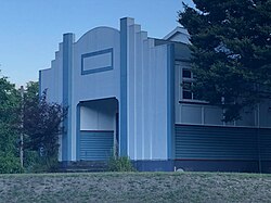
The local Tuai Power Station was opened in 1929 on the shores of Lake Whakamarino, as part of the Waikaremoana power scheme. Genesis Energy has controlled the power station remotely from Tokaanu power station since the early 2000s. [4]

Artist Doris Lusk depicted the power station in a 1948 painting. [5] She described the power station as a “gothic building in the middle of the wild hills”. [6]

Lake Whakamarino, also known as Tuai Lake, is popular with anglers. [7] It can be used by fly-fishers, and accessed with small unanchored boats. [8]

Demographics

Statistics New Zealand describes Tuai as a rural settlement, which covers 21.99 km2 (8.49 sq mi) [1] and had an estimated population of 240 as of June 2023, [2] with a population density of 11 people per km2. It is part of the larger Maungataniwha-Raupunga statistical area. [9]

Historical population
YearPop.±% p.a.
2006243    
2013213−1.86%
2018216+0.28%
Source: [10]

Tuai had a population of 216 at the 2018 New Zealand census, an increase of 3 people (1.4%) since the 2013 census, and a decrease of 27 people (−11.1%) since the 2006 census. There were 78 households, comprising 105 males and 111 females, giving a sex ratio of 0.95 males per female. The median age was 31.2 years (compared with 37.4 years nationally), with 57 people (26.4%) aged under 15 years, 45 (20.8%) aged 15 to 29, 84 (38.9%) aged 30 to 64, and 27 (12.5%) aged 65 or older.

Ethnicities were 26.4% European/Pākehā, 84.7% Māori, and 2.8% Pacific peoples. People may identify with more than one ethnicity.

Although some people chose not to answer the census's question about religious affiliation, 38.9% had no religion, 25.0% were Christian, 26.4% had Māori religious beliefs and 1.4% had other religions.

Of those at least 15 years old, 18 (11.3%) people had a bachelor's or higher degree, and 36 (22.6%) people had no formal qualifications. The median income was $22,100, compared with $31,800 nationally. 12 people (7.5%) earned over $70,000 compared to 17.2% nationally. The employment status of those at least 15 was that 66 (41.5%) people were employed full-time, 21 (13.2%) were part-time, and 15 (9.4%) were unemployed. [10]

Marae

Te Kūhā Tārewa Marae and Te Poho o Hinekura or Ruapani meeting house is a meeting place of the Tūhoe hapū of Ngāti Hinekura, and the Ngāti Ruapani hapū of Ngati Hinekura and Tuwai. [11] [12]

In October 2020, the Government committed $1,949,075 from the Provincial Growth Fund to upgrade the marae and 23 other Ngāti Kahungunu marae. The funding was expected to create 164 jobs. [13]

Education

Te Kura o Waikaremoana is a Year 1–8 co-educational state primary school. [14] It is a decile 2 school with a roll of 19 as of April 2023. [15] [16]

Related Research Articles

<span class="mw-page-title-main">Taumarunui</span> Town in Manawatū-Whanganui Region, New Zealand

Taumarunui is a small town in the King Country of the central North Island of New Zealand. It is on an alluvial plain set within rugged terrain on the upper reaches of the Whanganui River, 65 km south of Te Kūiti and 55 km west of Tūrangi. It is under the jurisdiction of Ruapehu District and Manawatū-Whanganui region.

<span class="mw-page-title-main">Murupara</span> Town in the Bay of Plenty Region, New Zealand

Murupara is a town in the Whakatāne District and Bay of Plenty Region of New Zealand's North Island. The town is in an isolated part of the region between the Kaingaroa Forest and Te Urewera protected area, on the banks of the Rangitaiki River, 65 kilometres southeast of Rotorua. Indigenous Māori also make up over 90% of the population.

<span class="mw-page-title-main">Māhia Peninsula</span> Peninsula in Hawkes Bay, New Zealand

Māhia Peninsula is located on the east coast of New Zealand's North Island, in the Hawke's Bay region, between the towns of Wairoa and Gisborne.

Ngongotahā is a small settlement on the western shores of Lake Rotorua in the North Island of New Zealand. It is located 10 km (6.2 mi) northwest of the Rotorua central business district, and is part of the functional urban area. Ngongotahā is considered as a suburb of Rotorua, and has a population of 5,230 as of June 2023.

<span class="mw-page-title-main">Tolaga Bay</span> Town in Gisborne District, New Zealand

Tolaga Bay is both a bay and small town on the East Coast of New Zealand's North Island located 45 kilometres northeast of Gisborne and 30 kilometres south of Tokomaru Bay.

<span class="mw-page-title-main">Kawhia Harbour</span> Harbour and settlement in Waikato, New Zealand

Kawhia Harbour is one of three large natural inlets in the Tasman Sea coast of the Waikato region of New Zealand's North Island. It is located to the south of Raglan Harbour, Ruapuke and Aotea Harbour, 40 kilometres southwest of Hamilton. Kawhia is part of the Ōtorohanga District and is in the King Country. It has a high-tide area of 68 km2 (26 sq mi) and a low-tide area of 18 km2 (6.9 sq mi). Te Motu Island is located in the harbour.

<span class="mw-page-title-main">Moerewa</span> Place in Northland Region, New Zealand

Moerewa is a small town in the Northland Region of the North Island of New Zealand. It is located close to the Bay of Islands five kilometres to the west of Kawakawa.

Mōkau is a small town on the west coast of New Zealand's North Island, located at the mouth of the Mōkau River on the North Taranaki Bight. Mōkau is in the Waitomo District and Waikato region local government areas, just north of the boundary with the New Plymouth District and the Taranaki Region. Prior to 1989, the town was classed as being in Taranaki, and there is still a feeling that the community of interest is most associated with New Plymouth, 90 km to the southwest. State Highway 3 passes through the town on its route from Te Kūiti to Waitara and, eventually, New Plymouth.

<span class="mw-page-title-main">Arapuni</span> Settlement in Waikato, New Zealand

Arapuni is a rural town centre on the Waikato river in the South Waikato District of New Zealand. The town sits next to the Arapuni Dam, a hydroelectric dam at Lake Arapuni commissioned in 1929. The Arapuni Power Station consists of eight turbines which give a total output of 196 MW, the largest of the power stations on the Waikato river. The Arapuni hydro station is owned and operated by Mercury Energy.

Te Teko is a small inland town along the banks of the Rangitaiki River in the Bay of Plenty region of New Zealand's North Island.

<span class="mw-page-title-main">Kuratau</span> Settlement in Waikato, New Zealand

Kuratau is a small village north of Pukawa, on the western side of New Zealand's Lake Taupō.

Whirinaki is a small coastal settlement in Hawke's Bay, in the eastern North Island of New Zealand. It sits just north of the mouth of the Esk River, a few kilometres north of Bay View and a similar distance east of Eskdale. It lies on State Highway 2, just north of its junction with State Highway 5.

<span class="mw-page-title-main">Raupunga</span> Settlement in Hawkes Bay Region, New Zealand

Raupunga is a small settlement in the northern Hawke's Bay Region of New Zealand's eastern North Island. It is located close to the country's highest railway bridge, the Mohaka Viaduct, which crosses the Mohaka River. The predominantly Māori village is expected to have a population of 266 people by 2033.

<span class="mw-page-title-main">Frasertown</span> Settlement in Hawkes Bay Region, New Zealand

Frasertown is a small settlement in the northern Hawke's Bay Region of New Zealand's eastern North Island.

<span class="mw-page-title-main">Te Araroa (town)</span> Town in the Gisborne District of New Zealand

Te Araroa is a town in the Gisborne Region of the North Island of New Zealand. It is situated 175 km north of Gisborne city, along State Highway 35 between Tokata and Awatere. Te Araroa is the birthplace of noted Māori politician Sir Āpirana Ngata. Māori in the area are generally associated with the Ngāti Porou iwi. It is 100 metres from its local beach.

<span class="mw-page-title-main">Wharekahika</span> Town in Gisborne District, New Zealand

Wharekahika or Hicks Bay is a bay and coastal area in the Gisborne District of the North Island of New Zealand. It is situated 150 km east of Ōpōtiki and 186 km north of Gisborne city, along State Highway 35 between Potaka and Te Araroa.

<span class="mw-page-title-main">Okere Falls</span> Rural settlement in Bay of Plenty Region, New Zealand

Okere Falls is a small town located 21 km from Rotorua on SH 33 between Rotorua and Tauranga on the North Island of New Zealand. The town is situated on the shore of the Okere Inlet of Lake Rotoiti, from which the Kaituna River flows north towards the Bay of Plenty.

Piopio is a small town in the Waitomo District. It is situated on State Highway 3 approximately 23 km from Te Kūiti.

<span class="mw-page-title-main">Rotoiti, Bay of Plenty</span> Settlement in Rotorua Lakes District, New Zealand

Rotoiti is a settlement on the shore of Lake Rotoiti, in Rotorua Lakes within the Bay of Plenty Region of New Zealand's North Island.

<span class="mw-page-title-main">Mourea</span> Rural settlement in Bay of Plenty Region, New Zealand

Mourea is a settlement in Rotorua Lakes within the Bay of Plenty Region of New Zealand's North Island.

References

  1. 1 2 "ArcGIS Web Application". statsnz.maps.arcgis.com. Retrieved 29 January 2023.
  2. 1 2 "Subnational population estimates (RC, SA2), by age and sex, at 30 June 1996-2023 (2023 boundaries)". Statistics New Zealand . Retrieved 25 October 2023. (regional councils); "Subnational population estimates (TA, SA2), by age and sex, at 30 June 1996-2023 (2023 boundaries)". Statistics New Zealand . Retrieved 25 October 2023. (territorial authorities); "Subnational population estimates (urban rural), by age and sex, at 30 June 1996-2023 (2023 boundaries)". Statistics New Zealand . Retrieved 25 October 2023. (urban areas)
  3. Hariss, Gavin. "Tuai, Hawke's Bay". topomap.co.nz. NZ Topo Map.
  4. Pollock, Kerryn (30 November 2015). "Tuai power station 2007". Te Ara - the Encyclopedia of New Zealand . Ministry for Culture and Heritage.
  5. Derby, Mark. "'Powerhouse, Tuai', 1948". Te Ara - the Encyclopedia of New Zealand . Ministry for Culture and Heritage.
  6. "Power House, Tuai". christchurchartgallery.org.nz. Christchurch Art Gallery.
  7. "Tuai and Lake Whakamarino New Zealand". tourism.net.nz. New Zealand Tourism Guide.
  8. "Trout numbers boosted at hydro lakes". Gisborne Herald. 7 December 2017.
  9. 2018 Census place summary: Maungataniwha-Raupunga
  10. 1 2 "Statistical area 1 dataset for 2018 Census". Statistics New Zealand. March 2020. 7015752.
  11. "Te Kāhui Māngai directory". tkm.govt.nz. Te Puni Kōkiri.
  12. "Māori Maps". maorimaps.com. Te Potiki National Trust.
  13. "Marae Announcements" (Excel). growregions.govt.nz. Provincial Growth Fund. 9 October 2020.
  14. "Ministry of Education School Profile". educationcounts.govt.nz. Ministry of Education.
  15. "New Zealand Schools Directory". New Zealand Ministry of Education. Retrieved 12 December 2022.
  16. "Education Review Office Report". ero.govt.nz. Education Review Office. Archived from the original on 25 May 2019. Retrieved 25 May 2019.