This article relies largely or entirely on a single source .(August 2024) |
Tuckertown | |
|---|---|
 Tuckertown, c. 1923 | |
| Country | United States |
| State | Texas |
| County | Navarro |
Tuckertown, or Tucker Town, is a ghost town in Navarro County, Texas, United States.
This article relies largely or entirely on a single source .(August 2024) |
Tuckertown | |
|---|---|
 Tuckertown, c. 1923 | |
| Country | United States |
| State | Texas |
| County | Navarro |
Tuckertown, or Tucker Town, is a ghost town in Navarro County, Texas, United States.
Tuckertown was settled in early July 1923 during an oil boom. The population was 20 by 1940. Most residents moved after World War II, and it was abandoned by the mid-1960s. [1]

Texas is the most populous state in the South Central region of the United States. It borders Louisiana to the east, Arkansas to the northeast, Oklahoma to the north, New Mexico to the west, and the Mexican states of Chihuahua, Coahuila, Nuevo León, and Tamaulipas to the south and southwest. Texas has a coastline on the Gulf of Mexico to the southeast. Covering 268,596 square miles (695,660 km2), and with over 30 million residents as of 2023, it is the second-largest state by both area and population.

Young County is a county located in the U.S. state of Texas. As of the 2020 census, its population was 17,867. Its county seat is Graham. The county was created in 1856 and organized in 1874. It is named for William Cocke Young, an early Texas settler and soldier.
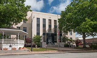
Washington County is a county in Texas. As of the 2020 census, the population was 35,805. Its county seat is Brenham, which is located along U.S. Highway 290, 72 miles northwest of Houston. The county was created in 1835 as a municipality of Mexico and organized as a county in 1837. It is named for George Washington, the first president of the United States.
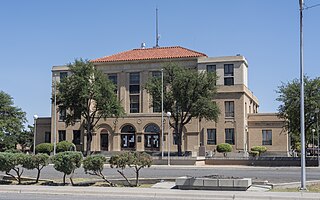
Reeves County is a county located in the U.S. state of Texas. As of the 2020 census, its population was 14,748. Its county seat and most populous city is Pecos. The county was created in 1883 and organized the next year. It is named for George R. Reeves, a Texas state legislator and colonel in the Confederate Army. It is one of the nine counties that comprise the Trans-Pecos region of West Texas. Reeves County comprises the Pecos micropolitan statistical area.

Palo Pinto County is a county located in the U.S. state of Texas. As of the 2020 census, its population was 28,409. The county seat is Palo Pinto. The county was created in 1856 and organized the following year.
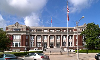
Limestone County is a county in the U.S. state of Texas. As of the 2020 census, its population was 22,146. Its county seat is Groesbeck. The county was created in 1846.

Hansford County is a county located in the U.S. state of Texas. As of the 2020 census, its population was 5,285. Its county seat is Spearman. The county was created in 1876 and organized in 1889. It is named for John M. Hansford, a Texas state congressman and judge.
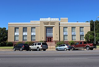
Gillespie County is a county located on the Edwards Plateau in the U.S. state of Texas. As of the 2020 census, its population was 26,725. The county seat is Fredericksburg. It is located in the heart of the rural Texas Hill Country in Central Texas. Gillespie is named for Robert Addison Gillespie, a soldier in the Mexican–American War. It is known as the birthplace of 36th president of the United States of America Lyndon B. Johnson.

Comanche County is a county located on the Edwards Plateau in Central Texas. As of the 2020 census, its population was 13,594. The county seat is Comanche. The county was founded in 1856 and is named for the Comanche Native American tribe.

Cherokee County is a county located in the U.S. state of Texas. As of the 2020 census, its population was 50,412. The county seat is Rusk, which lies 130 miles southeast of Dallas and 160 miles north of Houston. The county was named for the Cherokee, who lived in the area before being expelled in 1839. Cherokee County comprises the Jacksonville micropolitan statistical area, which is also included in the Tyler–Jacksonville combined statistical area.
Navarro is a town in Navarro County, Texas, United States. The population was 232 at the 2020 census.

The Texas panhandle is a region of the U.S. state of Texas consisting of the northernmost 26 counties in the state. The panhandle is a square-shaped area bordered by New Mexico to the west and Oklahoma to the north and east. It is adjacent to the Oklahoma Panhandle, land which Texas previously claimed. The 1820 Missouri Compromise declared no slavery would be allowed in states admitted from the Louisiana Purchase above 36°30′ north latitude. Texas was annexed in 1845 from still more westerly land. The Compromise of 1850 removed territory north of this line from Texas, and set the border between the Texas Panhandle and the New Mexico Territory at the 103rd meridian west. The eastern border at the 100th meridian west was inherited from the Adams–Onís Treaty of 1819, which defined the border between the United States and New Spain. The Handbook of Texas defines the southern border of Swisher County as the southern boundary of the Texas Panhandle region.

Washington-on-the-Brazos is an unincorporated community along the Brazos River in Washington County, Texas, United States. The town is best known for being the site of the Convention of 1836 and the signing of the Texas Declaration of Independence.

The Yadkin River is one of the longest rivers in the US state of North Carolina, flowing 215 miles (346 km). It rises in the northwestern portion of the state near the Blue Ridge Parkway's Thunder Hill Overlook. Several parts of the river are impounded by dams for water, power, and flood control. The river becomes the Pee Dee River at the confluence of the Uwharrie River south of the community of Badin and east of the town of Albemarle. The river then flows into South Carolina near Cheraw, which is at the Fall Line. The entirety of the Yadkin River and the Great Pee Dee River is part of the Yadkin-Pee Dee River Basin.

Lavaca Bay is a northwestern extension of the Matagorda Bay system found mostly in Calhoun County, Texas, United States. The ports of Port Lavaca and Point Comfort have been established on the bay, and are the main areas of human habitation. Linnville was located on the bay until its abandonment after the Great Raid of 1840, and the major port of Indianola was found near the confluence with the main Matagorda Bay, until the town's final destruction following the massive hurricane of 1886. Smaller communities include Olivia, Alamo Beach and Magnolia Beach. Lavaca Bay is approximately 82 miles (130 km) northeast of Corpus Christi, about 121 miles (190 km) southwest of Houston, and 145 miles (230 km) southeast of San Antonio.

The Tuckertown Reservoir is the reservoir formed by the Tuckertown Dam35°29′05″N80°10′36″W at the North end of Badin Lake and the High Rock Dam 35°36′03″N80°14′06″W at the bottom of High Rock Lake in the Uwharrie Lakes Region in the U.S. state of North Carolina.
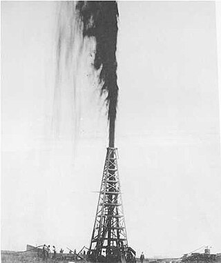
The Texas oil boom, sometimes called the gusher age, was a period of dramatic change and economic growth in the U.S. state of Texas during the early 20th century that began with the discovery of a large petroleum reserve near Beaumont, Texas. The find was unprecedented in its size (worldwide) and ushered in an age of rapid regional development and industrialization that has few parallels in U.S. history. Texas quickly became one of the leading oil-producing states in the U.S., along with Oklahoma and California; soon the nation overtook the Russian Empire as the top producer of petroleum. By 1940 Texas had come to dominate U.S. production. Some historians even define the beginning of the world's Oil Age as the beginning of this era in Texas.

Tres Palacios Bay is a northeastern extension of Matagorda Bay on the Texas coast in Matagorda County. It is fed by the Tres Palacios River. The city of Palacios is located on its shores. A channel that connects Palacios to the Intracoastal Waterway has been dredged through the bay.
Tucker is an extinct town in southwestern Ripley County, in the U.S. state of Missouri. The GNIS classifies it as a populated place. The community lies on Missouri Route Z, south of Gatewood and three miles north of the Missouri-Arkansas border.