Kerens, Texas

Last updated
Kerens, Texas
Downtown Kerens Wiki (1 of 1).jpg
Downtown Kerens
Nickname: 
"Little Ugly"
Motto: 
"Going no where fast" Accomplishments ="Birthplace Of Big Tex" [1]
TXMap-doton-Kerens.PNG
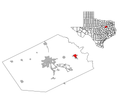
Location of Kerens, Texas
Navarro County Kerens.svg
Coordinates: 32°7′50″N96°13′45″W / 32.13056°N 96.22917°W / 32.13056; -96.22917
Country United States
State Texas
County Navarro
Area
[2]
  Total2.50 sq mi (6.48 km2)
  Land2.50 sq mi (6.48 km2)
  Water0.00 sq mi (0.01 km2)
Elevation
371 ft (113 m)
Population
 (2010)
  Total1,573
  Estimate 
(2019) [3]
1,523
  Density608.96/sq mi (235.11/km2)
Time zone UTC-6 (Central (CST))
  Summer (DST) UTC-5 (CDT)
ZIP code
75144
Area code 903/430
FIPS code 48-38992 [4]
GNIS feature ID1339049 [5]
Website http://ci.kerens.tx.us/
Historical population
CensusPop.Note
1900 735
1910 94528.6%
1920 1,34342.1%
1930 1,4356.9%
1940 1,287−10.3%
1950 1,198−6.9%
1960 1,123−6.3%
1970 1,44628.8%
1980 1,5829.4%
1990 1,7027.6%
2000 1,681−1.2%
2010 1,573−6.4%
2019 (est.)1,523 [3] −3.2%
U.S. Decennial Census [6]

Kerens is a city in Navarro County, Texas, United States. The population was 1,573 at the 2010 census.

Contents

History

Kerens was established in 1881 when the St. Louis Southwestern Railway of Texas was built through the county, according to the Texas Handbook of History, and was named for Judge R. C. Kerens of St. Louis. The railroad bypassed the nearby settlement of Wadeville, and within a short time all of the businesses from Wadeville moved to the new town. By the mid-1890s, the handbook said, the town had three cotton gin-mills, four grocery stores, two hotels, two drug stores, a wagonmaker, and a weekly newspaper named the Navarro Blade. [7]

Big Tex, the giant icon of the State Fair of Texas, had his beginnings in Kerens. [1] In 1949, residents built a 49-foot-tall (15 m) Santa Claus constructed from iron drill casing and papier mache to help encourage holiday sales. In 1951, State Fair president R. L. Thornton purchased Santa's components for $750 and had Dallas artist Jack Bridges transform them into a cowboy for the annual fair.

Geography

Kerens is located at 32°7′50″N96°13′45″W / 32.13056°N 96.22917°W / 32.13056; -96.22917 (32.130639, –96.229207). [8]

According to the United States Census Bureau, the city has a total area of 2.3 square miles (6.0 km2), all land.

Demographics

2020 census

Kerens racial composition [9]
(NH = Non-Hispanic) [lower-alpha 1]
RaceNumberPercentage
White (NH)82254.62%
Black or African American (NH)34022.59%
Native American or Alaska Native (NH)30.2%
Asian (NH)80.53%
Pacific Islander (NH)60.4%
Some Other Race (NH)60.4%
Mixed/Multi-Racial (NH)926.11%
Hispanic or Latino 22815.15%
Total1,505

As of the 2020 United States census, there were 1,505 people, 631 households, and 434 families residing in the city.

2000 census

As of the census [4] of 2000, there were 1,681 people, 682 households, and 448 families residing in the city. The population density was 720.4 inhabitants per square mile (278.1/km2). There were 750 housing units at an average density of 321.4 per square mile (124.1/km2). The racial makeup of the city was 70.14% White, 22.13% African American, 0.48% Native American, 0.06% Asian, 5.77% from other races, and 1.43% from two or more races. Hispanic or Latino of any race were 7.61% of the population.

There were 682 households, out of which 33.0% had children under the age of 18 living with them, 48.8% were married couples living together, 13.5% had a female householder with no husband present, and 34.2% were non-families. 31.8% of all households were made up of individuals, and 20.7% had someone living alone who was 65 years of age or older. The average household size was 2.46 and the average family size was 3.13.

In the city, the population was spread out, with 28.1% under the age of 18, 7.6% from 18 to 24, 26.5% from 25 to 44, 19.7% from 45 to 64, and 18.1% who were 65 years of age or older. The median age was 36 years. For every 100 females, there were 83.5 males.

The median income for a household in the city was $27,969, and the median income for a family was $36,719. Males had a median income of $26,683 versus $21,600 for females. The per capita income for the city was $13,000. About 13.3% of families and 19.5% of the population were below the poverty line, including 23.8% of those under age 18 and 18.9% of those age 65 or over.

Education

The City of Kerens is served by the Kerens Independent School District. [12]

Climate

The climate in this area is characterized by hot, humid summers and generally mild to cool winters. According to the Köppen Climate Classification system, Kerens has a humid subtropical climate, abbreviated "Cfa" on climate maps. [13]

Notable people

Related Research Articles

<span class="mw-page-title-main">Jourdanton, Texas</span> City in Texas, United States

Jourdanton is a city in and the county seat of Atascosa County, Texas, United States. The population is 4,094. It is part of the San Antonio metropolitan statistical area. The mayor is Robert "Doc" Williams. The city manager is Bobby J. Martinez. The police chief is Eric Kaiser. The fire chief is Jay Fojtik.

<span class="mw-page-title-main">Caldwell, Texas</span> City in Texas, United States

Caldwell is a city in and the county seat of Burleson County, Texas, United States. The population was 3,993 at the 2020 census. It is part of the Bryan-College Station metropolitan area.

<span class="mw-page-title-main">Point Comfort, Texas</span> City in Texas, United States

Point Comfort is a city in Calhoun County, Texas, United States. It is a part of the Victoria, Texas Metropolitan Statistical Area. The population was 737 at the 2010 census.

<span class="mw-page-title-main">Rosebud, Texas</span> City in Texas

Rosebud is a city in Falls County, Texas, United States. Its population was 1,296 at the 2020 census.

<span class="mw-page-title-main">Leonard, Texas</span> City in Texas, United States

Leonard is a city in Fannin County, Texas, United States. The population was 1,990 at the 2010 census.

<span class="mw-page-title-main">Trenton, Texas</span> City in Texas, United States

Trenton is a city in Fannin and Grayson counties, Texas, United States. The population was 635 at the 2010 census.

<span class="mw-page-title-main">Fairfield, Texas</span> City in Texas, United States

Fairfield is a city in Freestone County, Texas, United States. The population was 2,850 at the 2020 census, down from 3,094 at the 2000 census. It is the county seat of Freestone County and was founded as such in 1851.

<span class="mw-page-title-main">Malakoff, Texas</span> City in Texas, United States

Malakoff is a city in Henderson County, Texas, United States. The population was 2,179 at the 2020 census. The city is named after a Russian fort of Malakoff, which played a pivotal role during the siege of Sevastopol during the Crimean War.

<span class="mw-page-title-main">Tool, Texas</span> City in Texas, United States

Tool is a city in Henderson County, Texas, United States. The population was 2,175 at the 2020 census. Located on the west side of Cedar Creek Lake, it is a popular second home and retiree destination.

<span class="mw-page-title-main">Trinidad, Texas</span> City in Texas, United States

Trinidad is a city in Henderson County, Texas, United States, near the Trinity River from which the town's name was derived. The population was 860 at the 2020 census, down from 886 at the 2010 census.

<span class="mw-page-title-main">Hawley, Texas</span> City in Texas, United States

Hawley is a city in Jones County, Texas, United States. The population was 634 at the 2010 census. Named for Congressman Robert B. Hawley, it is part of the Abilene metropolitan area.

<span class="mw-page-title-main">Buffalo, Texas</span> City in Texas, United States

Buffalo is a city in Leon County, Texas, United States. The population was 1,767 at the 2020 census.

<span class="mw-page-title-main">Goodlow, Texas</span> City in Texas, United States

Goodlow is a city in Navarro County, Texas, United States. Its population was estimated at 197 in the 2019 census.

<span class="mw-page-title-main">Powell, Texas</span> Town in Texas, United States

Powell is a town in Navarro County, Texas, United States. The population was 136 at the 2010 census.

<span class="mw-page-title-main">Rice, Texas</span> City in Texas, United States

Rice is a city in Navarro County, Texas, United States. The population was 923 at the 2010 census.

<span class="mw-page-title-main">Annetta South, Texas</span> Town in Texas, United States

Annetta South is a town in Parker County, Texas, United States. The population was 526 at the 2010 census.

<span class="mw-page-title-main">Emory, Texas</span> City in Texas, United States

Emory is a city in Rains County, Texas, United States. The population was 1,239 at the 2010 census. It is the county seat of Rains County. Previously known as Springville, the city and county are named after Emory Rains who was a legislator from the area. Rains was the author of the Homestead Law of Texas which was later used as a model for the protection of homesteads throughout the United States. Special legislation passed to create Rains County called for the citizens to vote on the location of the county seat and for that selected town to be named Emory.

<span class="mw-page-title-main">Aspermont, Texas</span> Town in Texas, United States

Aspermont is a town in the U.S. state of Texas, and is the county seat of Stonewall County. The population was 835 at the 2019 census.

<span class="mw-page-title-main">Hawkins, Texas</span> City in Texas, United States

Hawkins is a city in Wood County, Texas, United States. The population was 1,274 at the 2020 census. It is located twenty miles north of the larger city of Tyler. Just east of the community is Jarvis Christian University, a historically black institution of higher learning.

<span class="mw-page-title-main">Ackerly, Texas</span> City in Texas, United States

Ackerly is a city in Dawson and Martin Counties in the U.S. state of Texas. As of the 2010 Census, the population was 220. The Martin county portion of Ackerly is part of the Midland-Odessa metropolitan area.

References

  1. 1 2 "City of Kerens Texas". City of Kerens Texas. Retrieved October 3, 2012.
  2. "2019 U.S. Gazetteer Files". United States Census Bureau. Retrieved August 7, 2020.
  3. 1 2 "Population and Housing Unit Estimates". United States Census Bureau. May 24, 2020. Retrieved May 27, 2020.
  4. 1 2 "U.S. Census website". United States Census Bureau . Retrieved 2008-01-31.
  5. "US Board on Geographic Names". United States Geological Survey. 2007-10-25. Retrieved 2008-01-31.
  6. "Census of Population and Housing". Census.gov. Retrieved June 4, 2015.
  7. "KERENS, TEXAS".
  8. "US Gazetteer files: 2010, 2000, and 1990". United States Census Bureau. 2011-02-12. Retrieved 2011-04-23.
  9. "Explore Census Data". data.census.gov. Retrieved 2022-05-22.
  10. https://www.census.gov/ [ not specific enough to verify ]
  11. "About the Hispanic Population and its Origin". www.census.gov. Retrieved 18 May 2022.
  12. "Kerens Independent School District". Kerens Independent School District. Archived from the original on July 8, 2012. Retrieved October 3, 2012.
  13. Climate Summary for Kerens, Texas
  1. Note: the US Census treats Hispanic/Latino as an ethnic category. This table excludes Latinos from the racial categories and assigns them to a separate category. Hispanics/Latinos can be of any race. [10] [11]