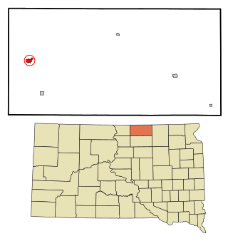
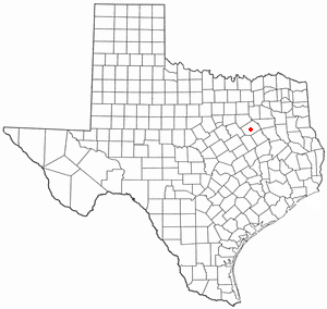
Navarro County is a county in the U.S. state of Texas. As of the 2020 census, the population was 52,624. Its county seat is Corsicana. The county is named for José Antonio Navarro, a Tejano leader in the Texas Revolution who signed the Texas Declaration of Independence.

Eureka County is a county in the U.S. state of Nevada. As of the 2020 census, the population was 1,855, making it the second-least populous county in Nevada. Its county seat is Eureka.

Climax is a city in Greenwood County, Kansas, United States. As of the 2020 census, the population of the city was 45.
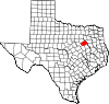
Eureka is a city in and the county seat of Greenwood County, Kansas, United States. As of the 2020 census, the population of the city was 2,332.

Wildwood is a city in St. Louis County, Missouri, United States. It is located in the far western portion of the county. As of the 2020 census, the population was 35,417. Wildwood is the home of the Al Foster Trail, and numerous other trails, parks, and reserves such as Rockwoods Reservation and Babler State Park.
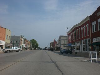
Eureka is a city in western McPherson County, South Dakota, United States, near the North Dakota state line. The population was 813 at the 2020 census.

Fairfield is a city and county seat of Freestone County, Texas, United States. The population was 2,850 at the 2020 census, down from 3,094 at the 2000 census. It was founded in 1851.

Trinidad is a city in Henderson County, Texas, United States, near the Trinity River from which the town's name was derived. The population was 860 at the 2020 census, down from 886 at the 2010 census.
Jewett is a city in Leon County, Texas, United States. The population was 793 at the 2020 census. It was laid out in 1871 by the International Railroad Company.
Angus is a city in Navarro County, Texas, United States. The population was 444 at the 2020 census.

Barry is a city in Navarro County, in the U.S. state of Texas. The population was 220 at the 2020 census.

Blooming Grove is a town in western Navarro County, Texas, United States. As of the 2020 census, the town population was 857, up from 821 in the 2010 census.

Mildred is a town in Navarro County, Texas, United States. The population was 399 at the 2020 census.

Navarro is a town in Navarro County, Texas, United States. The population was 232 at the 2020 census.
Oak Valley is a town in Navarro County, Texas, United States. The population was 406 at the 2020 census.

Retreat is a town in Navarro County, Texas, United States. The population was 410 at the 2020 census.

Rice is a city in Navarro County, Texas, United States. The population was 1,203 at the 2020 census.

Richland is a town in Navarro County, Texas, United States. The population was 255 at the 2020 census.

Summersville is a town in Shannon and Texas counties in the U.S. state of Missouri. The population was 453 at the 2020 census.

Streetman is a town in Freestone and Navarro counties in Texas, United States. As of the 2020 census the population was 248.