Tulgheș

Last updated • 6 min readFrom Wikipedia, The Free Encyclopedia
Tulgheș
Gyergyótölgyes
Biserica de lemn din Tulghes1.jpg
Romanian Orthodox wooden church
Tulghes jud Harghita.png
Location in Harghita County
Romania location map.svg
Red pog.svg
Tulgheș
Location in Romania
Coordinates: 46°56′27″N25°43′3″E / 46.94083°N 25.71750°E / 46.94083; 25.71750
CountryRomania
County Harghita
Government
  Mayor (20202024) Marcel Vancu [1] (PSD)
Area
244.47 km2 (94.39 sq mi)
Elevation
650 m (2,130 ft)
Population
 (2021-12-01) [2]
2,941
  Density12/km2 (31/sq mi)
Time zone EET/EEST (UTC+2/+3)
Postal code
537330
Area code +(40) 266
Vehicle reg. HR
Website www.tulghes.ro

Tulgheș (Hungarian : Gyergyótölgyes or colloquially Tölgyes, Hungarian pronunciation: [ˈɟɛrɟoːtølɟɛʃ] , meaning "place with oak trees in Gyergyó") is a commune in Harghita County, Romania. It lies in eastern Transylvania. The commune is composed of four villages: Hagota (Hágótő), Pintic (Péntekpataka), Recea (Récefalva), and Tulgheș.

Contents

Demography

At the 2011 census, 70.8% of inhabitants were Romanians and 28.8% Hungarians (Székelys). At the 2002 census, 65.5% of inhabitants were Romanian Orthodox and 31.3% Roman Catholic. [3] At the 2021 census, Tulgheș had a population of 2,941; of those, 70.59% were Romanians and 25.06% Hungarians. [4]

Tulgheș and Recea have ethnic Romanian majorities with large minorities of ethnic Hungarians, Pintic has an absolute Romanian majority, and Hagota has a Hungarian majority.

General information

Tulgheș commune is situated in the northeast part of Harghita County, at an average altitude of 650 metres (2,130 feet), on the lower part of the Bistricioara River.

This river flows from Călimani from an altitude of 1,350 m (4,430 ft) and crosses a total of 68.5 km (42.6 mi). The Bistricioara River Basin is formed by the streams:

Tulgheș received its name from the Tulgheș Pass, which links the Hang Depression in Neamț County with the Giurgeu Depression in Harghita County.

Tulghes center Tulghes.jpg
Tulgheș center

Transportation and important places in the area

Transportation in the area is exclusively by road.

Nearby notable cities include: Borsec (20 km (12 mi)), Bilbor (45 km (28 mi) via Borsec and then DJ144A), Toplița (45 km), Ditrău (34 km (21 mi) via DJ127), Gheorgheni (47 km (29 mi) via DJ127 81 km (50 mi) via Toplița).

Larger cities in the area include: Piatra Neamț (93 km (58 mi)), Târgu Neamț (69 km (43 mi)), Vatra Dornei (109 km (68 mi) via the Bistrița Valley, 89 km (55 mi) via Borsec-Creanga Pass-Bilbor on DJ174A).

Geomorphological and climatic highlights

The mountains around the village are:

The climate is specific to mountain zones with cool summers (average temperature of 14-16 degrees C in July) and moderate winters.

The average annual temperature ranges from 5-6 degrees C, and the average rainfall is about 1000mm/m2. There is snow on the ground 80–100 days per year, with an average thickness of 250 cm in the higher mountain altitudes. Due to the shelter of the mountains surrounding it, The Corbu-Tulgheș Depression receives more favorable weather conditions than in the Giurgeu Depression of the Upper Mureș Valley, where temperatures are much lower.

Economic highlights

The primary economic source is the development of local natural resources. However, a secondary source is pastoral farming and vegetable farming practiced in private households, where a smaller yield is cultivated because the primary goal is sustainability.

On the way toward Mt. Grințieș via the Primatar River Valley on the perimeter of Preluca Ursului, there is a uranium deposit with two areas of experimental exploration: Primatar I and II, which are currently in preservation.

The community also benefits from a post office and several private trade shops, including a barber, shoemaker and blacksmith.

Historical highlights

Tulghes viewed from the Putna Valley, 1914 Tulghes from Putna Valley in 1914.jpg
Tulgheș viewed from the Putna Valley, 1914

The community of Tulgheș developed after the 17th century, mainly in the 19th century when there was a change in the local Transcarpathian roads. At the end of the 18th century, the Priska Pass used to be the gateway for travelers by foot and horseback. The official customs and quarantine office was on Mt. Priska (Piricske) between Putna and Belcina. Those coming from Gheorgheni (Gyergyószentmiklós) used to climb up Mount Tătarul (Tatárhágó) and then descend via the Putna Valley, and, through Tulgheș, arrived in Moldavia. The Transylvanian checkpoint at Priska moved in 1806 toward Gura Putnei in Tulgheș, while the Moldovan checkpoint moved to Prisecani (1792).

The population flood from the Mureș corridor (Romanian and Székely) and from the Bistrița Valley took over the existing Romanian population in Tulgheș.

The name, which comes from “Oak Tree” after the oak forest found on the southern slope of the foothills of the Bistrița Mountains toward the Bistricioara Valley, originates from the Hungarian Tölgyes. However, it was later renamed officially Tulgheș after 1920, similar to Rezu Mare (Nagyréz), Pârâul Mărului (Marpatak), Gyergótölgyes, etc.

Opportunities

In the Tulgheș area, there are 30 mineral springs, of which 11 have been recorded and inventoried. The current bioclimate also makes the area suitable for spas. The most important springs are Șesul Comarnicului, Laurențiu, Branea, Prisecani, Diacul de Sus, Diacul de Jos, Cibeni, Șandoreni and Rezu Mare.

Touristic landmarks and memorials

Natives

Related Research Articles

<span class="mw-page-title-main">Neamț County</span> County of Romania

Neamț County is a county (județ) of Romania, in the historic region of Moldavia, with the county seat at Piatra Neamț. The county takes its name from the Neamț River.

<span class="mw-page-title-main">Harghita County</span> County of Romania

Harghita County is a county in the center of Romania, in eastern Transylvania, with the county seat at Miercurea Ciuc.

<span class="mw-page-title-main">Mureș County</span> County of Romania

Mureș County is a county (județ) of Romania, in the historical region of Transylvania, with the administrative centre in Târgu Mureș. The county was established in 1968, after the administrative reorganization that re-introduced the historical județ (county) system, still used today. This reform eliminated the previous Mureș-Magyar Autonomous Region, which had been created in 1952 within the People's Republic of Romania. Mureș County has a vibrant multicultural fabric that includes Hungarian-speaking Székelys and Transylvanian Saxons, with a rich heritage of fortified churches and towns.

<span class="mw-page-title-main">Piatra Neamț</span> Municipality in Neamț, Romania

Piatra Neamț is the capital city of Neamț County, in the historical region of Western Moldavia, in northeastern Romania. Because of its very privileged location in the Eastern Carpathian mountains, it is considered one of the most picturesque cities in Romania. The Nord-Est Regional Development Agency is located in Piatra Neamț.

<span class="mw-page-title-main">Toplița</span> Municipality in Harghita, Romania

Toplița is a municipality in Harghita County, Transylvania, Romania.

<span class="mw-page-title-main">Bistrița (Siret)</span> River in Romania, tributary to Siret River

The Bistrița is a river in the Romanian regions of Maramureș, Bukovina and Moldavia. It is a right tributary of the river Siret. At Chetriș, near Bacău, it flows into the Siret. Its source is in the Rodna Mountains, at the foot of the Gârgalău Peak. It flows through the counties Bistrița-Năsăud, Suceava, Neamț, and Bacău. The towns Vatra Dornei, Bicaz, Piatra Neamț, Roznov, Buhuși, and Bacău lie along the Bistrița. The Bistrița is 283 km (176 mi) long, and its basin area is 7,039 km2 (2,718 sq mi).

<span class="mw-page-title-main">Borsec</span> Town in Harghita, Romania

Borsec is a town in Harghita County, Transylvania, Romania. The town and the surrounding areas are well known for their spas and mineral waters. It has a population of 2,585, with a majority of ethnic Hungarians.

<span class="mw-page-title-main">Rodna Mountains</span> Mountain range in northeast region of Romania

Rodna Mountains are a subdivision of the Inner Eastern Carpathians in northern Romania. The name comes from the nearby Rodna Veche village. At 2,303 metres, Pietrosul Rodnei is the highest peak in all of the Eastern Carpathians.

<span class="mw-page-title-main">Durău</span>

Durău is a ski resort located in north-eastern Romania, in Neamț County, Moldavia near the Ceahlău Massif. The location is disadvantaged because of the lack of accessibility, the only access road being DN15 ; the regular route from Bicaz is closed as of February 2006 due to landslides.

<span class="mw-page-title-main">Prundu Bârgăului</span> Commune in Bistrița-Năsăud, Romania

Prundu Bârgăului is a commune in Bistrița-Năsăud County, Romania, in the historical region of Transylvania. It is composed of two villages, Prundu Bârgăului and Susenii Bârgăului (Felsőborgó).

Pintic may refer to several places in Romania:

The Bistricioara is a right tributary of the river Bistrița in Romania, which it joins at the upper end of Lake Izvorul Muntelui, near the village Bistricioara. It flows through the villages Bilbor, Capu Corbului, Corbu, Tulgheș, Bradu, Grințieș and Bistricioara. Upstream from its confluence with the Borcut, it is also called Răcila. Its length is 64 km (40 mi) and its basin size is 770 km2 (300 sq mi).

The Rezu Mare is a left tributary of the river Putna in Romania. It flows into the Putna near Tulgheș. Its length is 16 km (9.9 mi) and its basin size is 47 km2 (18 sq mi).

The Putna is a right tributary of the river Bistricioara in Romania. Upstream from its confluence with the Putna Întunecoasă in the village of Hagota, it is also called Putna Noroioasă. It discharges into the Bistricioara in Tulgheș. Its length is 23 km (14 mi) and its basin size is 175 km2 (68 sq mi).

<span class="mw-page-title-main">Corbu, Harghita</span> Commune in Harghita, Romania

Corbu is a commune in Harghita County, Transylvania, Romania. The commune is composed of two villages, Capu Corbului (Hollósarka) and Corbu.

<span class="mw-page-title-main">Întregalde</span> Commune in Alba, Romania

Întregalde is a commune located in Alba County, Transylvania, Romania. It is composed of eleven villages: Dealu Geoagiului (Havasgyógy), Ghioncani, Iliești, Întregalde, Ivăniș, Mărinești, Modolești, Necrilești (Nekrilesti), Popești (Popesti), Sfârcea (Szfirecsea) and Tecșești (Teksesty).

<span class="mw-page-title-main">Tiha Bârgăului</span> Commune in Bistrița-Năsăud, Romania

Tiha Bârgăului is a commune in Bistrița-Năsăud County, Transylvania, Romania. It is composed of five villages: Ciosa (Csószahegy), Mureșenii Bârgăului (Marosborgó), Piatra Fântânele (Báránykő), Tiha Bârgăului, and Tureac (Turjágó).

<span class="mw-page-title-main">Bicazu Ardelean</span> Commune in Neamț, Romania

Bicazu Ardelean is a commune in Neamț County, Romania. It is composed of three villages: Bicazu Ardelean, Telec (Gyergyózsedánpatak), and Ticoș (Tikos).

<span class="mw-page-title-main">Grințieș</span> Commune in Neamț, Romania

Grințieș is a commune in Neamț County, Western Moldavia, Romania. It is composed of three villages: Bradu, Grințieș, and Poiana.

<span class="mw-page-title-main">Tarcău Mountains</span>

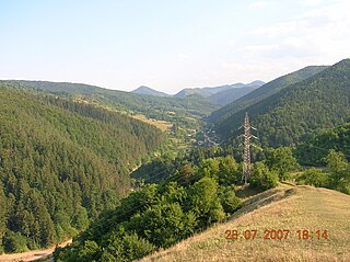
The Tarcău Mountains are a mountain range, part of the Moldavian-Muntenian Carpathians of the Outer Eastern Carpathians.

References

  1. "Results of the 2020 local elections". Central Electoral Bureau. Retrieved 10 June 2021.
  2. "Populaţia rezidentă după grupa de vârstă, pe județe și municipii, orașe, comune, la 1 decembrie 2021" (XLS). National Institute of Statistics.
  3. Romanian Census 2002; retrieved on July 23, 2010
  4. "Populația rezidentă după grupa de vârstă, pe județe și municipii, orașe, comune, la 1 decembrie 2021" (in Romanian). INSSE. 31 May 2023.

Bibliography