Tuljapur taluka

Last updated

Tuljapur Tahsil
tehsil
India Maharashtra location map.svg
Red pog.svg
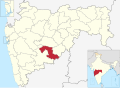
Tuljapur Tahsil
Location in Maharashtra, India
Coordinates: 17°51′N076°09′E / 17.850°N 76.150°E / 17.850; 76.150
CountryFlag of India.svg  India
State Maharashtra
District Osmanabad
Population
 (2011)
  Total279,277
Languages
  Official Marathi
Time zone UTC+5:30 (IST)
PIN
413601
Lok Sabha constituency Osmanabad
Vidhan Sabha constituency Tuljapur [1]

Tuljapur Tahsil is a tahsil/taluka (subdistrict) in Osmanabad district, Maharashtra on the Deccan Plateau of India. The town of Tuljapur is the administrative headquarters of the tahsil. There are 107 panchayat villages in Tuljapur Tahsil. [2]

Contents

Demographics

In the 2001 Indian census, Tuljapur Tahsil had a population of 250,149, with 129,622 (51.8%) males and 120,527 (48.2%) females, for a gender ratio of 930 females per thousand males. [3] The tahsil was 80.9% rural in 2001. [3]

In the 2011 census, Tuljapur Tahsil had 279,277 inhabitants [4] and a gender ratio of 919 females per thousand males. [5] The tahsil was 81.2% rural. [4] The literacy rate in 2011 was 75.66% overall in Tuljapur Tahsil, with a rate of 84.53% for males and 66.06% for females. [6] In 2011 in Tuljapur Tahsil, 12.3% of the population was 0 to 6 years of age. [4]

Towns and villages

There are two towns in Tuljapur Tahsil, Taljapur and Naldurg, both of which have municipal councils. Among the eighty-seven villages in the tahsil are: [7]

Related Research Articles

<span class="mw-page-title-main">Osmanabad district</span> District of Maharashtra in India

Osmanabad District officially known as Dharashiv District is an administrative district in the Marathwada region in the Indian state of Maharashtra. The district headquarter is located at Osmanabad. The District of Osmanabad derives its name from the last ruler of Hyderabad, the 7th Nizam, Mir Osman Ali Khan, of which the region was a part till 1947. This region was earlier part of The Hyderabad State until Independence.This primarily rural district occupies an area of 7,569 km2 (2,922 sq mi) of which 241.4 km2 (93.2 sq mi) is urban and has a population of 1,657,576 of which 16.96% were urban.

<span class="mw-page-title-main">Osmanabad</span> City in Maharashtra, India

Osmanabad, officially known as Dharashiv, is a city and a municipal council in Osmanabad district in the Indian state of Maharashtra. The city is the administrative headquarter of Osmanabad district. It is the seventh largest city in Marathwada, and the 39th largest city in Maharashtra by population.

Tuljapur is a town with a municipal council in Dharashiv district in the Indian state of Maharashtra. It is the administrative seat of Tuljapur taluka.

Bhoom is a town with a municipal council in Osmanabad district, Maharashtra, India, and it is the headquarters of Bhoom tahsil. Bhoom municipal corporation is established in 1948. Bhoom is a small town situated in a valley of the Banashankar hill ranges of Sahyadri. It is situated on the banks of the River Banaganga, which eventually flows into the Bhima. In 1717, Sambhaji II of Kolhapur gave Bhoom as jagir to Shrimant Senakhaskhel Yashwantrao Thorat (a chief and military leader of his troops) for his bravery. In 19th century Bhoom was under Nizam territory during the British raj in India. However it was independently ruled by the ' Thorat ' royal family. Shrimant Vijaysinh Amarsinh Thorat is the present head of Bhoom. He was the President of Bhoom Municipal Council from 1991 -2006.

Kalamb is one of eight tehsils in the Osmanabad district in the state of Maharashtra, India. Headquarters for the tehsil is the town of Kalamb. There are ninety-one panchayat villages in the Kalamb Tehsil.

Walwa is a taluka in Sangli district in the Indian state of Maharashtra. It is also known as Walwa-Islampur Taluka. There are ninety-five panchayat villages in Walwa Taluka.

Washi is a Nagar panchayat village and the headquarters of Washi taluka in Bhoom subdivision of Osmanabad district of Maharashtra state in India. The village of Washi is 22 km by road northeast of the town of Bhoom, and 25 km by road northwest of Yermala. The nearest railway station is 40 km by road southwest to Yedshi in Osmanabad District.

Terkheda is a panchayat village in Washi taluka of Osmanabad district in India. Terkheda is the only village listed in its gram panchayat, but it is surrounded by twelve small villages and has an old history; Hindus, Lingayats and Muslims all live together there. The village is surrounded by many hills and is next to the Tirna River. National Highway 211 runs just south of the main village.

Udgir Taluka, officially known as, Udayagiri Taluka, is a taluka and administrative subdivision of Latur District in the Indian state of Maharashtra. The administrative center for the taluka is the town of Udgir. In the 2011 census there were eighty-seven panchayat villages in Udgir Taluka.

Lohara Tehsil is a tehsil/taluka (subdistrict) in Osmanabad district, Maharashtra on the Deccan Plateau of India. Lohara Bk. is the administrative headquarters of the tehsil. There are forty-seven villages in Lohara Taluka.

Paranda Tahsil is a tahsil (subdistrict) in Osmanabad district, Marathwada region in Maharashtra on Deccan Plateau of India. The town of Paranda is the administrative headquarters of the tahsil. There are seventy-two panchayat villages in Paranda Tahsil.

Bhoom Tahsil is a tehsil in Osmanabad district, Maharashtra on the Deccan Plateau of India. The town of Bhoom is the administrative headquarters of the tahsil. There are seventy-four panchayat villages in Bhoom Tahsil. In 19th century Bhoom was under Nizam territory during the British raj in India. However it was independently ruled by the Thorat royal family. Shrimant Vijaysinh Amarsinh Thorat is the present head of Bhoom. He was the President of Bhoom Municipal Council from 1991 -2006.

Osmanabad Tahsil is a tahsil/taluka (subdistrict) in Osmanabad district, Maharashtra on the Deccan Plateau of India. The town of Osmanabad is the administrative headquarters of the tahsil. There are 110 panchayat villages in Osmanabad Tahsil.

Washi Tahsil is a tahsil/taluka (subdistrict) in Osmanabad district, Maharashtra on the Deccan Plateau of India. The town of Washi is the administrative headquarters of the tahsil. There are forty-three panchayat villages in Washi Tahsil.

Umarga (Omerga) Tehsil is a tehsil/ taluka/ subdistrict in Osmanabad district, Maharashtra on the Deccan Plateau of India. The town of Umarga is the administrative headquarters of the tehsil. There are 79 panchayat villages in Umarga Tehsil.

Alur is a panchayat village in the state of Maharashtra, India. It is administratively under the Umarga Tahsil of Osmanabad District in Maharashtra. There is only the single village of Alur in the Alur gram panchayat. The village is 31 km by road southeast of Naldurg and 52 km by road southwest of Umarga, but only 13 km by road northeast of Wagdari, in Solapur District.

Lohara Bk. is a Nagar Panchayat town in the state of Maharashtra, India. Lohara Bk. is headquarters for and administratively under Lohara Tehsil of Osmanabad District in Maharashtra. There is only the single town of Lohara Bk. in the Lohara Bk. Nagar panchayat. The village of Lohara Bk. is 22 km by road west of the village of Sastur and 33 km by road east of the town of Tuljapur.

Sastur is a panchayat village in the state of Maharashtra, India. Administratively, Sastur is under Lohara Tehsil of Osmanabad District in Maharashtra. There is only the single village of Sastur in the Sastur gram panchayat. The village of Sastur is 20 km by road northwest of the village of Madaj and 22 km by road east of the village of Lohara Bk.

Madaj is a panchayat village in the state of Maharashtra, India. Administratively, Madaj is under Umarga Tehsil of Osmanabad District in Maharashtra. There is only the single village of Madaj in the Madaj gram panchayat. The village of Madaj is 17 km by road north of the town of Umarga and 20 km by road southeast of the village of Sastur.

<span class="mw-page-title-main">Karmala Taluka</span> Taluka in Maharashtra, India

Karmala Taluka is one of the 11 talukas of Solapur district in the Indian state of Maharashtra. Parts of the movie Sairat were shot in this taluka. Its headquarters are in the town of Karmala.

References

  1. "Assembly Constituencies-Post delimitation: Maharashtra: Osmanabad District" (PDF). National Informatics Centre, Government of India. Archived from the original (PDF) on 5 May 2013.
  2. "Reports of National Panchayat Directory: Village Panchayat Names of Tuljapur, Osmanabad, Maharashtra". Ministry of Panchayati Raj, Government of India.
  3. 1 2 "Census 2001 Population Finder: Maharashtra: Osmanabad: Tuljapur". Office of The Registrar General & Census Commissioner, Ministry of Home Affairs, Government of India.
  4. 1 2 3 "Population, Child Population in the age-group 0–6 and Literates by residence and sex, State, Districts, Tahsils 2011: Maharashtra" (PDF). Press Information Bureau, Mumbai. p. 41.
  5. "Sex ratio of Population and Child Population in the age-group 0–6, State, Districts, Tahsils 2011: Maharashtra" (PDF). Press Information Bureau, Mumbai. p. 8.
  6. "Literacy rates by residence and sex, State, Districts, Tahsils 2011: Maharashtra" (PDF). Press Information Bureau, Mumbai. p. 17.
  7. "NPR Report: Maharashtra: Osmanabad: Tuljapur". National Population Register, Ministry of Home Affairs, Government of India. 2011. Archived from the original on 13 August 2015.