
The Mojave River is an intermittent river in the eastern San Bernardino Mountains and the Mojave Desert in San Bernardino County, California, United States. Most of its flow is underground, while its surface channels remain dry most of the time, except for the headwaters and several bedrock gorges in the lower reaches.

The Santa Monica Mountains are a coastal mountain range in Southern California, next to the Pacific Ocean. It is part of the Transverse Ranges. The Santa Monica Mountains National Recreation Area encompasses this mountain range. Because of its proximity to densely populated regions, it is one of the most visited natural areas in California.

The Santa Rosa Mountains are a short mountain range in the Peninsular Ranges system, located east of the Los Angeles Basin and northeast of the San Diego metropolitan area of southern California, in the southwestern United States.

The Simi Hills are a low rocky mountain range of the Transverse Ranges in eastern Ventura County and western Los Angeles County, of southern California, United States.

The Carrizo Plain is a large enclosed grassland plain, approximately 50 miles (80 km) long and up to 15 miles (24 km) across, in southeastern San Luis Obispo County, California, United States, about 100 miles (160 km) northwest of Los Angeles. The southern portion of the Carrizo Plain is within the 246,812-acre (99,881 ha) Carrizo Plain National Monument, which also includes most of the Caliente Range. The Carrizo Plain is the largest single native grassland remaining in California. It includes Painted Rock in the Carrizo Plain Rock Art Discontiguous District, which is listed on the National Register of Historic Places. In 2012 it was further designated a National Historic Landmark due to its archeological value. The San Andreas Fault occurs along the eastern edge of the Carrizo Plain at the western base of the Temblor Range.

The Diablo Range is a mountain range in the California Coast Ranges subdivision of the Pacific Coast Ranges in northern California, United States. It stretches from the eastern San Francisco Bay Area at its northern end to the Salinas Valley area at its southern end.

The Verdugo Mountains, also known as the Verdugo Hills or simply The Verdugos, are a small, rugged mountain range of the Transverse Ranges system in Los Angeles County, California. Located just south of the western San Gabriel Mountains, the Verdugo Mountains region incorporates the cities of Burbank, Glendale, Pasadena, and La Cañada Flintridge; the unincorporated communities of Altadena and La Crescenta-Montrose; as well as the City of Los Angeles neighborhood of Sunland-Tujunga.

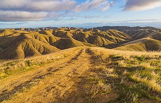
The Soda Mountains are located in the eastern Mojave Desert in San Bernardino County, California, USA. The range lies to the north of Interstate 15 west of the town of Baker.
The Piute Mountains are a mountain range located in the Eastern Mojave Desert and within Mojave Trails National Monument, in San Bernardino County, California.

The Orocopia Mountains are located in Riverside County in southern California, United States, east of the Coachella Valley, west of the Chuckwalla Mountains, and south of Interstate 10 in the Colorado Desert. The range lies in an east-west direction, and is approximately 18 miles long. The Orocopia Mountains are north of and overlooking the Salton Sea and south of Joshua Tree National Park, with the Chocolate Mountains to the southeast and the scenic Mecca Hills just northwest.
Tierra Redonda Mountain is a mountain in northwestern San Luis Obispo County, California. It is in the eastern portion of the Santa Lucia Range, separated from the main ridge by the Nacimiento River.
The Sylvania Mountains Wilderness is a federally designated wilderness area located 30 miles (48 km) east of Bishop in the state of California. The wilderness is 18,677acres in size and is managed by the Bureau of Land Management (BLM). The California Desert Protection Act of 1994 created the Sylvania Mountains Wilderness and was added to the National Wilderness Preservation System. The wilderness is bordered by Nevada stateline on the east, Piper Mountain Wilderness on the west and Death Valley National Park to the south.
The Bighorn Mountains are a mountain range of the Mojave Desert and Transverse Ranges, located in San Bernardino County, California. They are primarily within a Bureau of Land Management (BLM) protected area.
The Panoche Hills are a low mountain range in the Southern Inner California Coast Ranges System, in western Fresno County, California.
The Red Hills are a mountain range in Tuolumne County, California. Elevations within the Red Hills vary between 750 and 1,750 feet above sea level. Slopes of the hills themselves vary from about 30% to 75%.

The Santa Teresa Hills are a range of mountains in Santa Clara County, California, located primarily in the city of San Jose. They separate the San Jose neighborhoods of Almaden Valley to the west and Santa Teresa to the east.

Pine Hill Ecological Reserve is a nature reserve of 403 acres (1.63 km2) located due east of Folsom Lake in the Sierra Nevada foothills, in El Dorado County, California. The reserve was established in 1979, and is managed by the Bureau of Land Management.

The Santa Rosa Wilderness is a 72,259-acre (292.42 km2) wilderness area in Southern California, in the Santa Rosa Mountains of Riverside and San Diego counties, California. It is in the Colorado Desert section of the Sonoran Desert, above the Coachella Valley and Lower Colorado River Valley regions in a Peninsular Range, between La Quinta to the north and Anza Borrego Desert State Park to the south. The United States Congress established the wilderness in 1984 with the passage of the California Wilderness Act, managed by both the US Forest Service and the Bureau of Land Management. In 2009, the Omnibus Public Land Management Act was signed into law which added more than 2,000 acres (8.1 km2). Most of the Santa Rosa Wilderness is within the Santa Rosa and San Jacinto Mountains National Monument.

Berryessa Snow Mountain National Monument is a national monument of the United States comprising 344,476 acres (139,404 ha) of the California Coast Ranges in Napa, Yolo, Solano, Lake, Colusa, Glenn and Mendocino counties in northern California. Cache Creek Wilderness is located within the monument.

Sand to Snow National Monument is a U.S. National Monument located in San Bernardino County and northern Riverside County, Southern California.


