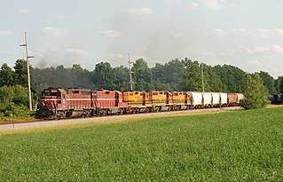
Groveland is a town in Livingston County, New York, United States. The population was 3,249 at the 2010 census. The town is centrally located in the county, south of Geneseo.
Tuscarora township is a township in Steuben County, New York, United States. The population was 1,400 at the 2000 census. The township is named after the Tuscarora tribe.
Mount Morris is a village in the town of Mount Morris in Livingston County, New York, United States. The village population was 2,986 at the 2010 census, out of 4,465 in the entire town. The village and town are named after Robert Morris.
Mount Morris is a town in Livingston County, New York, United States. The population was 4,465 at the 2010 census. The town and village were named after Robert Morris, a Founding Father of the United States.

Retsof is a hamlet and census-designated place (CDP) within the town of York in Livingston County, New York, United States. The community, situated 30 miles (48 km) southwest of the city of Rochester, is off New York State Route 63 approximately one mile east of State Route 36. As of the 2010 census, it had a population of 340.

Cuylerville is a hamlet in the Town of Leicester, in Livingston County, New York, United States. The population was 297 at the 2010 census, which lists the community as a census-designated place.
Lakeville is a hamlet and census-designated place (CDP) in the town of Livonia, Livingston County, New York, United States. Its population was 756 as of the 2010 census.
East Avon is a hamlet and census-designated place (CDP) in the town of Avon, Livingston County, New York, United States. The population was 608 at the 2010 census.
Hemlock is a hamlet and census-designated place (CDP) in the town of Livonia, Livingston County, New York, United States. The population was 557 as of the 2010 census.
Piffard is a census-designated place (CDP) and hamlet in the town of York, Livingston County, New York, United States. As of the 2010 census, its population was 220. The ZIP Code is 14533.
Dalton is a hamlet and census-designated place (CDP) in the towns of Nunda and Portage in Livingston County, New York, United States. The population was 362 at the 2010 census.
Greigsville is a hamlet and census-designated place (CDP) in the town of York, Livingston County, New York, United States. Its population was 209 as of the 2010 census. The community is located at the intersection of New York State Route 36 and New York State Route 63.
Groveland Station is a census-designated place (CDP) in Livingston County, New York, United States. The CDP consists of the hamlet of Groveland and nearby residential areas. The CDP population was 281 as of the 2010 census. New York State Route 63 passes through the community.
Kysorville is a hamlet and census-designated place (CDP) in the town of West Sparta, Livingston County, New York, United States. Its population was 110 as of the 2010 census.
Wadsworth is a hamlet and census-designated place (CDP) in the town of York, Livingston County, New York, United States. Its population was 190 as of the 2010 census. New York State Route 36 passes through the community.
Websters Crossing is a hamlet and census-designated place (CDP) in the town of Springwater, Livingston County, New York, United States. Its population was 69 as of the 2010 census. New York State Route 15 passes through the community.
York is a hamlet and census-designated place (CDP) in the town of York, Livingston County, New York, United States. Its population was 544 as of the 2010 census. New York State Route 36 passes through the community.
Linwood is a hamlet and census-designated place (CDP) in the town of York, Livingston County, New York, United States. Its population was 74 as of the 2010 census. Linwood had a post office until February 6, 1993; it still has its own ZIP code, 14486.
Livonia Center is a hamlet and census-designated place (CDP) in the town of Livonia, Livingston County, New York, United States. Its population was 421 as of the 2010 census. Livonia Center has a post office with ZIP code 14488, which opened on April 9, 1811.
South Lima is a hamlet and census-designated place (CDP) in Livingston County, New York, United States. Its population was 240 as of the 2010 census. South Lima had a post office from January 10, 1854, until April 17, 2010; it still has its own ZIP code, 14558.


