
Calaveras County, officially the County of Calaveras, is a county in the northern portion of the U.S. state, California. As of the 2010 census, the population was 40,171. The county seat is San Andreas. Angels Camp is the only incorporated city in the county. Calaveras is the Spanish word for skulls; the county was reportedly named for the remains of Native Americans discovered by the Spanish explorer Captain Gabriel Moraga.

Stanislaus County is located in the Central Valley of the U.S. state of California. As of the 2010 census, the population was 514,453. The county seat is Modesto.
Modesto, officially the City of Modesto, is the county seat and largest city of Stanislaus County, California, United States. With a population of approximately 201,165 at the 2010 census, it is the 18th largest city in the state of California and forms part of the Modesto–Merced combined statistical area.

Myszków is a town in Poland, with 31,650 inhabitants (2019). Situated on the Warta river in the Silesian Voivodeship, previously in Częstochowa Voivodeship (1975–1998), it is the capital of Myszków County. Myszków historically belongs to Lesser Poland, and the area where the town is now located, until the Partitions of Poland was part of Kraków Voivodeship’s County of Lelów. Myszków is located along one of the oldest Polish rail lines – the Warsaw–Vienna railway, also, near the town goes another important rail line – the Central Rail Line

Nakło nad Notecią is a town in northern Poland on the river Noteć with 23,687 inhabitants (2007). Since 1999, it has been in the Kuyavian-Pomeranian Voivodeship. It was in Bydgoszcz Voivodeship from 1975 to 1998. It is the seat of Nakło County, and also of Gmina Nakło nad Notecią.

Kęty is a town in Oświęcim County, Lesser Poland Voivodeship, Poland with 18,955 inhabitants (2012). The town located in Silesian Foothills dates its earliest document from 1277 when Polish prince of Opole Władysław confirmed sale of the settlement and adoption of Lviv city rights. The town's name comes from the word kąt. The greatest development of the town came under the rule of Jagiellons, when the town became royal property.

Stanislaus National Forest is a United States national forest which manages 898,099 acres of land in four counties in the Sierra Nevada in Northern California. It was established on February 22, 1897, making it one of the oldest national forests. It was named after the Stanislaus River.

The Stanislaus River is a tributary of the San Joaquin River in north-central California in the United States. The main stem of the river is 96 miles (154 km) long, and measured to its furthest headwaters it is about 150 miles (240 km) long. Originating as three forks in the high Sierra Nevada, the river flows generally southwest through the agricultural San Joaquin Valley to join the San Joaquin south of Manteca, draining parts of five California counties. The Stanislaus is known for its swift rapids and scenic canyons in the upper reaches, and is heavily used for irrigation, hydroelectricity and domestic water supply.

Melones is a former settlement in Calaveras County, California, now submerged beneath a reservoir named New Melones Lake. It lay at an elevation of 955 feet. Melones was founded on the site of a ferry operated from 1848 by John W. Robinson and Stephen Mead. The town initially took its name from the ferry.

St. Stanislaus Roman Catholic Oratory - Roman Catholic parish in the historic Mitchell Street District of Milwaukee, Wisconsin. It was designed by Polish nobleman Leonard Kowalski, one of Milwaukee's early Polish residents, who took the name Leonard Schmidtner and spoke German.

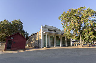
Knights Ferry is an unincorporated historic community in Stanislaus County, California, United States. Nestled in the foothills of the Sierra Nevada, it is about 40 miles (64 km) east of Modesto on the Stanislaus River. The Willms Ranch, a California Landmark near the town, was one of many filming locations for the television series Bonanza and Little House on the Prairie. It is home to the Knights Ferry Bridge, the longest covered bridge west of the Mississippi at 330 feet (100 m) in length. Today, it is home to a K-8 Elementary School, and a museum about the history of the town and also about local wildlife. The town's ruins include a mill and a jail.

Bear River is an unincorporated community in Itasca and Saint Louis counties in the U.S. state of Minnesota.
La Grange is a small unincorporated community in rural Stanislaus County, California. Its altitude is 249 feet (76 m). As of 2008 it has a population of 345. It is located at 37°39′49″N120°27′49″W along the Tuolumne River, and is near the La Grange Dam and the New Don Pedro Dam.

Merced Falls is an unincorporated community in Merced County, California. It is located on the north bank of the Merced River 6 miles (9.7 km) east of Snelling, at an elevation of 348 feet . Merced Falls was named for a set of rapids on the Merced River.

Daniels is a ghost town straddling the Patapsco River east of Woodstock and north of Old Ellicott City in Baltimore and Howard counties, Maryland, United States. It is the location of the Daniels Mill, a site listed on the National Register of Historic Places. Daniels is the home town of former Howard County Executive and State Senator James N. Robey. A postal office operated in the community from 1 March 1943 to 31 August 1971.
Pinecrest is an unincorporated community in Tuolumne County, California, United States. Pinecrest is located near Pinecrest Lake northwest of Mi-Wuk Village. Pinecrest Lake sits in what was once a meadow surrounded by granite outcroppings. Originally, Pinecrest Lake was called Strawberry Flat because of the wild strawberries that once grew there. In the 1960s the name was officially changed to Pinecrest. The campground adjacent to the lake is under the white fir, cedar, and sugar pine trees.
Hills Ferry is a small unincorporated community of the northern San Joaquin Valley in Stanislaus County, California. Hills Ferry is located at 37°20′56″N120°58′47″W.
Langworth is a small unincorporated community in Stanislaus County, California, United States and is 3 miles west of Oakdale, California.
The Empire City Historic Landmark is a California Historic Landmark in honor of the pioneer John C. Marvin who from 1850, settled on the south bank of the Tuolumne River and called the town "Empire City". Empire City was the head of navigation for small steamboats that could ascend the Tuolumne River carrying passengers and supplies. It was the shipping point for the large grain crops grown in the area. At its height, the town had three stores, a three-story hotel, two boarding houses, a blacksmith shop, a church, and a school house. Empire City was voted as the county seat of Stanislaus County from October 1854 to December 1855. The town was destroyed by flood waters during the Great Flood of 1862. A new railroad town was built 40 years later 1 mile north of the old town site, taking the name Empire.
There are 45 routes assigned to the "J" zone of the California Route Marker Program, which designates county routes in California. The "J" zone includes county highways in Alameda, Calaveras, Contra Costa, Fresno, Kern, Inyo, Mariposa, Merced, Sacramento, San Benito, San Joaquin, Stanislaus, and Tulare counties.
