Narwar is a town and a nagar panchayat in Shivpuri district in the Indian state of Madhya Pradesh. Narwar is a historic town and the Narwar Fort is just east of the Kali Sindh River and is situated at a distance of 42 km from Shivpuri. Narwar was known as Narwar District during the times of Gwalior State. It is mentioned as Nalpura in many medieval Sanskrit inscriptions. The Narwar Fort is surrounded by the Kali Sindh River. There are three dams, Harsi Dam, Mohini Sagar and Atal Sagar. Presently the Fort is being renovated by the Archaeological Survey of India.

Guna is a city and a municipality in Guna district in the Indian state of Madhya Pradesh. It is the administrative headquarters of Guna District and is located on the banks of Parbati river.

Khetri Nagar is a town in Jhunjhunu district of Rajasthan in India. It is part of the Shekhawati region. Khetri is actually two towns, "Khetri Town" founded by Raja Khet Singhji Nirwan and "Khetri Nagar" which is about 10 km away from Khetri. Khetri Nagar, well known for its Copper Project, was built by and is under the control of Hindustan Copper Limited, a public sector undertaking under the Government of India. Khetri Nagar is also very well known with name of 'Copper'.Ther are many attached village near khetri nagar like Manota Khurd the people of this village was employed in mines.Khetri is full of heritage, diversity.People of various religions live with mutual cooperation and harmony here. Today this adorable part of India is backward due to lack of development works.Khetri is a Town and Tehsil in Jhunjhunu district of Rajasthan state in India. Total number of villages in this Tehsil is 106. Khetri Tehsil sex ratio is 914 females per 1000 of males.Average literacy rate of Khetri Tehsil in 2011 were 72.51% in which, male and female literacy were 85.58% and 58.39% respectively.
Dakshin Jhapardaha is a census town in Domjur CD Block of Howrah Sadar subdivision in Howrah district in the state of West Bengal, India. It is close to Domjur and also a part of Kolkata Urban Agglomeration.
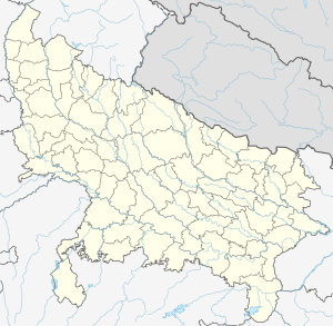
Daurala is a town and a nagar panchayat in Meerut district in the state of Uttar Pradesh, India.
Gulaothi is a town, near Bulandshahr city and municipal board in the Bulandshahr district that falls under the Meerut division of the Indian state of Uttar Pradesh.
Guriahati is a census town in the Cooch Behar I CD block in the Cooch Behar Sadar subdivision of the Cooch Behar district in the Indian state of West Bengal.

Khatima is a town and a municipal board in Udham Singh Nagar district in the Indian state of Uttarakhand.
Kiraoli is a town and a nagar panchayat in Agra district in the Indian state of Uttar Pradesh.
Kolaras is a town and a nagar parishad in Shivpuri district in the Indian state of Madhya Pradesh. Kolaras is located on NH3 presently called NH46. It is religious city and famous with name mini vrindavan.
Konganapuram is a panchayat town in Salem district in the Indian state of Tamil Nadu.
Nallur (Nalloor) is a panchayat town in Kanniyakumari district in the Indian state of Tamil Nadu.
Pilibanga is a town and a municipality in Hanumangarh district in the Indian state of Rajasthan.
Tikri is a town and a nagar panchayat in Baghpat in the Indian state of Uttar Pradesh.
Valavanur is a panchayat town in Viluppuram district in the Indian state of Tamil Nadu. It is situated near to the Tamil Nadu–Puducherry border on NH 45A.
Fatehabad is a town in Agra district in the state of Uttar Pradesh, India. It is nearly 35 km south-east of Agra in the direction of Etawah. The historical name of the town is Samugarh.

Shahpur is a town and a notified area in Bhojpur district in the Indian state of Bihar.
Shahpur is a town and a nagar panchayat in Muzaffarnagar district in the Indian state of Uttar Pradesh. As of 2001, it had a population of 17,186.

Salon is a town and nagar panchayat in Raebareli district in the Indian state of Uttar Pradesh. It serves as the headquarters of a tehsil as well as a community development block. Originally it was also the headquarters of the entire district, but they were moved after the Indian Rebellion of 1857. It is located a bit to the south of the Sai river, at the junction of the Raebareli-Pratapgarh and Jais-Khaga roads. Other roads lead to Dalmau, Manikpur, and Kunda. To the east is a large jhil.
Shirahatti is a panchayat town in Gadag district in the Indian state of Karnataka.


