Saharanpur is a city and a municipal corporation in Uttar Pradesh, India. It is also the administrative headquarters of Saharanpur district.

Budhana is a town, block, tehsil, Nagar Panchayat, and one of the constituencies of the Uttar Pradesh Legislative Assembly in Muzaffarnagar district in the state of Uttar Pradesh, India.
Chandpur is a town and a municipal board in Bijnor district in the Indian state of Uttar Pradesh, India.
Jhinjhana is a town and a nagar panchayat in Shamli district in the Indian state of Uttar Pradesh.
Kairana is a city and a municipal board in Shamli district of the Indian state of Uttar Pradesh.
Kandhla is a town and a municipal board in Shamli District in the Indian state of Uttar Pradesh.
Noorpur is a City and a Municipal Board in Bijnor District in the Indian State of Uttar Pradesh. It has a mixed population of Muslims, Hindus, Sikkh, Christians and other religions as well.
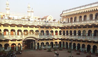
Sarsawa is a town at the border of Haryana and a municipal board in Saharanpur district in the Indian state of Uttar Pradesh.

Shamli is a city and the headquarters of Shamli district, in the Indian state of Uttar Pradesh. It is a part of Delhi NCR and is an administrative subdivision under Saharanpur division.
Tundla is a town and a municipal board in Firozabad district in the Indian state of Uttar Pradesh.
Jalalabad is a town and a nagar panchayat in Shamli district in the Indian state of Uttar Pradesh. It is a historical town situated on Delhi Saharanpur road. Dating back to the Mughal period, situated close to the borders of Haryana and Uttarakhand states, and surrounded by a very fertile agricultural region namely famous for plentiful yields in grains and fruits, Jalalabad is internationally famous for its wood carving work cottage industry. It is a thriving market of local agricultural produce, including basmati rice and mangoes. A variety of agro-based industrial enterprises - such as textile, sugar, paper and cigarette factories - are located around it. It is 41 km from Saharanpur and 40 km from Muzaffarnagar.
Kandela is a village in Shamli district in the Indian state of Uttar Pradesh.
Asara is a large village situated on National Highway 709B (India) in the Chhaprauli Mandal of Baghpat District in Uttar Pradesh in India. The village is about 12.01 kilometres from the town of Chhaprauli, and is 33.70 km distance from district headquarters at Baghpat, and situated on the banks of the Yumuna Canal.
Garhi Abdulla Khan is a village situated in Thana Bhawan Block of Shamli district. i.e. a Tehsil in Uttar Pradesh, India.

Shamli is a district in the Indian state of Uttar Pradesh. This district was carved out from Muzaffarnagar District on 28 September 2011 as Prabudh Nagar and renamed Shamli in July 2012. Shamli is the headquarters of the district. Shamli is located along the Delhi–Saharanpur, Meerut-Karnal and Panipat-Khatima Highways.
Balwa Gujran is a village in Shamli district in the Indian state of Uttar Pradesh about 85 km from Delhi. Its nearest town is Shamli, about 3 km in distance. Balwa Gujran is a Gurjar village of chauhan gotra as it can be confirmed from it name Gujran.
Huruhuri is a village about 2 km north from the Gomti River in the tehsil of Kerakat, Jaunpur, Uttar Pradesh, India. It belongs to the Varanasi Division. It is located 25 km east of the city of Jaunpur, 4 km west of Kerakat, and 274 km from Lucknow, the capital of Uttar Pradesh. Hurhuri's Postal Index Number is 222142 and the postal head office is situated in Kerakat and Branch Office is JaiGopalGanj. Huruhuri is situated Near State Highway 36.
Saluni is a village in the Saharanpur district of Uttar Pradesh, India. It is located in the Saharanpur tehsil. The nearest post office is Sarsawa. It comes under Saluni Panchayath and belongs to Saharanpur Division. It is located 14 km towards west from District headquarters Saharanpur. 576 km from State capital Lucknow.

Bisauri is a village of the Jaunpur district, Uttar Pradesh, Northern India. Bisauri's Postal Index Number is 222129 and its post office is at Patrahi. The village is also a Gram Panchayat, comprising itself and the village of Tiwaripur.
Kaniyan is a village consisting of a gram panchayat, Block Kandhla, Tehsil Shamli, District Shamli in the northern state of Uttar Pradesh situated in the Doab region of River Ganga and Yamuna.

