Uplawmoor railway station

Last updated

Uplawmoor
Uplawmoorstation11.JPG
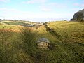
Uplawmoor station site in 2007
General information
Location Uplawmoor, Renfrewshire
Scotland
Coordinates 55°45′49″N4°29′28″W / 55.7635°N 4.4910°W / 55.7635; -4.4910
Grid reference NS437550
Platforms2
Other information
StatusDisused
History
Original company Lanarkshire and Ayrshire Railway
Pre-grouping Caledonian Railway
Post-grouping LMS
Key dates
1 May 1903Opened [1]
1 January 1917Closed
2 March 1919Reopened
2 April 1962Closed to regular services

Uplawmoor railway station was a railway station serving the village of Uplawmoor, East Renfrewshire, Scotland as part of the Lanarkshire and Ayrshire Railway.

Contents

History

The station opened on 1 May 1903. [1] It closed between 1 January 1917 and 2 March 1919 due to wartime economy, [1] and closed permanently to passengers and freight on 2 April 1962. [1] [2] Upon closure, the nearby station Caldwell took on the name 'Uplawmoor'.

Although the station was closed to regular passengers, in 1964 the Royal Train was stabled here overnight during a visit to the area by the Queen Mother. [3]

Sidings ran to the Shillford Quarry that was located to the east of the station within Uplawmoor Wood.

Preceding station Historical railways Following station
Lugton High
Line and station closed
  Caledonian Railway
Lanarkshire and Ayrshire Railway
  Neilston
Line closed; station open

Related Research Articles

<span class="mw-page-title-main">Mount Florida railway station</span> Railway station in Glasgow, Scotland

Mount Florida railway station is a staffed island platform station on the Cathcart Circle. It serves the Mount Florida and Battlefield areas of Glasgow, Scotland and can get busy on match days as it is nearby to Hampden Park football stadium. Services are provided by ScotRail on behalf of Strathclyde Partnership for Transport.

<span class="mw-page-title-main">Cathcart railway station</span> Railway station in Glasgow, Scotland

Cathcart railway station is a railway station serving the Cathcart area of Glasgow, Scotland. It is located on the Cathcart Circle Line, 3.7 miles (6 km) south of Glasgow Central. Services are provided by ScotRail on behalf of Strathclyde Partnership for Transport.

<span class="mw-page-title-main">Muirend railway station</span> Railway station in Glasgow City, Scotland, UK

Muirend railway station is an island platform suburban railway station in the Muirend area of Glasgow, Scotland. The station, which opened in 1903, is managed by ScotRail and lies on the Neilston branch of the Cathcart Circle Lines.

<span class="mw-page-title-main">Williamwood railway station</span> Railway station in East Renfrewshire, Scotland

Williamwood railway station is a railway station in the Williamwood area of the town of Clarkston, East Renfrewshire, Greater Glasgow, Scotland. The station is managed by ScotRail and lies on the Neilston branch of the Cathcart Circle Lines. The line here forms the boundary which separates Clarkston and Giffnock.

<span class="mw-page-title-main">Whitecraigs railway station</span> Railway station in East Renfrewshire, Scotland, UK

Whitecraigs railway station is a railway station serving the Whitecraigs and Davieland areas of the towns of Giffnock and Newton Mearns, East Renfrewshire, Greater Glasgow, Scotland. The station is managed by ScotRail and lies on the Neilston branch of the Cathcart Circle 6+34 miles (10.9 km) southwest of Glasgow Central. The line here forms the boundary which separates Newton Mearns and Giffnock across Ayr Road.

<span class="mw-page-title-main">Patterton railway station</span> Railway station in East Renfrewshire, Scotland, UK

Patterton railway station is a railway station serving the Patterton, Crookfur and Greenlaw areas of the town of Newton Mearns, East Renfrewshire and the Deaconsbank and Jennylind areas of the Glasgow City council area, Scotland. The station is managed by ScotRail and lies on the Neilston branch of the Cathcart Circle Lines, 7+34 miles (12.5 km) southwest of Glasgow Central.

<span class="mw-page-title-main">Neilston railway station</span> Railway station in East Renfrewshire, Scotland, UK

Neilston railway station is a railway station in the village of Neilston, East Renfrewshire, Greater Glasgow, Scotland. The station is managed by ScotRail and lies on the Cathcart Circle Lines, 11+34 miles (18.9 km) southwest of Glasgow Central.

<span class="mw-page-title-main">Howwood railway station</span> Railway station in Renfrewshire, Scotland

Howwood railway station is a railway station serving the village of Howwood, Renfrewshire, Scotland. The station is managed by ScotRail and is on the Ayrshire Coast Line, 13 miles (21 km) south west of Glasgow Central.

<span class="mw-page-title-main">Glengarnock railway station</span> Railway station in North Ayrshire, Scotland

Glengarnock railway station is a railway station in the village of Glengarnock, North Ayrshire, Scotland, serving the towns of Beith and Kilbirnie. The station is managed by ScotRail and is on the Ayrshire Coast Line.

<span class="mw-page-title-main">Hawkhead railway station</span> Railway station in Renfrewshire, Scotland

Hawkhead railway station is a railway station in the Seedhill area of Paisley, Renfrewshire, Scotland. The station is managed by ScotRail and lies on the Paisley Canal Line, 6½ miles (10 km) west of Glasgow Central.

<span class="mw-page-title-main">Clarkston railway station</span> Railway station in East Renfrewshire, Scotland

Clarkston railway station is a suburban side platform railway station in the town of Clarkston, East Renfrewshire, Scotland. The station is managed by ScotRail and is on the East Kilbride branch of the Glasgow South Western Line. It was opened in 1866 by the Busby Railway.

<span class="mw-page-title-main">Ardrossan North railway station</span> Disused railway station in Ardrossan, Ayrshire

Ardrossan North railway station was a railway station serving the town of Ardrossan, North Ayrshire, Scotland as part of the Lanarkshire and Ayrshire Railway (L&AR). The station was the original Ardrossan terminus for this line until the nearby pier station opened two years later.

<span class="mw-page-title-main">Brackenhills railway station</span> Disused railway station in Scotland

Brackenhills railway station was a railway station approximately one mile south-west of the town of Beith, close to Barkip, North Ayrshire, Scotland, part of the Lanarkshire and Ayrshire Railway.

Glengarnock High railway station was a railway station serving the village of Glengarnock, North Ayrshire, Scotland as part of the Lanarkshire and Ayrshire Railway.

Kilbirnie South railway station was a railway station serving the town of Kilbirnie, North Ayrshire, Scotland as part of the Lanarkshire and Ayrshire Railway (L&AR).

<span class="mw-page-title-main">Caldwell railway station</span> Disused railway station in Scotland

Caldwell railway station was a railway station near the village of Uplawmoor, East Renfrewshire, Scotland. The station was originally part of the Glasgow, Barrhead and Kilmarnock Joint Railway. The station was renamed to Uplawmoor railway station in 1962, four years prior to its closure.

<span class="mw-page-title-main">Strathbungo railway station</span> Former railway station in Scotland

Strathbungo railway station was a railway station serving the village of Strathbungo, Renfrewshire,, Scotland. The station was originally part of the Glasgow, Barrhead and Kilmarnock Joint Railway.

<span class="mw-page-title-main">Bridge of Weir railway station</span> Disused railway station in Scotland

Bridge of Weir railway station was a railway station serving the village of Bridge of Weir, Renfrewshire, Scotland, originally as part of the Bridge of Weir Railway.

Loudounhill was a railway station on the Darvel and Strathaven Railway serving a rural area that included the landmark of Loudoun Hill in the Parish of Galston, East Ayrshire, Scotland.

<span class="mw-page-title-main">Netherton Goods station</span>

Netherton Goods station or Netherton Depot was a railway public freight facility located between Neilston railway station and Patterton railway station just west of the proposed site of Lyoncross railway station, East Renfrewshire, Scotland. Netherton Goods served the industrial and agricultural requirements for transportation in the vicinity, with the town of Arthurlie not far away, sitting on and near country lanes to Neilston, Arthurlie, and Barrhead. Netherton, Glanderston, Balgraystone, and Dyke Farms were located nearby. Netherton Goods was close to Lyoncross Junction between the Lanarkshire and Ayrshire Railway and the Paisley and Barrhead District Railway near Balgray Reservoir.

References

Notes

  1. 1 2 3 4 Butt (1995), p. 237
  2. Stansfield (1999), p. 41
  3. "Royal Train visits Uplawmoor in 1964".

Sources