Uplawmoor

Last updated

Uplawmoor
Loch Libo and Uplawmoor from the air (geograph 5923544).jpg
Loch Libo and Uplawmoor from the air
East Renfrewshire UK location map.svg
Red pog.svg
Uplawmoor
Scotland location map.svg
Red pog.svg
Uplawmoor
Location within Scotland
Population690 (mid-2020 est.) [1]
OS grid reference NS434552
Lieutenancy area
Country Scotland
Sovereign state United Kingdom
Post town GLASGOW
Postcode district G78
Dialling code 01505
Police Scotland
Fire Scottish
Ambulance Scottish
UK Parliament
Scottish Parliament
List of places
UK
Scotland
55°45′54″N4°29′46″W / 55.765°N 4.496°W / 55.765; -4.496 Coordinates: 55°45′54″N4°29′46″W / 55.765°N 4.496°W / 55.765; -4.496

Uplawmoor is a village in East Renfrewshire, Scotland. Its population was 700 as of 2016.

Contents

Historic Uplawmoor, [2] associated for centuries with the Barony of Caldwell and the Mure family, is still a vibrant community today, although bereft of the shops once to be found there. It has a primary school, hotel (Uplawmoor Hotel), village hall (Mure Hall), sports ground for tennis and football (including a playpark) and a golf club (Caldwell Golf Club). Nearby is the extensive Caldwell Estate with the roofless 18th century Caldwell House, which was designed by Robert Adam. The separate Caldwell Tower, of probable 16th century origin, is visible from the village. Several farms surround the village, as agriculture has always been of importance locally.

Historically the village was served by two railway lines - Lanarkshire and Ayrshire and Glasgow, Barrhead and Kilmarnock Joint Railway

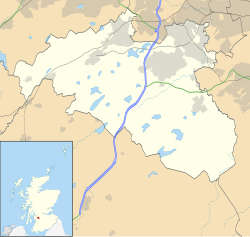
Uplawmoor has a rural setting, with farmland on one side and mainly beech woodland (Pollick Glen and Shillford Woods, with numerous paths) on the other. Below lies the valley where are the A736 and Loch Libo, a Scottish Wildlife Trust Site Of Special Scientific Interest, the winter home of flocks of whooper swans. At the end of the loch is an area of large tussock sedges and on the far side is a striking waterfall among more woodland. The old hamlet of Shillford lies towards Neilston on the A736.

Transport

Caldwell / Uplawmoor Station site in 2007. looking towards Lugton. Part of the main station building is on the right. Uplawmoorstationsite.JPG
Caldwell / Uplawmoor Station site in 2007. looking towards Lugton. Part of the main station building is on the right.
A view of the old station on the Ardrossan to Glasgow line. The railway still operates from Neilston to Glasgow. Uplawmoorstation.jpg
A view of the old station on the Ardrossan to Glasgow line. The railway still operates from Neilston to Glasgow.

Caldwell station opened on 27 March 1871. The station was renamed Uplawmoor after the closure of the Uplawmoor station on the Lanarkshire and Ayrshire Railway on 2 April 1962. The station closed permanently on 7 November 1966. A number of local campaigns to re-open the station have so far been unsuccessful. It has now become overgrown and only a platform remains to show that Uplawmoor actually had a railway line.

See also

Related Research Articles

Beith is a small town in the Garnock Valley, North Ayrshire, Scotland approximately 20 miles south-west of Glasgow. The town is situated on the crest of a hill and was known originally as the "Hill o' Beith" after its Court Hill.

<span class="mw-page-title-main">Saltcoats</span> Town in Scotland

Saltcoats is a town on the west coast of North Ayrshire, Scotland. The name is derived from the town's earliest industry when salt was harvested from the sea water of the Firth of Clyde, carried out in small cottages along the shore. It is part of the 'Three Towns' conurbation along with Ardrossan and Stevenston and is the third largest town in North Ayrshire.

<span class="mw-page-title-main">Lochwinnoch</span> Human settlement in Scotland

Lochwinnoch is a village in the council area and historic county of Renfrewshire in the west central Lowlands of Scotland. Lying on the banks of Castle Semple Loch and the River Calder, Lochwinnoch is chiefly a residential dormitory village serving nearby urban centres such as Glasgow and Paisley. Its population in 2001 was 2628.

<span class="mw-page-title-main">Newton Mearns</span> Town in Scotland

Newton Mearns is a suburban town and the largest settlement in East Renfrewshire, Scotland. It lies 7 miles (11 km) southwest of Glasgow City Centre on the main road to Ayrshire, 410 feet (125 m) above sea level. It has a population of approximately 26,993, stretching from Whitecraigs and Kirkhill in the northeast to Maidenhill in the southeast, to Westacres and Greenlaw in the west and Capelrig/Patterton in the northwest.

<span class="mw-page-title-main">Giffnock</span> A town in East Renfrewshire, Scotland

Giffnock is a town and the administrative centre of East Renfrewshire in the Central Lowlands of Scotland.

<span class="mw-page-title-main">Crianlarich</span> Human settlement in Scotland

Crianlarich is a village in Stirling council area and in the registration county of Perthshire, Scotland, around 6 miles (10 km) north-east of the head of Loch Lomond. The village bills itself as "the gateway to the Highlands".

<span class="mw-page-title-main">Drumnadrochit</span> Human settlement in Scotland

Drumnadrochit is a village in the Highland local government council area of Scotland, lying near the west shore of Loch Ness at the foot of Glen Urquhart. The village is close to several neighbouring settlements: the villages of Milton to the west, Kilmore to the east and Lewiston to the south. The villages act as a centre for regional tourism beside Loch Ness, as well as being a local economic hub for the nearby communities.

<span class="mw-page-title-main">West Kilbride</span> Village in North Ayrshire, Scotland

West Kilbride is a village and historic parish in North Ayrshire, Scotland, on the west coast by the Firth of Clyde, looking across the Firth of Clyde to Goat Fell and the Isle of Arran. West Kilbride and adjoining districts of Seamill and Portencross are generally considered to be a small town, having a combined population of 4,393 at the 2001 census.

<span class="mw-page-title-main">Catrine</span> Human settlement in Scotland

Catrine is a village in East Ayrshire, Scotland which was formerly a centre of cotton manufacture. It has a population of around 2,020 (mid-2020 est.)

<span class="mw-page-title-main">Neilston railway station</span> Railway station in East Renfrewshire, Scotland, UK

Neilston railway station is a railway station in the village of Neilston, East Renfrewshire, Greater Glasgow, Scotland. The station is managed by ScotRail and lies on the Cathcart Circle Lines, 11+34 miles (18.9 km) southwest of Glasgow Central.

<span class="mw-page-title-main">Lugton</span> Human settlement in Scotland

Lugton is a small village or hamlet in East Ayrshire, Scotland with a population of 80 people. The A736 road runs through on its way from Glasgow, 15 miles (24.1 km) to the north, to Irvine in North Ayrshire. Uplawmoor is the first settlement on this 'Lochlibo Road' to the north and Burnhouse is to the south. The settlement lies on the Lugton Water which forms the boundary between East Ayrshire and East Renfrewshire as well as that of the parishes of Dunlop and Beith.

<span class="mw-page-title-main">Taynuilt</span> Human settlement in Scotland

Taynuilt is a large village in Argyll and Bute, Scotland located at the western entrance to the narrow Pass of Brander.

The Lanarkshire and Ayrshire Railway (L&AR) was an independent railway company built to provide the Caledonian Railway with a shorter route for mineral traffic from the coalfields of Lanarkshire to Ardrossan Harbour, in Scotland.

<span class="mw-page-title-main">Uplawmoor (L&A) railway station</span> Railway station in East Renfrewshire, Scotland, UK

Uplawmoor railway station was a railway station serving the village of Uplawmoor, East Renfrewshire, Scotland as part of the Lanarkshire and Ayrshire Railway.

<span class="mw-page-title-main">Uplawmoor (GB&K) railway station</span> Disused railway station in Scotland

Uplawmoor railway station was a railway station near the village of Uplawmoor, East Renfrewshire, Scotland. The station was originally part of the Glasgow, Barrhead and Kilmarnock Joint Railway.

<span class="mw-page-title-main">Trabboch</span>

Trabboch is a hamlet in East Ayrshire, Scotland. Built as a miners village in the 1880s, it was owned and leased by Wm. Baird & Co., Ltd. and at one time had 94 dwellings. The miners rows stood, until demolition in 1969, on the Stair and Littlemill road, about two miles south of Stair, in that parish. The name is locally pronounced 'Traaboch'.

<span class="mw-page-title-main">Caldwell, East Renfrewshire</span>

Caldwell is a mansion and old estate with the remains of a castle nearby. These lands lie close to the Lugton Water and the villages of Uplawmoor in East Renfrewshire and Lugton in East Ayrshire.

<span class="mw-page-title-main">Symington, South Ayrshire</span> Human settlement in Scotland

Symington is a conservation village in South Ayrshire, Scotland. It is located in Symington parish, covering 0.41 square kilometres, and lies close to the A77 road from Ayr to Glasgow. Its church, built in 1160, remains one of the finest examples of a Norman church in Scotland.

<span class="mw-page-title-main">Loch Libo</span> Body of water

Loch Libo is a freshwater loch in East Renfrewshire, Parish of Neilston, Scotland. The Lugton Water has its source from the southern end of loch, running 14 miles before reaching its confluence with the River Garnock near Kilwinning. The village of Uplawmoor and the hamlet of Shillford lie nearby. 3 mi (4.8 km) away to the northeast is the town of Neilston.

<span class="mw-page-title-main">Netherton Goods station</span>

Netherton Goods station or Netherton Depot was a railway public freight facility located between Neilston railway station and Patterton railway station just west of the proposed site of Lyoncross railway station, East Renfrewshire, Scotland. Netherton Goods served the industrial and agricultural requirements for transportation in the vicinity, with the town of Arthurlie not far away, sitting on and near to country lanes to Neilston, Arthurlie and Barrhead. Netherton, Glanderston, Balgraystone and Dyke Farms were located nearby. Netherton Goods was close to Lyoncross Junction between the Lanarkshire and Ayrshire Railway and the Paisley and Barrhead District Railway near Balgray Reservoir.

References

  1. "Mid-2020 Population Estimates for Settlements and Localities in Scotland". National Records of Scotland. 31 March 2022. Retrieved 31 March 2022.
  2. Local Studies Group, Uplawmoor (2003). Old Uplawmoor. Catrine, Ayrshire: Stenlake Publishing.