Barrhead is a town in East Renfrewshire, Scotland, 13 km (8.1 mi) south-west of Glasgow city centre on the edge of the Gleniffer Braes. At the 2011 census its population was 17,268.

Newton Mearns is a suburban town and the largest settlement in East Renfrewshire, Scotland. It lies 7 miles (11 km) southwest of Glasgow City Centre on the main road to Ayrshire, 410 feet (125 m) above sea level. It has a population of approximately 26,993, stretching from Whitecraigs and Kirkhill in the northeast to Maidenhill in the southeast, to Westacres and Greenlaw in the west and Capelrig/Patterton in the northwest.

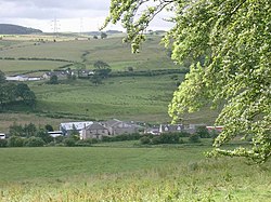
Uplawmoor is a village in East Renfrewshire, Scotland. Its population was 700 as of 2016.

Neilston is a village and parish in East Renfrewshire in the west central Lowlands of Scotland. It is in the Levern Valley, 2 miles (3.2 km) southwest of Barrhead, 3.8 miles (6.1 km) south of Paisley, and 5.7 miles (9.2 km) south-southwest of Renfrew, at the southwestern fringe of the Greater Glasgow conurbation. Neilston is a dormitory village with a resident population of just over 5,000 people.

Lugton is a small village or hamlet in East Ayrshire, Scotland with a population of 80 people. The A736 road runs through on its way from Glasgow, 15 miles (24.1 km) to the north, to Irvine in North Ayrshire. Uplawmoor is the first settlement on this 'Lochlibo Road' to the north and Burnhouse is to the south. The settlement lies on the Lugton Water which forms the boundary between East Ayrshire and East Renfrewshire as well as that of the parishes of Dunlop and Beith.
The Glasgow, Barrhead and Kilmarnock Joint Railway was a railway jointly owned by the Caledonian Railway and the Glasgow and South Western Railway, completed in 1873, and giving the latter a shorter access to its Carlisle main line. A branch to Beith was also built.

Strathbungo railway station was a railway station serving the village of Strathbungo, Renfrewshire,, Scotland. The station was originally part of the Glasgow, Barrhead and Kilmarnock Joint Railway.

The village or hamlet of Gatehead is located in East Ayrshire, Parish of Kilmaurs, Scotland. It is one and a quarter miles from Crosshouse and one and a half miles from Kilmarnock. In the 18th and 19th centuries the locality was a busy coal mining district. The settlement runs down to the River Irvine where a ford and later a bridge was located.
Knockentiber is a village in East Ayrshire, Parish of Kilmaurs, Scotland. Knockentiber is two miles west-northwest of Kilmarnock and 1⁄2 mile northeast of Crosshouse. Latitude:55.6193°N Longitude:4.5455°W and grid reference NS397392. The population was 359 in 1991, however the population is much higher following the construction of several housing estates (2007). In the 18th and 19th and mid 20th centuries the locality was a highly industrialised coal mining district. The settlement is on the Carmel Burn, which runs into the River Irvine, around one mile to the south.

The hamlet of Auchentiber is in North Ayrshire, Parish of Kilwinning, Scotland. Auchentiber is four miles northeast of Kilwinning on the Lochlibo Road, 2+1⁄4 mi (3.5 km) from the hamlet of Burnhouse and 2+1⁄2 mi (4 km) from the village of Barrmill. Grid Ref. NS3647. Some new housing has been built, but the settlement is still very much a hamlet. The settlement is on the Lugton Water, which runs into the River Garnock after running through Montgreenan and Eglinton Country Park in Irvine.

The Levern Water, is a small river in East Renfrewshire and Glasgow, Scotland. It rises in the Long Loch, and flows generally north and east, past the towns of Neilston and Barrhead, for a total distance of 9 miles (14 km). It empties into the White Cart River.
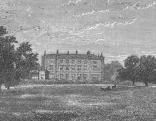
Caldwell is a mansion and old estate with the remains of a castle nearby. These lands lie close to the Lugton Water and the villages of Uplawmoor in East Renfrewshire and Lugton in East Ayrshire.

Loch Brown, also known in Scots as Loch Broun, Broon or Broom, was situated in a kettle hole in the mid-Ayrshire clayland near Crosshands. It is nowadays (2011) visible as a surface depression in pastureland, partially flooded, situated in a low-lying area close to farms and dwellings of Skeoch, Dalsangan, Ladebrae, Lochhill, and Crosshands, mainly in the Parish of Mauchline and partly in Craigie, East Ayrshire, Scotland. Duveloch is an old name for the loch and this may derive from the Gaelic Dubh, meaning black or dark loch.

Auchenbathie, Auchinbathie Tower or rarely Barcraigs Tower is a ruined fortification, a tower house, once held by the Wallace Clan of Elderslie, situated in Renfrewshire, Parish of Lochwinnoch, Scotland. The spelling used varies greatly and "Auchenbathie" will be used here as the standard spelling. The pronunciation locally is "Auchenbothy", the same as a Victorian mansion in Kilmacolm; no connection is known.

Burnhouse, sometimes known locally as The Trap from "Man Trap", is a small village or hamlet in North Ayrshire, Parish of Beith, Scotland. It lies on a crossroads of old B706 and the more recent A736 Lochlibo Road, between Lugton and Torranyard.

Lylestone is a hamlet in North Ayrshire, Parish of Kilwinning, Scotland. The habitation is situated between Kilwinning and Auchentiber on the B778. It was originally built as a row of housing for quarry workers.

Loch Libo is a freshwater loch in East Renfrewshire, Parish of Neilston, Scotland. The Lugton Water has its source from the southern end of loch, running 14 miles before reaching its confluence with the River Garnock near Kilwinning. The village of Uplawmoor and the hamlet of Shillford lie nearby. 3 mi (4.8 km) away to the northeast is the town of Neilston.

Netherton Goods station or Netherton Depot was a railway public freight facility located between Neilston railway station and Patterton railway station just west of the proposed site of Lyoncross railway station, East Renfrewshire, Scotland. Netherton Goods served the industrial and agricultural requirements for transportation in the vicinity, with the town of Arthurlie not far away, sitting on and near to country lanes to Neilston, Arthurlie and Barrhead. Netherton, Glanderston, Balgraystone and Dyke Farms were located nearby. Netherton Goods was close to Lyoncross Junction between the Lanarkshire and Ayrshire Railway and the Paisley and Barrhead District Railway near Balgray Reservoir.

Earlston is a hamlet in Riccarton, East Ayrshire, Scotland. The habitation dates from at least the early 18th century and is near Caprington Castle and Todrigs Mill. It was for many years the site of a large sawmill and a mine pumping engine, and had sidings of the Glasgow and South-Western Railway's Fairlie Branch.

Dams to Darnley Country Park is a 1350 acre country park in East Renfrewshire and Glasgow, in Scotland comprising the historic greenspace between the towns of Barrhead and Newton Mearns in East Renfrewshire, and the areas of Darnley, Parkhouse and Southpark Village in south Glasgow. Being designated since 2000, it is one of the newest country parks in Scotland.
Moffat, Lieutenant Commander John (2009), "I Sank the Bismark",Page 240.