
South Northamptonshire was from 1974 to 2021 a district in Northamptonshire, England. Its council was based in the town of Towcester, first established as a settlement in Roman Britain. The population of the Local Authority District Council in 2011 was 85,189.

East Northamptonshire was from 1974 to 2021 a local government district in Northamptonshire, England. Its council was based in Thrapston and Rushden. Other towns include Oundle, Raunds, Irthlingborough and Higham Ferrers. The town of Rushden was by far the largest settlement in the district. The population of the district at the 2011 Census was 86,765.
Upper Catesby is a hamlet in the civil parish of Catesby, Northamptonshire, about 3.5 miles (5.6 km) southwest of Daventry. The hamlet is about 550 feet (170 m) above sea level, at the top of a northwest-facing escarpment. The population is included in the civil parish of Hellidon.

Harlestone is a small village and civil parish in West Northamptonshire, England. It is divided into two smaller settlements, Upper and Lower Harlestone. At the time of the 2001 census, the parish's population was 420 people, increasing to 445 at the 2011 Census.

Flore is a village and civil parish in West Northamptonshire in England.

Weedon Bec, usually just Weedon, is a village and parish in West Northamptonshire, England. It is close to the source of the River Nene. The population of the civil parish at the 2011 census was 2,706.
The A427 road is a major road in the English Midlands. It connects the Leicestershire town of Market Harborough and the A6 with the Northamptonshire town of Oundle and the A605.

Benefield is a civil parish in North Northamptonshire, England, along the A427 road and about 6 miles (9.7 km) east of Corby and 3 miles (4.8 km) west of Oundle.
Boddington is a civil parish in West Northamptonshire, England, about 5 miles (8 km) north-east of Banbury off the A361 road.
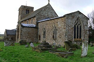
Upper Stowe is a village in West Northamptonshire in England. It is in the civil parish of Stowe Nine Churches. It has a church dedicated to St James. This was built to the design of P.C Hardwick in 1855. It has a bellcote rather than a tower.
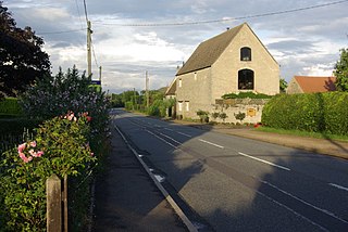
Lower Benefield is a village on the A427 road in North Northamptonshire, England, near Oundle. It is part of the civil parish of Benefield. The population is included in the Civil Parish of Weston and Weedon.
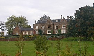
Benefield Castle was sited in the village of Lower Benefield, between the towns of Corby and Oundle in Northamptonshire at grid reference SP987884.

North Northamptonshire is a unitary authority area forming part of the ceremonial county of Northamptonshire, England, created in 2021. The largest towns in the area are Kettering, Corby, Wellingborough, Rushden, Irthlingborough, Thrapston and Oundle, plus a number of other towns and villages. The council is based in Corby.

West Northamptonshire is a unitary authority area covering part of the ceremonial county of Northamptonshire, England, created in 2021. By far the largest settlement in West Northamptonshire is the county town of Northampton, other significant towns include Daventry, Brackley and Towcester, the remainder of the area is rural.
Deenethorpe is a village and civil parish in North Northamptonshire, England. It is situated north-east of Corby and near the A43 road between Corby and Stamford. Nearby villages are Deene located 1.9 miles (3.1 km) to the North-West, Bulwick 1.9 miles (3.1 km) and Upper Benefield 2.5 miles (4.2 km) South-East to Deenethorpe.
Passenham is a small village in the civil parish of Old Stratford in south-west Northamptonshire, England. It is just north of the River Great Ouse, which forms the boundary with Buckinghamshire, and close to Stony Stratford in Milton Keynes.

Banhaw, Spring and Blackthorn's Woods is a 123.4 hectare biological Site of Special Scientific Interest east of Corby in Northamptonshire.

Stagecoach Gold bus route X4 is a bus route in England that links Northampton and Peterborough via Wellingborough, Kettering and Corby. This service is operated by the Stagecoach Midlands bus company.
Benefield is an English toponymic surname from one or more of the numerous places in England called Benfield or Binfield. Notable people with this name include:
