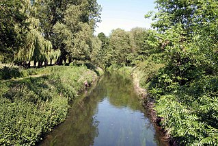
The Upper Witham IDB is an English Internal Drainage Board responsible for land drainage and the management of flood risk for an area to the west of the Lincolnshire city of Lincoln, broadly following the valleys of the upper River Witham, the River Till and the course of the Fossdyke Navigation.
Land to the west and south of Lincoln was regularly inundated by flood events occurring on the River Trent. The low lands between Torksey and Lincoln would be covered, and flood water would pass through the Lincoln Gap to flow down the course of the modern lower Witham, to reach the sea at Boston, Friskney and Wainfleet Havens.[1] Wheeler suggests that the normal course of the Witham in dryer weather was into Brayford Mere, a large lake to the west of Lincoln, and then westwards, roughly following the course of the Fossdyke Navigation to reach the Trent. To the east of Lincoln, the Langworth River flowed into another mere, located between Washingborough and Chapel Hill, and on to the sea near Boston. The Romans improved the watercourse from Lincoln to the Trent, to make it suitable for navigation, and cut a channel through the high ground in the centre of Lincoln. This continued to Short Ferry, and joined a tidal creek near Chapel Hill.[2]
An Act of Parliament was obtained in 1670, for improvements to the navigation between Boston and the Trent. The preamble stated that there had been a good navigation along this route for centuries, but that both the Witham and the Fossdyke had become clogged with silt. This was the first attempt to put the river system on a commercial footing. The City of Lincoln was to appoint Commissioners, and were given powers to improve the channels or, where necessary, to cut new channels and to build banks, sluices and locks. The Act made provision for the collection of reasonable tolls, in order to fund the work. Another Act of Parliament was passed in 1752, which created the Witham General Commissioners,[3] and divided the area to the east of Lincoln into six drainage districts, the Witham First, Second, Third, Fourth, Fifth and Sixth Districts.[4] At the same time, the civil engineer John Smeaton recommended works to improve the drainage of the area to the west of Lincoln, but these were not carried out at the time.[5]
Two major flood events took place soon afterwards. In 1770, water breached the Fossdyke embankment at Torksey, and land was flooded between the breach and Lincoln. A worse event happened in 1795, when the Trent breached the bank at Spalford. Around 20,000 acres (81km2) of land was flooded, some to a depth of 10 feet (3.0m). When the water reached Lincoln, it was constrained by the High Street, which is between 12 and 15 feet (3.7 and 4.6m) above the level of the surrounding land.[2] Houses in the lower part of Saxilby were flooded, and families had to be moved to the upper town, with several of them living in the church until the floods subsided. The villages of Broxholme, Fenton, Hardwick, Hathow, Kettlethorpe, Thorney, and Wigsley were like islands, and could only be reached by boat, while parts of Torksey, Brampton, Fenton and Kettlethorpe were flooded. The flood waters remained for 3 weeks, and it took 80 loads of faggots and over 400 tons of earth to repair the breach in the river wall. Flood risk from the Trent was reduced following further major flooding events in 1824 and 1852, after which the five major 'gaps' along the Trent, at Spalford, Newton, Torksey Lock, Torksey and Marton, were extensively repaired by the Courts of Sewers for Newark and Lincoln.[6]
In 1804 an Act of Parliament was obtained, to authorise the work proposed by Smeaton in 1752.[5] The Act stated that it was For embanking, draining and improving certain Lands in the City of Lincoln and County thereof and in the parishes or townships of Boultham, Skellingthorpe, Saxilby, Broxholme, North Carlton, South Carlton, Burton and Hathow in the County of Lincoln and for inclosing Lands in the said parish of Skellingthorpe. This created two drainage districts, the Lincoln West (North District) Drainage Board, responsible for an area of 1,545 acres (625ha) and the Lincoln West (South District) Drainage Board, responsible for 2,331 acres (943ha). Again, there was a commercial aspect to the Act, as the drainage districts could raise an annual tax on the owners of lands which benefitted from the drainage and embankment works.[7]
At that time, all discharge was by gravity, and the main outfall for both districts was through a tunnel under the River Witham at Coulson Road. From there it entered the Great Gowts Drain and the Syncil Dyke, to be discharged into the Witham below Lincoln. The Act enabled the North District to build a cast iron tunnel under the Fossdyke Navigation and a new drain to convey the water to the Main Drain of the South District. Additionally, they could build a catchwater drain along the edge of the higher ground to the east, which would discharge into the Fossdyke. The South District could also build a catchwater drain, running along the edge of higher ground to the south, and discharging into the Witham. When the works were completed, the drainage system was much as it is today.[7]
Organisation
By the mid-1920s, the government realised that the existing laws concerning land drainage were in disarray, with much of it still depending on Henry VIII's Statue of Sewers of 1531. In particular, it seemed unfair that lowland communities bore all the costs of ensuring that water from upland regions got to the sea without flooding the land, and the upland communities paid nothing. A Royal Commission was set up in 1927, to consider the problem, and summarised their findings in two main proposals. The first was that there should be an overall authority in each catchment area, with responsibility for the main rivers and their banks, and a requirement that they work closely with drainage authorities. The second was that drainage rates should be levied over a much wider area, than just those who benefitted directly from the work of the drainage authorities. These ideas were enshrined in the Land Drainage Act 1930.[8]
The Witham and Steeping Rivers Catchment Board was set up under the Act, and they constituted the Upper Witham Internal Drainage Board (IDB) by an order dated 14 September 1932, which would take effect from 1 April 1933. The Lincolnshire and Nottinghamshire Commissioners of Sewers were wound up, with their powers passing to the catchment board or drainage board as appropriate, and the North District and South District Drainage Boards were also abolished. Subsequently, the catchment board became part of the Lincolnshire River Board under the River Boards Act 1948, then the Lincolnshire River Authority under the Water Resources Act 1963, the Anglian Water Authority under the Water Act 1973, the National Rivers Authority under the Water Act 1989 and finally the Environment Agency under the Environment Act 1995.[9]
The Upper Witham IDB operates independently from the Witham First District IDB, the Witham Third District IDB, and the North East Lindsey IDB in that they have their own budgets, board, plant and machinery, but much of the administration is shared. The four IDBs have a common Chief Executive and Director of Operations, and a number of financial and administrative functions are also shared. The board consists of members who are elected and those who are appointed by the local authorities who pay drainage levies to the board. In the case of Upper Witham IDB, the number of appointed members exceeds the number of elected member.[10]
Pumping stations
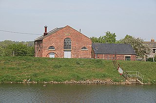
Oxpasture pumping station was built by the Upper Witham IDB in 1961
Before the advent of the Upper Witham IDB, most of the drainage was by gravity, although there were a few small areas where pumps were used. These were at Boultham, Skellingthorpe, Saxilby and Broxholme, and the pumps were operated by the Church Commissioners or by private individuals. For the rest of the region, the outfalls into the main rivers were controlled by sluice doors, some automatically operated, but many still hand operated. Under flood conditions, levels in the main drains rose rapidly, and internal pumps had to be stopped at the time when they were needed most.[7]
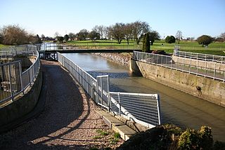
At Pyewipe, there was a steam pumping station, but no further information about it has been found. A new pumping station on the south bank of the Fossdyke was built in 1936, and initially contained two single-cylinder Ruston diesel engines, each directly connected to a 27-inch (69cm) Gwynnes pump. This was supplemented by a third engine in 1940, a twin-cylinder Ruston with a 30-inch (76cm) pump.[11] The number of pumping stations has steadily increased, and Upper Witham IDB had 15 operational stations in 2011. The board are responsible for the drainage of an area of 77.2 square miles (200km2), and they maintain 198 miles (319km) of drains within that area.[12]
Wheeler, William Henry; Batty, Leonard Charles (1896). A History of the Fens of South Lincolnshire. British Library Historical Print Collections. ISBN978-1-241-32839-9.
Related Research Articles
The River Witham is a river almost entirely in the county of Lincolnshire in the east of England. It rises south of Grantham close to South Witham at SK8818, passes through the centre of Grantham, passes Lincoln at SK9771 and at Boston, TF3244, flows into The Haven, a tidal arm of The Wash, near RSPB Frampton Marsh. The name "Witham" seems to be extremely old and of unknown origin. Archaeological and documentary evidence shows the importance of the Witham as a navigable river from the Iron Age onwards. From Roman times it was navigable to Lincoln, from where the Fossdyke was constructed to link it to the River Trent. The mouth of the river moved in 1014 following severe flooding, and Boston became important as a port.
The River Ancholme is a river in Lincolnshire, England, and a tributary of the Humber. It rises at Ancholme Head, a spring just north of the village of Ingham and immediately west of the Roman Road, Ermine Street. It flows east and then north to Bishopbridge west of Market Rasen, where it is joined by the Rase. North of there it flows through the market town of Brigg before draining into the Humber at South Ferriby. It drains a large part of northern Lincolnshire between the Trent and the North Sea.
The Foss Dyke, or Fossdyke, connects the River Trent at Torksey to Lincoln, the county town of Lincolnshire, and may be the oldest canal in England that is still in use. It is usually thought to have been built around AD 120 by the Romans, but there is no consensus among authors. It was refurbished in 1121, during the reign of King Henry I, and responsibility for its maintenance was transferred to the city of Lincoln by King James I. Improvements made in 1671 included a navigable sluice or lock at Torksey, and warehousing and wharves were built at Brayford Pool in the centre of Lincoln.
The River Idle is a river in Nottinghamshire, England whose source is the confluence of the River Maun and River Meden near Markham Moor. The Idle flows north from its source through Retford and Bawtry before entering the River Trent at West Stockwith. Its main tributaries are the River Poulter and the River Ryton. The river is navigable to Bawtry, and there is a statutory right of navigation to Retford. Most of the land surrounding the river is a broad flood plain and the river is important for conservation, with Sites of Special Scientific Interest being designated along its course.
The Louth Navigation was a canalisation of the River Lud. It ran for 11 miles (18 km) from Louth in Lincolnshire, England, to Tetney Haven, at the mouth of the Humber. It was authorised by Act of Parliament in 1763 and completed in 1770, under the supervision of the engineer John Grundy Jr. and then by James Hoggard. Eight locks were required to overcome the difference in altitude, six of which were constructed with sides consisting of four bays.
The South Forty-Foot Drain, also known as the Black Sluice Navigation, is the main channel for the land-drainage of the Black Sluice Level in the Lincolnshire Fens. It lies in eastern England between Guthram Gowt and the Black Sluice pumping station on The Haven, at Boston. The Drain has its origins in the 1630s, when the first scheme to make the Fen land available for agriculture was carried out by the Earl of Lindsey, and has been steadily improved since then. Water drained from the land entered The Haven by gravity at certain states of the tide until 1946, when the Black Sluice pumping station was commissioned.
Hatfield Chase is a low-lying area in South Yorkshire and North Lincolnshire, England, which was often flooded. It was a royal hunting ground until Charles I appointed the Dutch engineer Cornelius Vermuyden to drain it in 1626. The work involved the re-routing of the Rivers Don, Idle, and Torne, and the construction of drainage channels. It was not wholly successful, but changed the whole nature of a wide swathe of land including the Isle of Axholme, and caused legal disputes for the rest of the century. The civil engineer John Smeaton looked at the problem of wintertime flooding in the 1760s, and some remedial work was carried out.
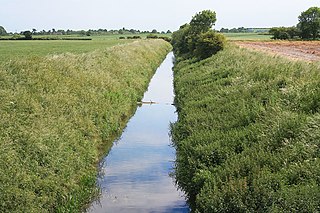
Barlings Eau is a small river near Barlings, Lincolnshire, England. It is a tributary of the River Witham, joining it near Short Ferry. It acts as the central spine for a number of other small rivers, which drain the low-lying land to either side. Most of its course is within the area managed by the Witham Third District IDB, an Internal Drainage Board responsible for land drainage. One of their pumping stations is on the banks of the river.
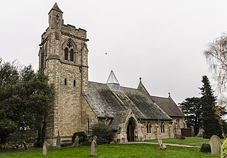
Skellingthorpe is a village and civil parish in the North Kesteven district of Lincolnshire, England. The population of the village at the 2011 census was 3,465. It is situated 3 miles (5 km) west of Lincoln, 4 miles (6 km) southeast of Saxilby, 6 miles (10 km) northwest of North Hykeham and 15 miles (24 km) east of Tuxford.
According to Whites 1856 Lincolnshire, Lawress Wapentake was one of the south-western divisions of the parts of Lindsey, in the Deanery and Archdeaconry of Stow, and consisting of the East Division and the West Division.
An internal drainage board (IDB) is a type of operating authority which is established in areas of special drainage need in England and Wales with permissive powers to undertake work to secure clean water drainage and water level management within drainage districts. The area of an IDB is not determined by county or metropolitan council boundaries, but by water catchment areas within a given region. IDBs are geographically concentrated in the Broads, Fens in East Anglia and Lincolnshire, Somerset Levels and Yorkshire.
The Witham Navigable Drains are located in Lincolnshire, England, and are part of a much larger drainage system managed by the Witham Fourth District Internal Drainage Board. The Witham Fourth District comprises the East Fen and West Fen, to the north of Boston, which together cover an area of 97 square miles (250 km2). In total there are over 438 miles (705 km) of drainage ditches, of which under 60 miles (97 km) are navigable. Navigation is normally only possible in the summer months, as the drains are maintained at a lower level in winter, and are subject to sudden changes in level as a result of their primary drainage function, which can leave boats stranded. Access to the drains is from the River Witham at Anton's Gowt Lock.
The Dogdyke Engine is a drainage engine near Tattershall, Lincolnshire, in England. The drainage of 2,500 acres (1,012 ha) of land around Tattershall was authorised in 1796, and came under the control of the Witham Third District commissioners in 1844
Witham First District IDB is an English internal drainage board which was set up under the terms of the Land Drainage Act 1930. The Board inherited the responsibilities of the Witham General Drainage Commissioners, who were first constituted by an Act of Parliament of 1762. They manage the land drainage of an area to the west of the River Witham, between Lincoln and Dogdyke, which includes the valley of the River Slea to above Sleaford.
The River Torne is a river in the north of England, which flows through the counties of South Yorkshire and North Lincolnshire. It rises at the Upper Lake at Sandbeck Hall, in Maltby in South Yorkshire, and empties into the River Trent at Keadby pumping station. Much of the channel is engineered, as it plays a significant role in the drainage of Hatfield Chase, which it crosses.
The River Eau is a 15-mile-long (24 km) tributary of the River Trent that flows through Lincolnshire, England.
Holderness Drain is the main feature of a Land Drainage scheme for the area of Holderness to the east of the River Hull in the East Riding of Yorkshire, England. Construction began in 1764, and several notable civil engineers were involved with the scheme over the years. Despite the high costs of the initial scheme, it was not particularly successful, because of the refusal of the ship owners of Hull to allow an outlet at Marfleet. They insisted that the water be discharged into the River Hull to keep the channel free of silt. Following a period of agricultural depression and the building of new docks in the early 1800s, an outlet at Marfleet was finally authorised in 1832. A high level system still fed upland water to the Hull, but the low level system discharged into the Humber, where levels were considerably lower. Following the success of steam pumping on the Beverley and Barmston Drain, the trustees looked at such a possibility for the Holderness Drain, but the development of the Alexandra Dock in the 1880s and then the King George V Dock in 1913 provided a solution, as the docks were topped up with water pumped from the drain, to lessen the ingress of silt-laden water.
Witham Third District IDB is an English internal drainage board set up under the terms of the Land Drainage Act 1930. The Board inherited the responsibilities of the Witham General Drainage Commissioners, who were first constituted by an Act of Parliament of 1762. They manage the land drainage of an area to the north and east of the River Witham, between Lincoln and Dogdyke, which includes the valley of the River Bain to above Hemingby, and the valleys of Barlings Eau and most of its tributaries, to the north east of Lincoln.
The Beverley and Barmston Drain is the main feature of a land drainage scheme authorised in 1798 to the west of the River Hull in the East Riding of Yorkshire, England. The area consisted of salt marshes to the south and carrs to the north, fed with water from the higher wolds which lay to the north, and from inundation by tidal water passing up the river from the Humber. Some attempts to reduce the flooding by building embankments had been made by the fourteenth century, and windpumps appeared in the seventeenth century. The Holderness Drainage scheme, which protected the area to the east of the river, was completed in 1772, and attention was then given to resolving flooding of the carrs.
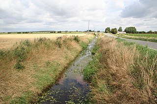
The River Till is a river in the county of Lincolnshire in England and is ultimately a tributary of the River Witham. Its upper reaches drain the land east of Gainsborough. The middle section is embanked, as the water level is higher than that of the surrounding land, and pumping stations pump water from low level drainage ditches into the river. Its lower reaches from the hamlet of Odder near Saxilby into the city of Lincoln were canalised, possibly as early as Roman times, as part of the Foss Dyke.
This page is based on this Wikipedia article Text is available under the CC BY-SA 4.0 license; additional terms may apply. Images, videos and audio are available under their respective licenses.