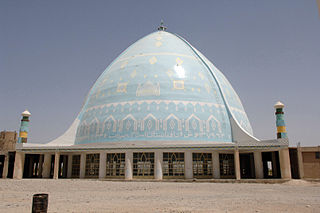
Kandahar is a city in Afghanistan, located in the south of the country on Arghandab River, at an elevation of 1,010 m (3,310 ft). It is Afghanistan's second largest city, after Kabul, with a population of about 614,118. It is the capital of Kandahar Province and the centre of the larger cultural region called Loy Kandahar.

Transport in Afghanistan is done mostly by road, rail and air. Much of the nation's road network was built in the mid-20th century but left to ruin during the last two decades of that century due to war and political turmoil. Officials of the current Islamic Emirate have continued to improve the national highways, roads, and bridges. In 2008, there were about 700,000 vehicles registered in Kabul. At least 1,314 traffic collisions were reported in 2022.

Zabul is one of the 34 provinces of Afghanistan, located in the south of the country. It has a population of 249,000. Zabul became an independent province from neighbouring Kandahar in 1963. Historically, it was part of the Zabulistan region. Qalat serves as the capital of the province. The major ethnic group are Pashtuns. Primary occupations within Zabul are agriculture and animal husbandry.

Ghazni is one of the 34 provinces of Afghanistan, located in southeastern Afghanistan. The province contains 19 districts, encompassing over a thousand villages and roughly 1.3 million people, making it the 5th most populous province. The city of Ghazni serves as the capital. It lies on the important Kabul–Kandahar Highway, and has historically functioned as an important trade center. The Ghazni Airport is located next to the city of Ghazni and provides limited domestic flights to Afghanistan's capital, Kabul.

Kandahār is one of the thirty four provinces of Afghanistan, located in the southern part of the country, sharing a border with Pakistan, to the south. It is surrounded by Helmand in the west, Uruzgan in the north and Zabul Province in the east. Its capital is the city of Kandahar, which is Afghanistan's second largest city, which is located on the Arghandab River. The greater region surrounding the province is called Loy Kandahar. The Emir of Afghanistan sends orders to Kabul from Kandahar making it the de facto capital of Afghanistan, although the main government body operates in Kabul. All meetings with the Emir take place in Kandahar, meetings excluding the Emir are in Kabul.

Paktika is one of the 34 provinces of Afghanistan, located in the eastern part of the country. Forming part of the larger Loya Paktia region, Paktika has a population of about 789,000, mostly ethnic Pashtuns. The town of Sharana serves as the provincial capital, while the most populous city is Urgun.
The Kharoti (Pashto:خروٹی) خروټی) are a Pashtun tribe of Ghilji origin, originating in the central part of Paktika Province, Afghanistan, but can be also found in other parts of the country. The Kharoti settled in Kharotabad in Quetta, British India around 1945.

Sharana is the capital of Paktika Province, Afghanistan. It is located at an altitude of 2,200 meters. Its population was estimated to be 2,200 in 2006. The city of Sharana has a population of 15,651 and is located within the heartland of the Sulaimankhel tribe of Ghilji Pashtuns. It has 6 districts and a total land area of 5,893 hectares. The total number of dwellings in this city are 1,739.

Andar is one of the eastern districts of Ghazni Province in Afghanistan. The population has been estimated at 88,300, all Pashtun. The district center is Miray while the other main town is Andar. The district is named after the Andar Ghilji tribe of the Pashtuns. The district also contains the town of Sardeh Band on its edge near the border with Paktika Province.
The following lists events that happened during 2004 in Afghanistan.

Sharana District or Sharan District is home to the city of Sharana, which is the capital of Paktika Province, Afghanistan. The Paktika Governor's compound is in Sharana, attached to the police headquarters for the province. The district is within the heartland of the Sulaimankhel tribe of Ghilji Pashtuns. The estimated population in 2019 was 63,626.

Dila District is a district of Paktika Province, Afghanistan. The district is within the heartland of the Sulaimankhel tribe of Ghilji Pashtuns.

Urgun is a district of the remote Paktika Province in Afghanistan.

Zerok District, also spelled Zirok, is a district of Paktika Province that once was a part of Paktia, Afghanistan. The main town is Zerok located on the main Khost-Urgun road.

National Highway 01 or NH01, formally called the Ring Road, is a 2,200-kilometre (1,400 mi) two-lane road network circulating inside Afghanistan, connecting the following major cities (clockwise): Kabul, Maidan Shar, Ghazni, Kandahar, Delaram, Herat, Maymana, Sheberghan, Mazar-i-Sharif, Puli Khumri and back to Kabul. It has extensions that connect Jalalabad, Bamyan, Khost, Lashkargah, Zaranj, Farah, Islam Qala, Torghundi, and Kunduz. It is part of AH1, the longest route of the Asian Highway Network. National Highway 01 consists of four major sections, NH0101 to NH0104, linking the major economic centers.

Pakistanis in Afghanistan are mostly refugees, but also include laborers, traders, businesspersons, and small number of diplomats. Those working in white-collar professions include doctors, engineers, teachers and journalists. Because Pakistan and Afghanistan are neighbouring states with a loosely controlled border, and a distributed population of ethnic Pashtuns and Baloch people, there is constant flow of population between the two countries.
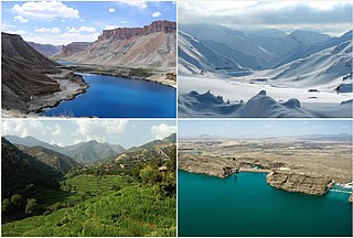
Tourism in Afghanistan is regulated by the Ministry of Information and Culture. There are at least 350 tourism companies operating in Afghanistan. Tourism was at its peak before the 1978 Saur Revolution, which was followed by the decades of warfare. Between 2013 and 2016, Afghan embassies issued between 15,000 and 20,000 tourist visas annually. Following Taliban's return to power in August 2021, visitor numbers gradually increased from 691 in 2021 to 2,300 in 2022, reaching 7,000 in 2023.

Lōya Paktiā is a historical and cultural region of Afghanistan, comprising the modern Afghan provinces of Khost, Paktia, and Paktika, as well as parts of Logar and compromises Kurram, Bannu and Waziristan of Khyber Pakhtunkhwa. Loya Paktia is vaguely defined by a common culture and history that is connected to the local indigenous tribes that reside in the region. Particular styles of clothing, articles of clothing, turban styles, turban cloth colors, dialects of Pashto language, etc. may sometimes be associated with specific tribes indigenous to Loya Paktia and thus integrate themselves into regional culture. For instance, a Pashtun tribesman from Loy Kandahar may quickly recognize a Pashtun from Loya Paktia based upon his turban style and color. Likewise, a Pashtun from Loya Paktia may recognize someone from Loy Kandahar based upon his unique style of collarless kameez (shirt) with specific embroidered patterns on the front. There are many subtle and intricate cultural indicators of this type that are not recorded in any known written history but simply known and observed by the tribesmen of the various Pashtun regions of Afghanistan and Pakistan.
2003 in Afghanistan. A list of notable incidents in Afghanistan during 2003
On July 15, 2014, in Urgun, Afghanistan, a car bomb suicide attack took place in a crowded bazaar killing 89 people and injuring another 42. It was the bloodiest attack on civilians in Afghanistan since the 2008 Kandahar bombing.

