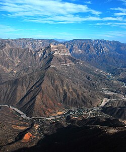
Copper Canyon is a group of six distinct canyons in the Sierra Madre Occidental in the southwestern part of the state of Chihuahua in northwestern Mexico that is 65,000 square kilometres (25,000 sq mi) in size. The canyons were formed by six rivers that drain the western side of the Sierra Tarahumara. All six rivers merge into the Rio Fuerte and empty into the Gulf of California. The walls of the canyon are a copper/green color, which is the origin of the name.

El Fuerte is a city and El Fuerte Municipality its surrounding municipality in the northwestern Mexican state of Sinaloa. The city population reported in the 2010 census was 12,566 people.
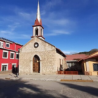
Creel is a town in the Sierra Tarahumara of the Mexican state of Chihuahua. It is the second-largest town in the municipality of Bocoyna. It is located some 175 kilometres (109 mi) to the southwest of the state capital, Chihuahua City. At the census of 2010, it had a population of 5,026, down from 5,338 as of 2005. It is notable for being inhabited mostly by Native Americans of the Rarámuri ethnic group, and the use of their native language is widespread in the population in daily life and public events such as church masses.
Casas Grandes Municipality is located in the northern Mexican state of Chihuahua. The municipal seat is the town of Casas Grandes, Chihuahua.

Ahumada is one of the 67 municipalities of Chihuahua, in northern Mexico. The municipal seat lies at Villa Ahumada. The municipality covers an area of 17,131.5 km².
Santa Eulalia is a town and seat of the municipality of Aquiles Serdán, in the northern Mexican state of Chihuahua. In 2010, the town had a population of 7,135, up from 2,089 in 2005.
Bocoyna is a town and seat of the municipality of Bocoyna, in Chihuahua state of northern Mexico. As of 2010, the town of Bocoyna had a population of 796, up from 735 as of 2005.
San Lorenzo is a town and seat of the municipality of Dr. Belisario Domínguez, in the northern Mexican state of Chihuahua. As of 2010, the town had a population of 441, up from 308 as of 2005.

Vicente Guerrero is a town and seat of the municipality of Guerrero, in the northern Mexican state of Chihuahua. As of 2010, the town had a population of 7,751, up from 6,536 as of 2005.
Manuel Benavides is a small town and seat of the municipality of Manuel Benavides, in the northern Mexican state of Chihuahua. As of 2010, the town had a population of 916, up from 200 as of 2005. It is a rural bordertown on the U.S.-Mexico border, with the town of Redford, Texas, directly opposite, on the U.S. side of the border.
Mariano Matamoros is a town and seat of the municipality of Matamoros, in the northern Mexican state of Chihuahua. As of 2010, the town had a population of 2,615, up from 2,256 as of 2005.
Matachí is a town and seat of the municipality of Matachí, in the northern Mexican state of Chihuahua. As of 2010, the town of Matachí had a population of 1,710.
Julimes is a town and seat of the municipality of Julimes, in the northern Mexican state of Chihuahua. As of 2010, the town of Julimes had a population of 1,795, up from 1,756 as of 2005.
Villa López is a town and seat of the municipality of López, in the northern Mexican state of Chihuahua. As of 2010, the town had a population of 2,184, up from 2,066 as of 2005.
Nonoava is a town and seat of the municipality of Nonoava, in the northern Mexican state of Chihuahua. As of 2010, the town of Nonoava had a population of 1,272, up from 1,209 as of 2005. The settlement was founded on the right bank of the Nonoava River in 1676 by the Jesuit missionary Francis Artuaga, and named Nuestra Señora de Montserrat de Nonoava.
Santa Cruz de Rosales is a town and seat of the municipality of Rosales, in the northern Mexican state of Chihuahua. As of 2010, the town had a population of 5,570, up from 5,377 as of 2005
Morelos is a town and seat of the municipality of Morelos Municipality, in the northern Mexican state of Chihuahua. As of 2010, the town had a population of 813, up from 735 as of 2005.
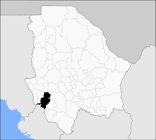
Urique is one of the 67 municipalities of Chihuahua, in northern Mexico. The municipal seat lies at Urique. The municipality covers an area of 3,968.6 km².
Temósachic is a town and seat of the municipality of Temósachic, in the northern Mexican state of Chihuahua. As of 2010, the town of Temósachic had a population of 1,841, up from 1,786 as of 2005.

The Seventh Federal Electoral District of Chihuahua(VII Distrito Electoral Federal de Chihuahua) is one of the 300 Electoral Districts into which Mexico is divided for the purpose of elections to the federal Chamber of Deputies and one of nine such districts in the state of Chihuahua.