
Akureyri Airport is a single-runway international airport in Akureyri, Iceland 3 kilometres (1.9 mi) south of the town centre. Air Iceland and Norlandair link the airport with several domestic locations.

Enrique Malek International Airport is an international airport serving David Sur, a city in the Chiriquí Province of Panama.
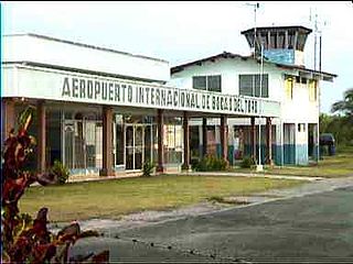
Bocas del Toro "Isla Colón" International Airport is a public airport located 1.5 kilometres (1 mi) northwest of the center of Bocas del Toro, a town on Isla Colón in the Bocas del Toro Province of Panama.

Albrook "Marcos A. Gelabert" International Airport is a public airport located 1.5 kilometres (1 mi) west of the center of Panama City, in the Panamá Province of Panama. It is on the site of the former Albrook Air Force Station. Previously, the airport was located in the area of Paitilla Punta Paitilla, operating approximately 70 years until January 1999, when the airport moved operations to Albrook. The name was changed to honor the Panamanian aviator Marcos A. Gelabert, whose contributions to Panamanian aviation included founding Panama's first airline and first school for training pilots.

Achutupo Airport is an airport serving the island town of Achutupo, in the San Blas archipelago of Panama. The runway is located on the mainland, 0.7 kilometres (0.4 mi) southwest of the island and is reached by boat.

Playón Chico Airport is an airport serving Ukupseni, an island in the San Blas Archipelago in the Guna Yala comarca of Panama.
Garachiné Airport is an airport serving the Pacific coastal town of Garachiné, in the Darién Province of Panama.
Mulatupo Airport is an airport serving the Caribbean island town of Mulatupo, in the Guna Yala comarca of Panama.
Puerto Obaldia Airport is an airport serving Puerto Obaldía, a Caribbean coastal town in the Guna Yala comarca of Panama.

Útila Airport is an airport serving Útila, Islas de la Bahía, Honduras. It handles regional and international air traffic for the town of Útila. The airport is served by several airlines on a daily schedule, as well as numerous private and charter flights.
Corazón de Jesús Airport is an airstrip serving Corazón de Jesús and Narganá, island towns in the Guna Yala comarca of Panama.
Ustupo Airport is a secondary airport serving the island town of Ustupo, Guna Yala comarca, Panama. It is 800 metres (0.5 mi) southwest on the mainland and reachable from the town by a boat.
Jaqué Airport is an airport serving Jaqué, a Pacific coastal town in the Darién Province of Panama.
El Real de Santa María Airport is an airstrip serving the small town of El Real de Santa María, in the Darién Province of Panama. El Real is 6.5 kilometres (4.0 mi) southwest of Yaviza, the southern end of the North American section of the Pan American Highway. There are no paved roads between the two towns.
San Miguel Airport is an airport serving San Miguel, a town in the Pearl Islands of Panama. It is just east of the town, on the northern side of Isla del Rey, the largest of the islands.
Tubualá Airport is an airport serving the island town of Tubualá, in the Guna Yala Province of Panama.

Panamá Pacífico International Airport is a commercial airport in Panama. It is located on the site of the former Howard Air Force Base, a United States Air Force base that was within the Panama Canal Zone. Panama City can be reached by crossing the nearby Bridge of the Americas.

Ometepe Airport is the only airport on Ometepe, the largest island in Lake Nicaragua. The airport is in the La Paloma comarca of Moyogalpa, Rivas Department, Nicaragua, 1.6 kilometres (1 mi) south of Moyogalpa.
Miraflores Airport is an airport serving La Palma, a port town and the capital of the Darién Province of Panama. The airport is 7 kilometres (4.3 mi) south of La Palma, and replaces the closed Captain Ramon Xatruch Airport.
Captain Ramon Xatruch Airport was an airport serving La Palma, a port town and the capital of the Darién Province of Panama. The runway is now the main street for the town, with buildings lining both sides.

