
Ruben Cantu Airport is an airport serving Atalaya District, of the Veraguas Province of Panama. The airport is 2 kilometres (1 mi) southeast of the city.
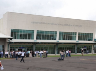
Enrique Adolfo Jiménez Airport is an international airport located in Colón, Panama, offering scheduled airline flights to Panama City, and to other destinations. The airport is just east of Colon's harbor and cargo handling facilities.
Calzada Larga Airport is a general aviation airport serving Caimitillo, a town in the Panamá Province of Panama.
Achutupo Airport is an airport serving the island town of Achutupo, in the San Blas archipelago of Panama. The runway is located on the mainland, 0.7 kilometres (0.4 mi) southwest of the island and is reached by boat.

Playón Chico Airport is an airport serving Ukupseni, an island in the San Blas Archipelago in the Guna Yala comarca of Panama.
Garachiné Airport is an airport serving the Pacific coastal town of Garachiné, in the Darién Province of Panama.
Mulatupo Airport is an airport serving the Caribbean island town of Mulatupo, in the Guna Yala comarca of Panama.

Ustupu-Ogobsucum Airport is an airport serving the island town of Ustupo in the Guna Yala comarca of Panama. It handles domestic flights and general aviation.
Alonso Valderrama Airport is an airport serving Chitré, a city in the Herrera Province of Panama. The airport is 2 kilometres (1.2 mi) northeast of the city, and 1.6 kilometres (1 mi) inland from the Gulf of Panama.
Corazón de Jesús Airport is an airstrip serving Corazón de Jesús and Narganá, island towns in the Guna Yala comarca of Panama.
El Porvenir Airport is an airport serving El Porvenir, in Panama. The airport is on an island 2 kilometres (1.2 mi) east of the mainland, in the archipelago bordering the Gulf of San Blas. All approaches and departures will be over the water.
Ailigandí Airport is an airstrip serving Ailigandí, an island town in the Guna Yala comarca of Panama. The airstrip is onshore, approximately 400 metres (1,312 ft) southeast of Ailigandí island and is reached by boat. There are no roads near the airstrip.
Augusto Vergara Airport is an airport serving the city of Los Santos, in Panama. It is located 16 kilometres (10 mi) southeast of the city, north of the town of Guararé.
Bahía Piña Airport is an airport serving Puerto Piña, a Pacific coastal village in the Darién Province of Panama.
Jaqué Airport is an airport serving Jaqué, a Pacific coastal town in the Darién Province of Panama.
Sambú Airport is an airport serving the Sambú River towns of Sambú and Puerto Indio, Panama.
San Miguel Airport is an airport serving San Miguel, a town in the Pearl Islands of Panama. It is just east of the town, on the northern side of Isla del Rey, the largest of the islands.
Tubualá Airport is an airport serving the island town of Tubualá, in the Guna Yala Province of Panama.
Cartí Airport is an airport serving the Cartí islands in the San Blas Archipelago of Panama. The airport is on the mainland, approximately 0.7 kilometres (0.4 mi) southwest of Cartí Sugtupu island.
