Utah State Route 24

Last updated

Utah 24.svg

State Route 24

Capitol Reef Scenic Byway
Utah State Route 24
Map of State Route 24
Route information
Maintained by UDOT
Length160.294 mi [1]  (257.968 km)
Existed1910 as a state highway; 1927 as SR-24–present
Major junctions
West endUS 50.svg US 50 in Salina
Major intersectionsUtah 118.svg SR-118 in Sigurd
Utah 62.svg SR-62 at Plateau Junction
Utah 25.svg SR-25 near Fish Lake
Utah 72.svg SR-72 near Loa
Utah 12.svg SR-12 in Torrey
Utah 95.svg SR-95 in Hanksville
East endI-70.svgUS 50.svg I-70  / US 50 near Green River
Location
Country United States
State Utah
Counties Sevier, Piute, Wayne, Emery
Highway system
  • Utah State Highway System
Utah 23.svg SR-23 Utah 25.svg SR-25

State Route 24 (SR-24) is a state highway in south central Utah which runs south from Salina through Sevier County then east through Wayne County and north east through Emery County. At a total of 163.294 miles (262.796 km), it is the longest contiguous state route in Utah. A portion of the highway has been designated the Capitol Reef Scenic Byway as part of the Utah Scenic Byways program. [2]

Contents

Route description

SR-24 between Loa and Lyman Utah State Route 24 Between Loa and Lyman, Utah.jpg
SR-24 between Loa and Lyman

The highway starts at US-50 near Salina and ends at I-70 near Green River, taking a 163-mile (262 km) scenic route between the Fishlake and Dixie National Forests then through Capitol Reef National Park, along the eastern side of the San Rafael Reef passing Goblin Valley State Park and meeting I-70 again near Green River. Along the way, it passes through the towns of Loa, Lyman, Bicknell, Torrey and Hanksville.

Portion of Capitol Reef along SR-24 Capitol Reef Along SR24.JPG
Portion of Capitol Reef along SR-24

The Mars Society established the Mars Desert Research Station just outside Hanksville, due to its Mars-like terrain .[ citation needed ]

The north easterly section past the San Rafael Reef is open desert with distant views of the Henry and La Sal Mountains. [1]

Traffic volume

SR-24 between Torrey and Hanksville Utah State Route 24, Near Mile 92 view in Direction North-West 110814 2.jpg
SR-24 between Torrey and Hanksville

The Average Daily Traffic (AADT) for SR-24 is at its greatest between Salina and Sigurd, where it varies between 3,085 down to 1,500 at the Junction with SR-118. Past that point, the volume of traffic varies greatly, reaching peaks where the highway coincides with the main streets in the several towns through which it passes. In Loa, the AADT reaches 2,080, in Torrey, it peaks at 1,230. Then the traffic dies down to 295 by the time SR-24 arrives back at I-70. [3]

History

SR-24 sign between Loa and Lyman Utah State Route 24 Between Loa, Utah and Lyman, Utah.jpg
SR-24 sign between Loa and Lyman

The road from SR-11 (by 1926 US-89) at Sigurd southeast and east to Hanksville became a state highway in 1910 (Wayne County) and 1912 (Piute and Sevier Counties). [4] The number was assigned in 1927 by the state legislature, [5] and in 1935 it was extended northeast from Hanksville to US-6 near Green River. [6]

SR-24 between Capitol Reef National Park and Torrey Utah State Route 24 Between Capitol Reef National Park and Torrey, Utah.jpg
SR-24 between Capitol Reef National Park and Torrey

A realignment in 1961 bypassed Capitol Reef Road between Fruita and Caineville; as part of the construction of I-70, the east end was moved west to that highway's exit 149 in 1964. SR-24 was extended north from its west end over former US-89 to present-day US-89 in 1969, and cut back slightly to its current end at US-50 in the 1977 renumbering. [4] (The 1969 extension was signed as part of US-89 until 1992, soon after I-70 was completed. [7] )

For a time in the 1950s and 1960s, there was also a State Route 24A, which was a short spur of SR-24 from Sigurd southwest along Main Street to SR-11/US-89. [8] [9]

Major intersections

CountyLocationmi [1] kmDestinationsNotes
Sevier Salina 0.0000.000US 50.svg US 50 (Main Street) Scipio Western terminus
Aurora 5.3018.531North plate.svg
Utah 260.svg
SR-260 north
Sigurd 7.70512.400North plate.svg
Utah 259.svg
To plate blue.svg
I-70.svg
To plate.svg
US 89.svg
SR-259 north to I-70  / US 89
8.16513.140South plate.svg
Utah 118.svg
SR-118 south Richfield
Glenwood 16.00625.759West plate.svg
Utah 119.svg
SR-119 west Richfield
Plateau Junction 32.31051.998South plate.svg
Utah 62.svg
SR-62 south Junction
Piute Fish Lake 39.09462.916North plate.svg
Utah 25.svg
SR-25 north
Wayne Loa 51.57583.002North plate.svg
Utah 72.svg
To plate blue.svg
I-70.svg
SR-72 north to I-70
Torrey 69.526111.891South plate.svg
Utah 12.svg
SR-12 south Escalante
Hanksville 116.484187.463South plate.svg
Utah 95.svg
SR-95 south Blanding
Emery Green River 159.811–
160.234
257.191–
257.872
I-70.svgUS 50.svg I-70  / US 50  Richfield, Green River I-70 exit 149.
160.294257.968Four Corners Mine RoadEastern terminus
1.000 mi = 1.609 km; 1.000 km = 0.621 mi

Related Research Articles

<span class="mw-page-title-main">U.S. Route 163</span> Highway in Arizona and Utah

U.S. Route 163 is a 64-mile (103 km) U.S. Highway that runs from US 160 northward to US 191 in the U.S. states of Arizona and Utah. The southernmost 44 miles (71 km) of its length are within the Navajo Nation. The highway forms part of the Trail of the Ancients, a National Scenic Byway. The highway cuts through the heart of Monument Valley and has been featured in numerous movies and commercials.

<span class="mw-page-title-main">Utah State Route 12</span> State highway in Garfield and Wayne counties in Utah, United States

State Route 12 or Scenic Byway 12 (SR-12), also known as "Highway 12 — A Journey Through Time Scenic Byway", is a 122.863-mile-long (197.729 km) state highway designated an All-American Road located in Garfield County and Wayne County, Utah, United States.

<span class="mw-page-title-main">U.S. Route 50 in Utah</span> Highway in Utah

U.S. Route 50 (US-50) in Utah crosses the center of the state. The highway serves no major population centers in Utah, with the largest city along its path being Delta. Most of the route passes through desolate, remote areas. Through the eastern half of the state the route is concurrent with Interstate 70 (I-70). US-50 both enters and exits Utah concurrent with US-6, however the two routes are separate through the center of the state.

<span class="mw-page-title-main">Interstate 70 in Utah</span> Section of Interstate highway in Utah

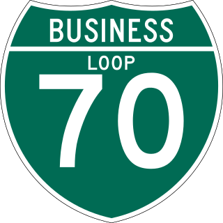
Interstate 70 (I-70) is a mainline route of the Interstate Highway System in the United States connecting Utah and Maryland. The Utah section runs east–west for approximately 232 miles (373 km) across the central part of the state. Richfield is the largest Utah city served by the freeway, which does not serve or connect any urban areas in the state. The freeway was built as part of a system of highways connecting Los Angeles and the Northeastern United States. I-70 was the second attempt to connect southern California to the east coast of the United States via central Utah, the first being a failed attempt to construct a transcontinental railroad. Parts of that effort were reused in the laying out of the route of I-70.

<span class="mw-page-title-main">Utah State Route 161</span> Highway in Utah, United States

State Route 161 (SR-161) is a 3.084-mile (4.963 km) long state highway, designated as a rural major connector, completely within Millard County in central Utah. The highway connects Interstate 70 (I-70) to I-15 while providing service to historic Cove Fort. The route was once part of U.S. Route 91 (US-91), but was renumbered to SR-161 in the 1970s, in parallel with the construction of I-70.

<span class="mw-page-title-main">Utah State Route 118</span> State highway in Sevier County, Utah, United States

State Route 118 (SR-118) is a state highway in the US state of Utah linking I-70/US-89 and Joseph to Richfield. The route is the main street for Joseph, Monroe and Richfield and spans 24.14 miles (38.85 km). The highway was established 1931, initially connecting Joseph to Monroe and Central Valley. Eventually, maintenance of the road was extended north to near Salina.

<span class="mw-page-title-main">Utah State Route 94</span>

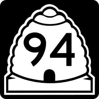
State Route 94 (SR-94), located entirely within Grand County, is a 0.958-mile-long (1.542 km) minor collector state highway in the U.S. state of Utah. The highway serves as a spur route into Thompson Springs. The highway was formed in 1969, at the same time Interstate 70 (I-70) was constructed through the area.

<span class="mw-page-title-main">Utah State Route 120</span>

State Route 120 (SR-120) is a state highway in the US state of Utah forming a business loop around I-70 serving the town of Richfield. The route forms the main street for Richfield and spans 3.89 miles (6.26 km). The highway was established 1969, coinciding with the construction of I-70 through Sevier County.

<span class="mw-page-title-main">Utah State Route 259</span>

State Route 259 (SH-259) is a short state highway within Sigurd in Sevier County, Utah connecting Interstate 70 (I-70)/U.S. Route 89 (US-89) to SR-24.

<span class="mw-page-title-main">Utah State Route 260</span> Highway in Utah

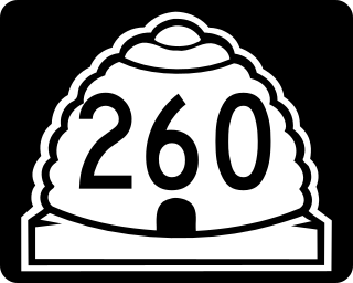
State Route 260 is a highway within Sevier County in central Utah that connects SR-24 to US-50 while passing through the town of Aurora in a span of four miles (6 km).

<span class="mw-page-title-main">U.S. Route 89 in Utah</span> Section of U.S. Highway in Utah, United States

U.S. Route 89 in the U.S. state of Utah is a north-south United States Highway spanning more than 502 miles (807.891 km) through the central part of the state, making it the longest road in Utah. Between Provo and Brigham City, US-89 serves as a local road, paralleling Interstate 15, but the portions from Arizona north to Provo and Brigham City northeast to Wyoming serve separate corridors. The former provides access to several national parks and Arizona, and the latter connects I-15 with Logan, the state's only Metropolitan Statistical Area not on the Interstate.

<span class="mw-page-title-main">Utah State Route 30</span>

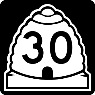
State Route 30 (SR-30) is a state highway in the U.S. state of Utah. It is the only highway signed as a Utah state route to traverse the entire width of the state. Legislatively the highway exists as 3 separate segments. With implied connections via Interstate 84 and U.S. Route 89, the highway is drivable as a continuous route from Nevada to Wyoming. The western segment is a historic corridor paralleling the pre-Lucin Cutoff routing of the First transcontinental railroad. A portion of the eastern segment has been designated the Bear Lake Scenic Byway as part of the Utah Scenic Byways program. The route was created in 1966 by combining several state highways into a single designation.

<span class="mw-page-title-main">Utah State Route 10</span>

State Route 10 (SR-10) is a State Highway in the U.S. state of Utah. The highway follows a long valley in Eastern Utah between the Wasatch Plateau on the west and the San Rafael Swell on the east.

<span class="mw-page-title-main">Utah State Route 72</span>

State Route 72 (SR-72) is a 35.393-mile-long (56.960 km) state highway in the U.S. state of Utah. The current alignment is an extension of SR-10. The highway provides access to Loa from Interstate 70 (I-70).

<span class="mw-page-title-main">Utah State Route 92</span> State highway in Utah, United States

State Route 92 (SR-92), also known in various portions as the Timpanogos Highway, and Alpine Loop Scenic Highway is a scenic state highway in Utah County, Utah that runs from I-15/US-89 in Lehi to US-189 in Provo Canyon. The route is 27.296 miles (43.929 km) long and is the only road with access to Sundance Ski Resort and the Aspen Grove Family Camp and Conference Center.

<span class="mw-page-title-main">Utah State Route 14</span>

State Route 14 (SR-14) is a state highway in southern Utah, running for 40.995 miles (65.975 km) in Iron and Kane Counties from Cedar City to Long Valley Junction. The highway has been designated the Markagaunt High Plateau Scenic Byway as part of the Utah Scenic Byways program.

<span class="mw-page-title-main">Utah State Route 25</span>

State Route 25 (SR-25), also part of the designated Fishlake Scenic Byway, is a state highway in the south central portion of the U.S. state of Utah. SR-25 runs from the junction of SR-24 near the town of Koosharem northeast to the west shore of Fish Lake. The highway runs for 9.995 miles (16.09 km).

<span class="mw-page-title-main">Utah State Route 28</span>

State Route 28 (SR-28) is a state highway in central Utah running for 43.612 miles (70.187 km) in Sanpete and Juab counties from Gunnison to Nephi. It serves as a connection from the Wasatch Front to the Sevier Valley.

<span class="mw-page-title-main">Utah State Route 119</span> State highway in Sevier County, Utah, United States

State Route 119 (SR-119) is a 8.753-mile-long (14.087 km) state highway in the U.S. state of Utah, connecting SR-119 in Richfield to SR-24 near Glenwood.

<span class="mw-page-title-main">Utah State Route 208</span> State highway in Duchesne County, Utah, United States

State Route 208 (SR-208) is a 10.205-mile (16.423 km), north–south state highway on the Uintah and Ouray Indian Reservation in the Uinta Basin in eastern Duchesne County, Utah, United States, that connects U.S. Route 40 (US-40) with Utah State Route 35 (SR-35).

References

  1. 1 2 3 "Highway Reference Online - SR-24". maps.udot.utah.gov. Utah Department of Transportation.
  2. "Capitol Reef Scenic Byway". Utah.com. Retrieved 2013-10-18.
  3. "Traffic Statistics". udot.utah.gov. Utah Department of Transportation. 2005.
  4. 1 2 "State Road Resolutions SR-24.pdf". Utah Department of Transportation. (17.9 MB), updated September 2007, accessed May 2008
  5. Utah State Legislature (1927). "Chapter 21: Designation of State Roads". Session Laws of Utah. 24. From Sigurd southeasterly via Plateau Junction, Loa and Fruita to Hanksville.
  6. Utah State Legislature (1935). "Chapter 37: Designation of State Roads". Session Laws of Utah. Route 24. From Sigurd southeasterly via Plateau Junction, Loa and Fruita to Hanksville, thence northeasterly to Green River on route 8.
  7. "State Road Resolutions SR-70.pdf". Utah Department of Transportation. (17.4 MB), updated November 2007, accessed May 2008
  8. Utah State Legislature (1963). "Chapter 39: Highway Code". Session Laws of Utah. p. 163. Route 24-A. From route 24 in Sigurd southwesterly to route 11.
  9. "USGS Topographic Map". Historic Aerials. USGS. 1969. Retrieved 25 May 2019.
Template:Attached KML/Utah State Route 24
KML is not from Wikidata

Commons-logo.svg Media related to Utah State Route 24 at Wikimedia Commons