Utah State Route 252

Last updated

Utah 252.svg

State Route 252

Utah State Route 252
SR-252 highlighted in red
Route information
Maintained by UDOT
Length6.755 mi [1]  (10.871 km)
Existed2007–present
Major junctions
South endUS 89.svgUS 91.svg US 89  / US 91 in Logan
Major intersectionsUtah 30.svg SR-30 in Logan
North endUS 91.svg US 91 in North Logan
Location
Country United States
State Utah
Highway system
  • Utah State Highway System
Utah 248.svg SR-248 Utah 256.svg SR-256

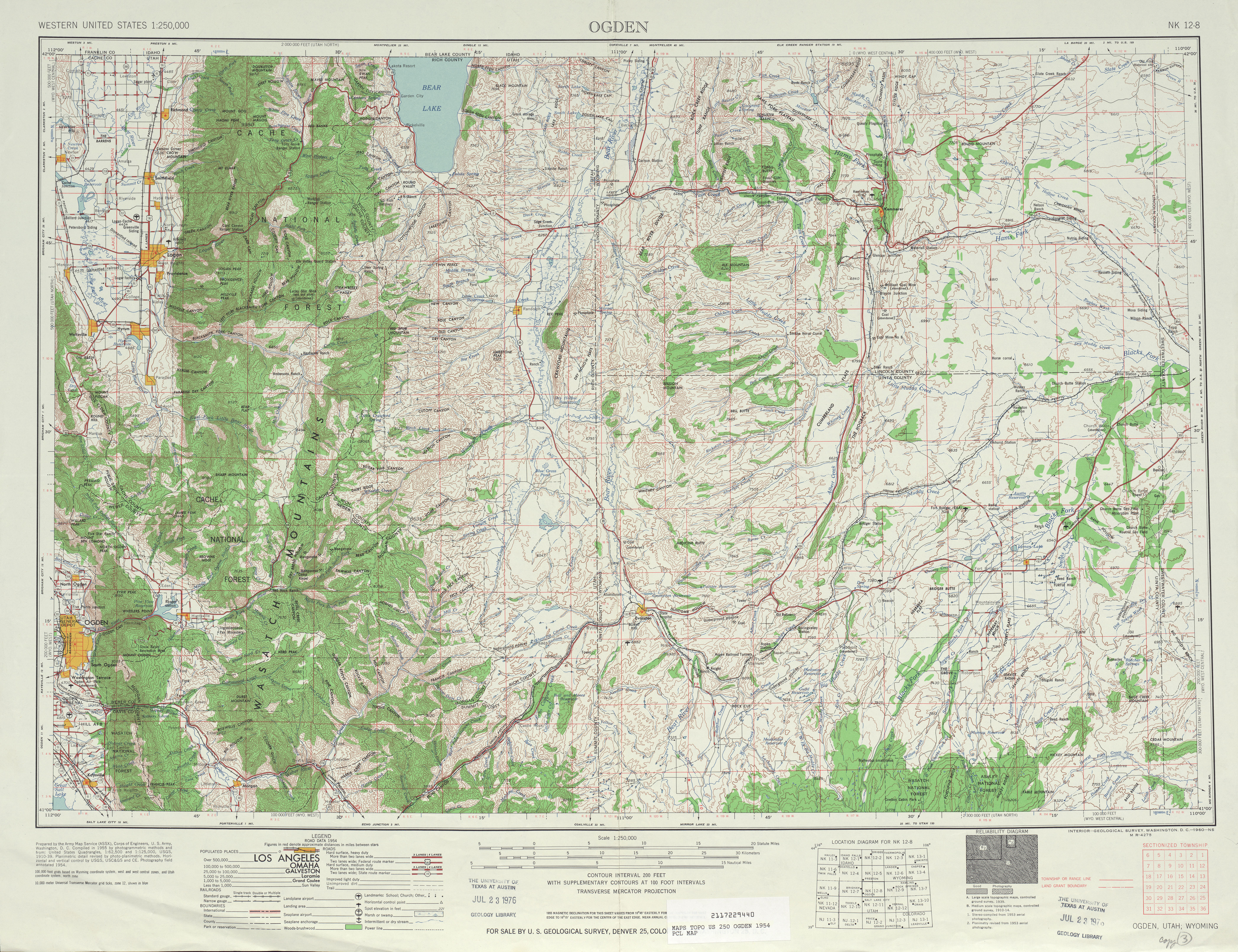
State Route 252 (SR-252) is a state highway that runs more than six miles (ten kilometers) in Cache County in the northern Utah city of Logan. The route goes from its southern terminus of US-89/US-91 and heads on a northerly path through the west side of Logan. The route's northern terminus is at US-91.

Contents

Route description

SR-252 begins at US-89/US-91 in southwestern Logan, near the Logan River Golf Course, ICON Health & Fitness corporate headquarters and HyClone's corporate headquarters, and heads north on 1000 West across the Logan River. On the southeast corner of the intersection with 600 South is Woodruff Elementary School; access from 1000 West was closed before the 2008-2009 school year as a condition of the addition of SR-252 to the state highway system. [2] As it continues north, SR-252 crosses 200 North (SR-30) and 400 North (a proposed realignment of SR-30) near the Cache County Jail. [3] Finally it reaches 2500 North (Airport Road) on the south boundary of the Logan-Cache Airport, where SR-252 turns east to its northern terminus at Main Street (US-91) in North Logan. [4]

The entire route is part of the National Highway System. [5]

History

When the Cache Valley was settled and developed in the 19th century, the northsouth road through the eastern part of the valley connected all the towns, including Hyrum, Providence, Logan, Hyde Park, and Smithfield. [6] Later, when Logan's Main Street was extended north and south, it bypassed Providence, Hyde Park, and the newer communities of Millville, River Heights, and North Logan to the west. This more direct route became the main state highway through the area in the 20th century, carrying SR-1 (US-91) north of and SR-101 (now SR-165) south of Logan. [7] [8]

The state legislature designated two routes in 1969 that served the areas east of Logan's Main Street, following in part the old road from the 19th century. State Route 238 began at SR-165 in Nibley, and headed east on 200 South into Millville, then north on that city's Main Street, becoming Providence's 200 West. It jogged east on 100 South (changed to 100 North in 1970 to remove traffic from the city center) to 100 West, and then continued north into River Heights on its 600 East (numbered to match Logan's grid). Finally, it turned west on River Heights Boulevard (changed to 600 South in 1970 to avoid hills), north on 400 East into Logan, and west on 300 South to end at US-91. [9] State Route 237 continued north from Logan, beginning at US-89 (400 North) and 600 East, and following 600 East, 1000 North, and 800 East through North Logan. In Hyde Park, the name changed to 250 East, and SR-237 turned west on 200 South, north on Main Street, and west on Center Street to a northern terminus at US-91. [10]

Other than the 1970 changes to SR-238 requested by the cities, the next change came in 1981. The part of SR-237 on Logan's 600 East and 1000 North, having "more the characteristics of a city street", was given to the city, and in exchange a same-length segment of 1400 North, a four-lane arterial connecting US-91 to SR-237, became a new State Route 239. [11] This left SR-237's south end at 800 East and 1000 North, where SR-288, a peripheral route around Utah State University, went both east and south. Portions of SR-288 were given to the city and university in 1992, and SR-237 was extended south three blocks on 800 East (former SR-288) to 700 North, a city street. [10]

In order to "benefit the long term mobility of the whole region", the Cache Metropolitan Planning Organization and Utah Department of Transportation decided in 2007 that a new western bypass of US-91 through the area would help reduce traffic through downtown Logan. In exchange for its creation as State Route 252, the county and cities agreed to take over maintenance of State Routes 237, 238, 239, and 288, minor roads that did not meet "the eligibility criteria for what constitutes a State Highway". [2]

A western bypass of Logan on 1000 West was planned at least since the 1970s as a local road, [9] but was not completed until about 1990.[ citation needed ] On the other hand, 2500 North (Airport Road), which SR-252 uses to get back to US-91, has a longer history. State Route 217 was designated in 1941 to begin at US-91 north of Logan and head west on 1800 North to Greenville, north on 600 West, and west on Airport Road to Benson. [12] It was modified in 1945 to use Airport Road directly from US-91, [13] [14] and was removed from the state highway system in 1969. [15]

Construction project [16] [17]

Project Description: The project follows the recently completed environmental document to improve the safety and capacity of 10th West/SR 252 and 2500 North and bring the route up to state standards. On 10th West, work will include widening the roadway to five lanes from US 91 to 300 North (including the Logan River Bridge) and a new west-side frontage road between 600 South and 200 South. Traffic signals and turn lanes will also be installed at 10th North and 14th North. On 2500 North work will include widening to five lanes from 600 West to Main St., plus two left turns onto Main St. As part of the project, the contractor will also close the north side of the 1100 West/US 91 intersection, as discussed during the environmental process. UDOT has selected Staker Parson Company as the general contractor. For background on the entire project, see the completed environmental document at Final Environmental Study. [18]

Major intersections

The entire route is in Cache County.

Locationmi [1] kmDestinationsNotes
Logan 0.0000.000US 89.svgUS 91.svg US 89  / US 91  Brigham City, Garden City Southern terminus
2.6064.194Utah 30.svg SR-30 (200 North) Riverside
North Logan 6.75510.871US 91.svg US 91 (Main Street) Preston Northern terminus
1.000 mi = 1.609 km; 1.000 km = 0.621 mi

Related Research Articles

<span class="mw-page-title-main">U.S. Route 91</span> Numbered Highway in Utah and Idaho in the United States

U.S. Route 91 or U.S. Highway 91 is a 172.7-mile-long (277.9 km) north–south United States highway running from Brigham City, Utah, to Idaho Falls, Idaho, in the U.S. states of Idaho and Utah. Despite the "1" as the last digit in the number, US 91 is no longer a cross-country artery, as it has mostly been replaced by Interstate 15. The highway currently serves to connect the communities of the Cache Valley to I-15 and beyond. Prior to the mid-1970s, US 91 was an international commerce route from Long Beach, California, to the Canada–US border north of Sweetgrass, Montana. US 91 was routed on the main streets of most of the communities it served, including Las Vegas Boulevard in Las Vegas and State Street in Salt Lake City. From Los Angeles to Salt Lake, the route was built along the corridor of the Arrowhead Trail. A portion of the highway's former route in California is currently State Route 91.

<span class="mw-page-title-main">Utah State Route 68</span> State highway in Utah, Salt Lake, and Davis counties in Utah, United States

State Route 68 (SR-68) is a state highway in the U.S. state of Utah. It is a major thoroughfare throughout the Wasatch Front as it runs north–south for 70.8 miles (113.9 km), linking US-6 near Elberta to US-89 in Woods Cross. The route intersects several major freeways and highways in the Salt Lake City metropolitan area including I-215, I-80, and I-15. The route is more commonly referred to as Redwood Road, after the street it is routed along throughout Salt Lake County. The highway is also routed for a short distance along 500 South and 200 West in Bountiful and Camp Williams Road in Utah County. The route is a surface street for its entire length.

<span class="mw-page-title-main">Utah State Route 186</span> State highway in Utah, United States

State Route 186 (SR-186) is a state highway entirely within Salt Lake City, capital of the U.S. state of Utah. It forms a quarter-beltway connecting US-89 and I-15 leading north from Salt Lake City to I-80 leading east; as such, it effectively forms the missing (non-freeway) quarter of the I-215 belt route around the city, though it does not directly connect to I-215 at the north end. Despite this beltway role, the route passes through downtown Salt Lake City because downtown is built right up to the northern mountains surrounding City Creek Canyon. The portion of the route connecting downtown to I-80 is a high-capacity street heavily used by commuters, especially those travelling to the University of Utah or between downtown and eastern neighborhoods, but the portion on Capitol Hill north of downtown is much narrower and has sharp turns around the Capitol grounds. The roadway runs 9.34 miles (15.03 km) along Victory Road, Columbus Street, 300 North, State Street, 400 South, 500 South, and Foothill Drive.

<span class="mw-page-title-main">Utah State Route 111</span> State highway in Utah, United States

State Route 111 (SR-111) is a state highway in the U.S state of Utah that runs north–south across the west side of the Salt Lake Valley in Salt Lake County. It connects SR-201 in Magna to SR-209 in West Jordan in a span of 10.6 miles (17.06 km). It is known as 8400 West and Bacchus Highway throughout the route's course, in respect of north to south.

<span class="mw-page-title-main">Utah State Route 38</span> State highway in Utah, United States

State Route 38 is a state highway in Box Elder County in the U.S. state of Utah. It runs north from Brigham City to Collinston. The highway was originally State Route 69, but was renumbered in 1993 due to sign theft caused by the sexual connotation of the number.

<span class="mw-page-title-main">Interstate 15 in Utah</span> Section of Interstate highway in Utah, United States

Interstate 15 (I-15) runs north–south in the U.S. state of Utah through the southwestern and central portions of the state, passing through most of the state's population centers, including St. George and those comprising the Wasatch Front: Provo–Orem, Salt Lake City, and Ogden–Clearfield. It is Utah's primary and only north–south interstate highway, as the vast majority of the state's population lives along its corridor; the Logan metropolitan area is the state's only Metropolitan Statistical Area through which I-15 does not pass. In 1998, the Utah State Legislature designated Utah's entire portion of the road as the Veterans Memorial Highway.

<span class="mw-page-title-main">U.S. Route 89 in Utah</span> Section of U.S. Highway in Utah, United States

U.S. Route 89 in the U.S. state of Utah is a north-south United States Highway spanning more than 502 miles (807.891 km) through the central part of the state, making it the longest road in Utah. Between Provo and Brigham City, US-89 serves as a local road, paralleling Interstate 15, but the portions from Arizona north to Provo and Brigham City northeast to Wyoming serve separate corridors. The former provides access to several national parks and Arizona, and the latter connects I-15 with Logan, the state's only Metropolitan Statistical Area not on the Interstate.

<span class="mw-page-title-main">Utah State Route 30</span> State highway in Utah, United States

State Route 30 (SR-30) is a state highway in the U.S. state of Utah. It is the only highway signed as a Utah state route to traverse the entire width of the state. Legislatively the highway exists as 3 separate segments. With implied connections via Interstate 84 and U.S. Route 89, the highway is drivable as a continuous route from Nevada to Wyoming. The western segment is a historic corridor paralleling the pre-Lucin Cutoff routing of the First transcontinental railroad. A portion of the eastern segment has been designated the Bear Lake Scenic Byway as part of the Utah Scenic Byways program. The route was created in 1966 by combining several state highways into a single designation.

<span class="mw-page-title-main">Utah State Route 18</span> State highway in Washington and Iron Counties in Utah, United States

State Route 18 (SR-18) is a state highway in southern Utah, running for 51.005 miles (82.085 km) in Washington and Iron Counties from St. George to Beryl Junction. It forms part of the Legacy Loop Highway from St. George to Parowan. The highway closely follows the route of the Old Spanish Trail through Dixie National Forest.

<span class="mw-page-title-main">Utah State Route 23</span> State highway in Utah, United States

State Route 23 (SR-23) is a state highway in northern Utah, running for 29.890 miles (48.103 km) in Cache County from Wellsville to the Idaho state line on the north end of Cornish.

<span class="mw-page-title-main">Utah State Route 34</span> State highway in Utah, United States

State Route 34 (SR-34) is a short east–west state highway in the city of St. George in southwestern Utah that connects Bluff Street (SR-18) on the west to River Road on the east while providing a connection to I-15. The route runs two miles through central St. George as St. George Boulevard. SR-34 was a portion of US-91 when it passed through the city, and serves as the northern corridor of the St. George Business Loop for I-15; Bluff St. (SR-18) from Interstate 15's Exit 6 to St. George Blvd. serves as the southern half.

<span class="mw-page-title-main">Utah State Route 103</span> State highway in Clearfield, Utah, United States

State Route 103 (SR-103) is a 0.225-mile-long (362 m) urban minor arterial state highway in the U.S. state of Utah. It branches off from SR-126 in downtown Clearfield and extends east to Interstate 15 (I-15), with the roadway continuing to the Falcon Hill National Aerospace Research Park, just outside Hill Air Force Base. The entire route is located in Davis County and was formed in 1965 coinciding with the construction of I-15.

<span class="mw-page-title-main">Utah State Route 101</span> Highway in Utah, United States

State Route 101 (SR-101) is a 21.811-mile (35.101 km) long state highway located in the U.S. state of Utah. The route serves as a spur route into the Uinta-Wasatch-Cache National Forest through the cities of Wellsville and Hyrum, with an intermediate intersection with U.S. Route 89 (US-89) and US-91. SR-101 starts at an intersection of Main Street and SR-23 in Wellsville. Heading generally eastward, the highway terminates at the Hardware Ranch Wildlife Management Area. SR-101 was first designated in 1931 as a loop off SR-1 from Logan, south to Hyrum, and west to Wellsville.

<span class="mw-page-title-main">Utah State Route 113</span> State highway in Utah, United States

State Route 113 (SR‑113) is a 7.1 miles (11.4 km) state highway in the Heber Valley in northern Wasatch County, Utah, United States, that connects U.S. Route 189 (US‑189) in Charleston with U.S. Route 40 (US‑40)/US‑189 in Heber City and forms a northern loop off of US‑189 by way of Midway. The entire length has been designated as part of the Provo Canyon Scenic Byway.

<span class="mw-page-title-main">Utah State Route 61</span> Highway in Utah, United States

State Route 61 (SR-61) is a nearly 7.3-mile-long (11.7 km) state highway in Cache County, Utah, connecting SR-23 in Cornish, to U.S. Route 91 (US-91) in Cove via Lewiston, in the extreme northern part of the state. The highway has existed since at least 1914 and as SR-61 since at least 1937. Between 735 and 2,180 vehicles travel along the highway on an average day in 2012.

<span class="mw-page-title-main">Utah State Route 147</span> State highway in Utah, United States

State route 147 (SR-147) is a state highway in the U.S. state of Utah. Spanning 18.175 miles (29.250 km), it connects West Mountain and Benjamin in western Utah Valley with Interstate 15 (I-15), Spanish Fork, and Mapleton on the east side of the valley.

<span class="mw-page-title-main">Utah State Route 157</span> State highway in Utah, United States

Utah State Route 157 (SR-157) is a state highway in Carbon County in the U.S. state of Utah. Spanning just over 5 miles (8.0 km), it connects Helper and Spring Glen with Kenilworth to the northeast.

<span class="mw-page-title-main">Utah State Route 237</span> Former state highway in Utah, United States

State Route 237 (SR-237) was a state highway in the U.S. state of Utah. From 1969 to 2007, it ran from Utah State University in Logan to U.S. Route 91 (US-91) in Hyde Park.

References

Template:Attached KML/Utah State Route 252
KML is from Wikidata
  1. 1 2 "State Route 252 Highway reference". Utah Department of Transportation.
  2. 1 2 Utah Department of Transportation, Highway Resolutions: "Route 252". (2.54 MB), updated November 2007, accessed May 2008
  3. Utah Transportation Commission, Meeting Minutes: June 18, 2004
  4. Google Maps street maps and USGS topographic maps, accessed May 2008 via ACME Mapper
  5. "Utah National Highway System". UDOT Data Portal. Retrieved January 23, 2019.
  6. G.M. Wheeler, U.S. Army Corps of Engineers, Land Classification Map of North-Eastern Utah and South-Eastern Idaho, 1878
  7. Utah State Legislature (1927). "Chapter 21: Designation of State Roads". Session Laws of Utah. 1. From the Utah-Idaho State line near Franklin, Idaho, thence in a southerly direction via Logan, Brigham, [...] and thence to the Utah-Arizona State line.
  8. Utah State Legislature (1931). "Chapter 55: Designation of State Roads". Session Laws of Utah. (101) From Logan southerly via Hyrum to Wellsville.
  9. 1 2 Utah Department of Transportation, Highway Resolutions: "Route 238". (3.96 MB), updated November 2007, accessed May 2008
  10. 1 2 Utah Department of Transportation, Highway Resolutions: "Route 237". (4.55 MB), updated November 2007, accessed May 2008
  11. Utah Department of Transportation, Highway Resolutions: "Route 239". (3.09 MB), updated November 2007, accessed May 2008
  12. Utah State Legislature (1941). "Chapter 34". Session Laws of Utah. Route 217. Beginning at a point on route 1 approximately 2.2 miles north of the center of Logan, thence west approximately three-fourths miles, thence northerly and westerly to the Benson Ward L. D. S. Church.
  13. Utah State Legislature (1945). "Chapter 61: State Roads and Routes". Session Laws of Utah. Route 217. From route 1 approximately two miles north of north city limtis [sic] of Logan westerly via Logan Airport to Benson Ward L. D. S. Church.
  14. United States Geological Survey, Ogden (scale 1:250,000), 1954
  15. Utah Department of Transportation, State Route History Archived 2007-02-25 at the Wayback Machine , accessed July 2007
  16. "UDOT | Keeping Utah Moving".
  17. "UDOT - Logan 10th West Project". Archived from the original on 2011-04-13. Retrieved 2011-02-14.
  18. "Archived copy" (PDF). Archived from the original (PDF) on 2011-04-13. Retrieved 2011-06-01.{{cite web}}: CS1 maint: archived copy as title (link)