Vanbawng

Last updated

Vanbawng
Village
Vanbawng1.jpg
Location map India Mizoram EN.svg
Red pog.svg
Vanbawng
Location in Mizoram
India location map.svg
Red pog.svg
Vanbawng
Location in Indian
Coordinates: 24°02′30″N93°02′46″E / 24.04167°N 93.04611°E / 24.04167; 93.04611
CountryIndia
State Mizoram
District Saitual
Languages
  Official Hmar, Mizo and English
Time zone UTC+5:30 (IST)
PIN
796261
Telephone code0389
Vehicle registration MZ-09
Sex ratio 622 females per 609 males / [1]
Climate Cwa
Literacy 98.17% [1]

Vanbawng is a village in the Phullen Block of Saitual district, in the state of Mizoram in India.

Contents

Population

15.84% (195 people) of Vanbawng's population are between 0-6 years old. The average sex ratio and the child sex ratio are both higher than the same averages for Mizoram state.

Per the constitution of India and the Panchyati Raaj Act, Vanbawng is administrated by Village Council (Head of Village), who is the elected representative.[ citation needed ]

Demographics

According to the 2011 census, the population in Vanbawng village is 1,231, comprising 220 households. [2] Of the residents, 49% of the population (609 people) are males, and 51% (622 people) are females. All the residents are members of Scheduled Tribes. The population of Vanbawng strongly reflects the different communities of the ethnic Mizo people.

In 2011, Vanbawng had a literacy rate of 98.17%, while Mizoram state had an average literacy rate of 91.33%. In Vanbawng, the literacy rate for men was 97.88%, while the literacy rate for women was 98.45%.

In Vanbawng village, 99.59% of the village population is from Schedule Tribe (ST). There is no population of Schedule Caste (SC) in Vanbawng village (Aizawl area).

Out of the total population, 686 were engaged in work activities. 99.71% of workers describe their work as Main Work (Employment or Earning more than 6 Months) while 0.29% were involved in Marginal activity providing livelihood for less than 6 months. Of 686 workers engaged in Main Work, 640 were cultivators (owner or co-owner) while 1 was an Agricultural labourer.

Administrative structure

Vanbawng is headed by the Village Council President. Almost all issues regarding the village administration are under this authority. The President and Village Council Members exercised all matters of village administration with regards to law and order and development projects. Some aid groups such like Young Mizo Association (YMA) and Mizo Hmeichhe Insuihkhawm Pawl [3] (MHIP) play an important role in social issues, which may reduce the burdens of the village council members.

Religion

Religion in Vanbawng
ReligionPercentage
Christianity
100%

All of the village residents identify as Christian (Protestant).

Presbyterian make up the majority of the population. However, Baptists, United Pentecostal Church and Seventh-day Adventists also live in the village.

Geography

Vanbawng is located in north of the Manipur boarder of Mizoram. It is situated on a ridge 1,132 metres (3715 ft) above sea level, with the Tuivai river valley to its east and the Tuivawl river valley to its west.

Climate

Vanbawng has a mild, sub-tropical climate due to its location and elevation. Under the Köppen climate classification, Vanbawng features a humid subtropical climate (Cwa). In summer, temperatures are moderately warm, averaging around 20–30 °C (68–86 °F). In winter, daytime temperatures are cooler in comparison to the rest of the year, averaging around 11–21 °C (52–70 °F). [4] Rainfall is mostly concentrated between April and October, with the heaviest rainfall occurring in May, July, August and September. The remainder of the year is notably drier.

Climate data for Vanbawng (1981–2010, extremes 1973–2010)
MonthJanFebMarAprMayJunJulAugSepOctNovDecYear
Record high °C (°F)29.5
(85.1)
33.8
(92.8)
34.6
(94.3)
35.5
(95.9)
34.2
(93.6)
33.6
(92.5)
33.2
(91.8)
32.2
(90.0)
32.7
(90.9)
33.1
(91.6)
32.8
(91.0)
28.5
(83.3)
35.5
(95.9)
Average high °C (°F)23.4
(74.1)
24.4
(75.9)
27.6
(81.7)
28.7
(83.7)
28.0
(82.4)
27.1
(80.8)
26.8
(80.2)
27.5
(81.5)
27.2
(81.0)
27.2
(81.0)
26.9
(80.4)
23.5
(74.3)
26.4
(79.5)
Average low °C (°F)11.7
(53.1)
13.3
(55.9)
16.5
(61.7)
17.7
(63.9)
19.1
(66.4)
19.9
(67.8)
20.0
(68.0)
20.4
(68.7)
19.9
(67.8)
19.1
(66.4)
16.2
(61.2)
12.9
(55.2)
17.2
(63.0)
Record low °C (°F)6.1
(43.0)
7.3
(45.1)
9.6
(49.3)
11.7
(53.1)
12.2
(54.0)
15.2
(59.4)
12.0
(53.6)
16.2
(61.2)
16.7
(62.1)
13.5
(56.3)
10.0
(50.0)
8.0
(46.4)
6.1
(43.0)
Average rainfall mm (inches)9.2
(0.36)
24.6
(0.97)
81.3
(3.20)
150.6
(5.93)
306.1
(12.05)
284.7
(11.21)
329.1
(12.96)
338.7
(13.33)
321.1
(12.64)
176.8
(6.96)
52.1
(2.05)
15.9
(0.63)
2,092
(82.36)
Average rainy days0.72.14.38.213.617.018.719.014.99.52.70.9111.4
Source: India Meteorological Department [5] [6]
Vanbawng
Climate chart (explanation)
J
F
M
A
M
J
J
A
S
O
N
D
 
 
13
 
 
20
11
 
 
23
 
 
22
13
 
 
73
 
 
25
16
 
 
168
 
 
27
18
 
 
289
 
 
26
18
 
 
406
 
 
26
19
 
 
320
 
 
25
19
 
 
321
 
 
26
19
 
 
305
 
 
26
19
 
 
184
 
 
25
18
 
 
43
 
 
23
15
 
 
15
 
 
21
12
Average max. and min. temperatures in °C
Precipitation totals in mm
Source: WMO
Imperial conversion
JFMAMJJASOND
 
 
0.5
 
 
69
53
 
 
0.9
 
 
71
55
 
 
2.9
 
 
77
60
 
 
6.6
 
 
80
64
 
 
11
 
 
79
65
 
 
16
 
 
78
66
 
 
13
 
 
78
66
 
 
13
 
 
78
66
 
 
12
 
 
78
67
 
 
7.2
 
 
76
64
 
 
1.7
 
 
73
59
 
 
0.6
 
 
70
54
Average max. and min. temperatures in °F
Precipitation totals in inches

Related Research Articles

<span class="mw-page-title-main">Mizoram</span> State in northeastern India

Mizoram is a state in northeast India, with Aizawl as its seat of government and capital city. The name of the state is derived from "Mizo", the self-described name of the native inhabitants, and "Ram", which in the Mizo language means "land." Thus "Mizo-ram" means "land of the Mizos". Within India's northeast region, it is the southernmost landlocked state, sharing borders with three of the Seven Sister States, namely Tripura, Assam and Manipur. The state also shares a 722-kilometre (449 mi) border with the neighbouring countries of Bangladesh and Myanmar.

<span class="mw-page-title-main">Coonoor</span> Hill Station in Tamil Nadu, India

Kunnur, natively spelt as Coonor, is a Taluk and a municipality of the Nilgiris district in the Indian State of Tamil Nadu. As of 2011, the town had a population of 45,494.

<span class="mw-page-title-main">Kanchipuram district</span> District of Tamil Nadu in India

Kancheepuram district is one of the 38 districts in the state of Tamil Nadu in India. The area comprising the present day Kancheepuram district was earlier a part of Chingleput district. The original Chingleput district was split in 1997 into form the present day Kancheepuram and Tiruvallur districts.

<span class="mw-page-title-main">Bangalore Urban district</span> District of Karnataka in India

Bangalore Urban district is one of the 31 districts of Karnataka and most densely populated district in the Indian state of Karnataka. It is surrounded by the Bangalore Rural district on the east and north, the Ramanagara district on the west and the Krishnagiri district of Tamil Nadu on the south. Bangalore Urban district came into being in 1986, with the partition of the erstwhile Bangalore district into Bangalore Urban and Bangalore Rural districts. Bangalore Urban has three Taluks : Bangalore City, Yelahanka and Anekal. It has 17 hoblies, 872 villages, 11 rural habitations, 5 towns, 1 tier-three city and 1 tier-one city, administered by 96 Village Panchayats 97 Taluk Panchayats , 5 Town Municipal Councils (Purasabes), 1 City Municipal Council (Nagarasabe) and 1 City Corporation .

<span class="mw-page-title-main">Mizo people</span> Ethnic group native to northeastern India

The Mizo people are a Tibeto-Burmese ethnic group native to the Indian state of Mizoram and neighbouring regions of Northeast India. They are related to the Zomi people and Chin people. The term Mizo covers several related ethnic groups or clans inside the Mizo group. The term Kuki, derived from Bengali, was used as a general classification in government records for the Zo ethnic groups who resided in the Lushai hills region. However, with the establishment of the state of Mizoram, the term Mizo became more widely recognized and used.

<span class="mw-page-title-main">Guna, India</span> City in Madhya Pradesh, India

Guna is a city and a municipality in Guna district in the Indian state of Madhya Pradesh. It is the administrative headquarters of Guna District and is located on the banks of Parbati river.

<span class="mw-page-title-main">Chikmagalur</span> City in Karnataka, India

Chikmagalur, known officially as Chikkamagaluru, is a city and the headquarters of Chikmagalur district in the Indian state of Karnataka. Located on the foothills of the Mullayanagiri peak of the Western Ghats, the city attracts tourists from around the world for its pleasant and favourable hill station climate, tropical rainforest and coffee estates.

Umaria is a municipality city in the Umaria district of the Shahdol Division of Madhya Pradesh, India.

Mahalingpur or Mahalingapura in Kannada is a town of Bagalkot district in the Indian state of Karnataka. Agriculture, weaving and jaggery production are the primary industries here. In the past, town was called as Naragatti. Later renamed as Mahalingpur after the gracious appearance of Lord Shri Mahalingeshwara. People speak typical Kannada, understand English and Hindi. The town is known for its picturesque surroundings and pleasant climate. The Ghataprabha River flows through nearby Nandagaon village from its source, which lies to the southwest of the town, and in Kudala Sangama gets merge with Krishna. Mahalingpur is one of the major commercial towns in the Bagalkot district. Jaggery and Saari's are common export marketing stuffs here.

Peth or Peint is the smallest tehsil of Nashik subdivision of Nashik district in Maharashtra, India. It belongs to Northern Maharashtra region. It belongs to Nashik Division. Peth is a Taluka headquarter. It is located 54 km to the West of Nashik District headquarters. It is also called as Peint. Pin code of Peth is 422208 and postal head office is Peth.

<span class="mw-page-title-main">Ramnagar, West Champaran</span> Town in Bihar, India

Ramnagar is a town and a notified area in Pashchim Champaran district in the Indian state of Bihar. Ramnagar is situated on the border of India-Nepal and Bihar - Uttar Pradesh.

<span class="mw-page-title-main">Nokha, Rohtas</span> Town in Bihar, India

Nokha is a nagar panchayat town and corresponding community development block in Rohtas district in the Indian state of Bihar. As of 2011, the population of the town of Nokha was 27,302 in 4,381 households. The rural population of Nokha block was 146,025, thus bringing the total block population 173,327. The economic situation of this region is mainly dependent on parboiled rice processed by number of rice mills in this area.

<span class="mw-page-title-main">Serchhip district</span> District of Mizoram in India

Serchhip District is one of the eleven districts of Mizoram state in India. The district occupies an area of 1421.60 km2. Serchhip town is the administrative headquarters of the district. This district came into existence on 15 September 1998, being carved out of the larger Aizawl District. Because of the way it was created it includes part of East Lungdar Tehsil and part of Thingsulthliah Tehsil.

Sironcha is a town and municipal council in Gadchiroli district of Maharashtra state in India. It connected with NH-63.

<span class="mw-page-title-main">North Lungpher</span> Village in Mizoram, India

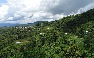
North Lungpher is a village in Mizoram, India. North Lungpher is a medium size village located in Thingsulthliah RD Block of Saitual district, Mizoram, with about 200 families residing there.

<span class="mw-page-title-main">Bramhapuri</span> Town in Maharashtra, India

Bramhapuri is a town and municipal council in Chandrapur district in the state of Maharashtra, India.

<span class="mw-page-title-main">Baragounia</span> Village in Odisha, India

Baragounia is a small village located in Bantala Tehsil of Angul district, Odisha, India, with a population of 2,310.

Kamargoria is a village in Raina II CD Block in Bardhaman Sadar South subdivision of Purba Bardhaman district in the Indian state of West Bengal.

<span class="mw-page-title-main">Phullen</span> Place in Mizoram, India

Phullen is a town in Saitual district, in the Indian state of Mizoram. As per the Constitution of India and Panchayati Raj Act, Phullen is administrated by a Village Council who are the elected representatives of the village. It is located 125 kilometres (78 mi) east of the State Capital Aizawl, which is also the capital of Mizoram. Phullen is a Block headquarters of Phullen Block, which is bounded by Darlawn Block towards west, Ngopa Block towards East, Thingsulthliah Block toward south, and Aizawl district in the north.

<span class="mw-page-title-main">Aizawl</span> Capital of Mizoram in India

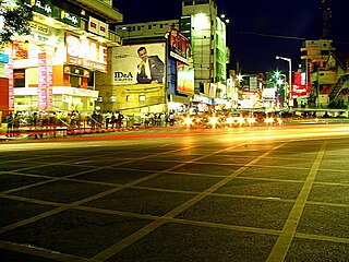
Aizawl is the capital of the state of Mizoram in India. Aizawl was officially established on 25 February 1890. With a population of 293,416, it is the largest city in the state. It is also the centre of administration containing all the important government offices, state assembly house and civil secretariat. The population of Aizawl strongly reflects the different communities of the ethnic Mizo people.

References

  1. 1 2 census2011.co.in
  2. "Vanbawng". censusindia.gov.in. Registrar General and Census Commissioner of India. Archived from the original on 14 April 2019. Retrieved 14 April 2019.
  3. "Mizo Hmeichhe insuihkhawm Pawl: Mizoram".
  4. "Vanbawng - the State Capital". Mizoram. Archived from the original on 7 October 2013. Retrieved 9 November 2012.
  5. "Station: Aizwal Climatological Table 1981–2010" (PDF). Climatological Normals 1981–2010. India Meteorological Department. January 2015. pp. 17–18. Archived from the original (PDF) on 5 February 2020. Retrieved 5 February 2020.
  6. "Vanbawng Climatological Table 1971–2000". India Meteorological Department. Retrieved 5 February 2020.