
Olympia Regional Airport is a public use airport located four nautical miles (7 km) south of the central business district of Olympia, a city in Thurston County and the capital of the U.S. state of Washington. It is owned by the Port of Olympia. It is about one mile (1.6 km) east of Interstate 5, actually within the boundaries of the city of Tumwater which is south of and adjacent to Olympia. The airport was identified in the Washington State Department of Transportation Long Term Aviation Study as a field that could potentially serve to relieve Seattle-Tacoma International Airport of increasing congestion.
Ryon Heliport is a private-use heliport located two miles north of the central business district of Pottsville, a city in Schuylkill County, Pennsylvania, United States. This heliport is privately owned by Richard F. Ryon.
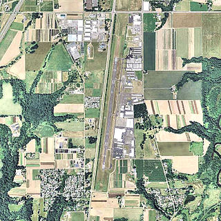
Aurora State Airport is a public airport located one mile (2 km) northwest of the central business district of Aurora, a city in Marion County, Oregon, United States. It is owned by the Oregon Department of Aviation.
Three Valleys Ranch Heliport is a private heliport located 21 miles north of Baker City in Baker County, Oregon, USA.
Beaverton Corporate Center Heliport is a former private heliport that was located 5 miles southeast of Beaverton in Washington County, Oregon, United States. The heliport is no longer in existence as of 2009, with the land it was on having been developed into mixed-use commercial property.
Horseman Heliport is a private heliport located 7 miles northwest of Bend in Deschutes County, Oregon, United States.
Mahlon Sweet Field Heliport is a private heliport located 7 miles northwest of Eugene in Lane County, Oregon, United States.
Southern Oregon General Hospital Heliport is a private heliport located north of Grants Pass in Josephine County, Oregon, United States.
Round Butte Heliport is a private heliport located 4 miles northwest of Metolius in Jefferson County, Oregon, USA.
Holy Rosary Medical Center Heliport is a private heliport located north of Ontario in Malheur County, Oregon, United States.
Rose Garden Heliport is a private heliport located in inner northeast Portland, Multnomah County, Oregon, United States.
Cruse Memorial Heliport is a private heliport located 1 mile northeast of Reedsport in Douglas County, Oregon, United States.
Douglas Community Hospital Heliport was a private heliport located one nautical mile (2 km) southeast of the central business district of Roseburg, in Douglas County, Oregon, United States. It was privately owned by Douglas Community Hospital and had one helipad designated H1 with a 40 x 40 ft concrete surface.
South Hill Heliport is a private heliport located 5 miles (8.0 km) south of Salem in Marion County, Oregon, United States.

Rentschler Heliport is a private heliport for the exclusive use of Raytheon Technologies, located 2 miles southeast of East Hartford, Connecticut.
Creasy Airport is an airport located in unincorporated Galveston County, Texas, United States. The airport is located southwest of Santa Fe and west of Hitchcock.
Camp Edwards Heliport is a private use heliport located at Camp Edwards, a U.S. Army facility in Barnstable County, Massachusetts, United States. The airport is located three nautical miles (6 km) north of the central business district of Bourne, Massachusetts. It is owned by the Massachusetts Army National Guard.
Sabre Army Heliport is a military use heliport located at Fort Campbell, seven nautical miles (13 km) northwest of the central business district of Clarksville, in Montgomery County, Tennessee, United States. Owned by the United States Army, it has one runway designated 4/22 with a concrete surface measuring 4,451 by 109 feet.
Haverstraw Heliport is a privately owned, public use heliport located one nautical mile (2 km) east of Haverstraw, a village in the Town of Haverstraw, Rockland County, New York, United States.
DeSoto Heliport is a city-owned public heliport in DeSoto, Dallas County, Texas, United States, located 3 nautical miles (5.6 km) north of the central business district. The heliport has no IATA or ICAO designation.
