
Erode District is a district in the Kongu Nadu region of the state of Tamil Nadu, India. It was the largest district by area in the state before the formation of Tirupur District. The headquarters of the district is Erode. It is divided into two revenue divisions, Erode and Gobichettipalayam, and is further subdivided into 10 taluks. Periyar district was a part of Coimbatore District before its division into two on September 17, 1979 and was renamed as Erode District in 1996.It is consider to be a largest city by area in Tamilnadu covering above 8000 sq.km. As of 2011, the district had a population of 2,251,744 with a sex-ratio of 993 females for every 1,000 males, much above the national average of 929.
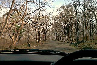
Sathyamangalam is a town and municipality in Erode district in the Indian state of Tamil Nadu. It lies on the banks of river Bhavani, a tributary of River Cauvery in the foothills of the Western Ghats. It is about 65 km from Erode ,55 km from Tiruppur and 70 km from Coimbatore. As of 2011, the town had a population of 57,814.

Bhavani is a major river in Kongu Nadu region of Tamil Nadu, India. It's a major tributary of the Kaveri River.

Bannari is a small village located at a distance of 12 km from Sathyamangalam town and 35 km from Gobichettipalayam town in Erode District and 82 km from Coimbatore city on Coimbatore-Bangalore NH 209 and it is close to Tamil Nadu and Karnataka border (20 km).

State Highway 15 (SH-15) is a State Highway maintained by the Highways Department of Government of Tamil Nadu. It connects Erode with Udagamandalam (Ooty) in the western part of Tamil Nadu.

Savandapur is a panchayat in Gobichettipalayam taluk in Erode District of Tamil Nadu state, India. It is about 10 km from Gobichettipalayam and 35 km from district headquarters Erode.
Tamil Nadu State Highway 81(SH-81) is a State Highway maintained by the Highways Department of Government of Tamil Nadu. It connects Gobichettipalayam with Dharapuram in the western part of Tamil Nadu.

Pudukkaraipudur is a panchayat in Gobichettipalayam taluk in Erode District of Tamil Nadu state, India. It is about 5 km from Gobichettipalayam and 35 km from district headquarters Erode. The village is located on the road connecting Gobichettipalayam with Anthiyur. Pudukkaraipudur has a population of about 1,473. The famous Pariyur Kondathu Kaliamman temple is about 2 km from Pudukkaraipudur. The other famous temples in and around are Karungaradu Murugan Temple, Arulmigu Suyambu Makaliamman Temple and Arulmigu Vayal Karuppsamy Temple.
Arakkankottai is a panchayat village in Gobichettipalayam taluk in Erode District of Tamil Nadu state, India. It is about 17 km from Gobichettipalayam and 52 km from district headquarters Erode. The village is located on the road connecting Gobichettipalayam with Sathyamangalam. Arakkankottai has a population of about 3690.
Chandrapuram is a panchayat village in Gobichettipalayam taluk in Erode District of Tamil Nadu state, India. It is about 10 km from Gobichettipalayam and 25 km from district headquarters Erode. The village is located on the road connecting Gobichettipalayam with Erode. Chandrapuram has a population of about 1597.
Gudakkarai is a panchayat village in Gobichettipalayam taluk in Erode District of Tamil Nadu state, India. It is about 28 km from Gobichettipalayam and 63 km from district headquarters Erode. The village is located on the road connecting Gobichettipalayam with Punjai Puliampatti. Gudakkarai has a population of about 3289.
Kanakampalayam is a panchayat village in Gobichettipalayam taluk in Erode District of Tamil Nadu state, India. It is about 10 km from Gobichettipalayam and 47 km from district headquarters Erode. The village is located on the road connecting Gobichettipalayam with Athani, Tamil Nadu. Kanakampalayam has a population of about 6209.
Kongarpalayam is a panchayat village in Gobichettipalayam taluk in Erode District of Tamil Nadu state, India. It is about 16 km from Gobichettipalayam and km from district headquarters Erode. The village is located on the road connecting Gobichettipalayam with Sathyamangalam via Vaniputhur. Kongarpalayam has a population of about 5346.
Kondayampalayam is a panchayat village in Gobichettipalayam taluk in Erode District of Tamil Nadu state, India. It is about 10 km from Gobichettipalayam and 48 km from district headquarters Erode. The village is located on the road connecting Gobichettipalayam with Athani, Tamil Nadu via Kallipatti. Kondayampalayam has a population of about 6988.
Kullampalayam is a panchayat village in Gobichettipalayam taluk in Erode District of Tamil Nadu state, India. It is about 1.2 km from Gobichettipalayam and 34 km from District Capital Erode. The village is located on the road connecting Gobichettipalayam with Erode. Kullampalayam has a population of about 2790.
Nanjai Gobi is a panchayat village in Gobichettipalayam taluk in Erode District of Tamil Nadu state, India. It is about 6 km from Gobichettipalayam and 36 km from district headquarters Erode. The village is located on the road connecting Gobichettipalayam with Athani, Tamil Nadu. Nanjai Gobi has a population of about 1589.
Olalakovil is a panchayat village in the Gobichettipalayam taluk, in Erode District of Tamil Nadu state, India. It is about 33 km from Gobichettipalayam and 70 km from the district headquarters, Erode. Olalakovil is located on the road connecting Gobichettipalayam with Avinashi. Olalakovil has a population of about 4,805.
Perundalaiyur is a panchayat village in Gobichettipalayam taluk in Erode District of Tamil Nadu state, India. It is about 17 km from Gobichettipalayam and 27 km from district headquarters Erode. The village is located on the road connecting Gobichettipalayam with Bhavani. Perundalaiyur has a population of about 3410.
Punjaithuraiyampalayam is a panchayat village in Gobichettipalayam taluk in Erode District of Tamil Nadu state, India. It is about 11 km from Gobichettipalayam and 46 km from district headquarters Erode. The village is located on the road connecting Gobichettipalayam with Sathyamangalam via Vaniputhur. Punjaithuraiyampalayam has a population of about 8312.


