Ventura Intercity Service Transit Authority

Last updated
VCTC Intercity
Parent Ventura County Transportation Commission
Founded 1994
Headquarters 950 County Square Dr, Ventura, California
Service area Ventura County, California
Service type Bus service, paratransit
Operator Roadrunner Shuttle
Chief executive Darren Kettle
Website VCTC Intercity

VCTC Intercity (formerly known as Ventura Intercity Service Transit Authority or VISTA [1] ) is a public transit agency providing bus service in Ventura County, California. It provides an intercity bus service between the cities of Ventura, Oxnard, Camarillo, Thousand Oaks, Moorpark, Santa Paula, and Fillmore in Ventura County, and to communities in neighboring Los Angeles and Santa Barbara counties. The agency is part of the Ventura County Transportation Commission, a governmental body that oversees transportation planning and funding in Ventura County.

Ventura County, California County in California, United States

Ventura County is a county in the southern part of the U.S. state of California. As of the 2010 census, the population was 823,318. The largest city is Oxnard, and the county seat is the city of Ventura.

California State of the United States of America

California is a state in the Pacific Region of the United States. With 39.6 million residents, California is the most populous U.S. state and the third-largest by area. The state capital is Sacramento. The Greater Los Angeles Area and the San Francisco Bay Area are the nation's second and fifth most populous urban regions, with 18.7 million and 9.7 million residents respectively. Los Angeles is California's most populous city, and the country's second most populous, after New York City. California also has the nation's most populous county, Los Angeles County, and its largest county by area, San Bernardino County. The City and County of San Francisco is both the country's second-most densely populated major city after New York City and the fifth-most densely populated county, behind only four of the five New York City boroughs.

Intercity bus service bus moving across the roads between towns and cities

An intercity bus service or intercity coach service, also called a long-distance, express, over-the-road, commercial, long-haul, or highway bus or coach service, is a public transport service using coaches to carry passengers significant distances between different cities, towns, or other populated areas. Unlike a transit bus service, which has frequent stops throughout a city or town, an intercity bus service generally has a single stop at one location in or near a city, and travels long distances without stopping at all. Intercity bus services may be operated by government agencies or private industry, for profit and not for profit. Intercity coach travel can serve areas or countries with no train services, or may be set up to compete with trains by providing a more flexible or cheaper alternative.

Contents

History

Before VISTA was formed in 1994, the County of Ventura provided rudimentary intercity bus service. One line ran along US 101 with stops in Ventura, Oxnard, Camarillo, Thousand Oaks, and Westlake Village. Another service linked Thousand Oaks and Moorpark via SR 23. The city of Fillmore sponsored a route consisting of a few trips between Fillmore and Ventura along SR 126. Because of the limited nature of these services, the Ventura County Transportation Commission proposed a comprehensive intercity bus system. [2]

Ventura, California City in California, United States

Ventura, officially the City of San Buenaventura, is the county seat of Ventura County, California, United States. The coastal site, set against undeveloped hills and flanked by two free-flowing rivers, has been inhabited for thousands of years. European explorers encountered a Chumash village, referred to as Shisholop, here while traveling along the Pacific coast. They witnessed the ocean navigation skill of the native people and their use of the abundant local resources from sea and land. The eponymous Mission San Buenaventura was founded nearby in 1782 where it benefitted from the water of the Ventura River. The town grew around the mission compound and incorporated in 1866. The development of nearby oil fields in the 1920s and the age of automobile travel created a major real estate boom during which many designated landmark buildings were constructed. The mission and these buildings are at the center of a downtown that has become a cultural, retail, and residential district and visitor destination.

Oxnard, California City in California, United States

Oxnard is a city in Ventura County, California, United States. Located along the coast of Southern California, it is the most populous city in Ventura County and the 19th most populous city in California. Incorporated in 1903, the city lies approximately 60 miles (97 km) west of downtown Los Angeles and is part of the larger Greater Los Angeles area.

Camarillo, California City in California, United States

Camarillo is a city in Ventura County in the U.S. state of California. As of the 2010 United States Census, the population was 65,201, an increase of 8,117 from the 57,084 counted in the 2000 Census. The Ventura Freeway is the city's primary thoroughfare. Camarillo is named for Adolfo and Juan Camarillo, two of the few Californios to preserve the city's heritage after the arrival of Anglo settlers. The railroad coast route came through in 1898 and built a station here. Adolfo Camarillo eventually employed 700 workers growing mainly lima beans. Walnuts and citrus were also grown on the ranch. Adolfo bred Camarillo White Horses in the 1920s through the 1960s and was well known for riding them, dressed in colorful Spanish attire, in parades such as the Fiesta of Santa Barbara.

Service on four core lines (Highway 101, East County, Highway 126, and a Central County route serving Camarillo, Camarillo State Mental Hospital, Point Mugu, and Oxnard) started in July 1994. [2] Over time, these routes have been adjusted according to ridership. With the closing of Camarillo State Hospital and the repurposing of the hospital grounds as a California State University campus, the Central route was cancelled and two new campus shuttle routes were implemented. In 1998, service was extended to Warner Center in Los Angeles County, and in 2001, service was extended to Santa Barbara.

Camarillo State Mental Hospital was a psychiatric hospital for both developmentally disabled and mentally ill patients in Camarillo, California. The hospital closed in 1997. The site has been redeveloped as the California State University, Channel Islands. The university has retained the distinctive Mission Revival Style architecture, and the bell tower in the South quad has been adopted as the symbol of the university.

Point Mugu, California Unincorporated community in California, United States

Point Mugu, California is a cape or promontory within Point Mugu State Park on the Pacific Coast in Ventura County, near the city of Port Hueneme and the city of Oxnard. The park has 5 miles (8 km) of shoreline and more than 70 miles (110 km) of hiking trails. The name is believed to be derived from the Chumash Indian term "Muwu", meaning "beach", which was first mentioned by Cabrillo in his journals in 1542. It is also a name applied to the nearby NAS Point Mugu, a test range facility known by various names over the years, including Pacific Missile Test Center and Naval Air Missile Test Center.

Santa Barbara, California City in California, United States

Santa Barbara is the county seat of Santa Barbara County in the U.S. state of California. Situated on a south-facing section of coastline, the longest such section on the West Coast of the United States, the city lies between the steeply rising Santa Ynez Mountains and the Pacific Ocean. Santa Barbara's climate is often described as Mediterranean, and the city has been promoted as the "American Riviera". As of 2014, the city had an estimated population of 91,196, up from 88,410 in 2010, making it the second most populous city in the county after Santa Maria. The contiguous urban area, which includes the cities of Goleta and Carpinteria, along with the unincorporated regions of Isla Vista, Montecito, Mission Canyon, Hope Ranch, Summerland, and others, has an approximate population of 220,000. The population of the entire county in 2010 was 423,895.

In early 2015, VCTC changed the name of the service from VISTA to VCTC Intercity. [1]

The VCTC Intercity bus service is operated by Roadrunner Shuttle, a private company based in Camarillo which contracts with VCTC. [3] Due to the length of the VISTA routes, over-the-road coaches are used. [4]

Routes

Intercity

Highway 101

Provides service along the length of US 101 in Ventura County, originating at the Pacific View Mall, and stopping at various places in Oxnard, Camarillo, and Thousand Oaks.

U.S. Route 101 (US 101) in the state of California is one of the last remaining and longest U.S. Routes still active in the state, and the longest highway of any kind in California. US 101 was also one of the original national routes established in 1926. Significant portions of US 101 between the Los Angeles area and the San Francisco Bay Area follow El Camino Real, the historic road connecting the former Alta California's 21 missions.

Pacific View Mall

Pacific View Mall is a regional, enclosed mall located on the West Coast in Ventura, California. It is the largest shopping center in Ventura County, and covers a leasable area of almost 1,000,000 sq ft (93,000 m2). It was aptly renamed for its nearby view of the Pacific Ocean, overlooking Pierpont Bay.

Highway 126

This route also originates at the Pacific View Mall in Ventura and operates along SR 126 to Saticoy, Santa Paula, and Fillmore, with limited service to Piru.

East County

VISTA East County route operates in the SR 23 corridor between Westlake Village, Thousand Oaks, Moorpark, and Simi Valley.

Conejo Connection

Four round trips, two in the morning and two in the afternoon, connect Oxnard, Camarillo, and Thousand Oaks with the Warner Center Transit Hub and other stops at Warner Center, a business and residential complex in the western San Fernando Valley, in Los Angeles County. At the transit hub, riders may connect with the Metro Orange Line and other transit services from a variety of agencies, providing access to many points in Los Angeles County.

Coastal Express

This route connects Ventura with Carpinteria and Santa Barbara. Peak hour trips also serve Goleta and the University of California, Santa Barbara.

CSUCI Camarillo and CSUCI Oxnard

Originally two separate lines, this shuttle route connects California State University, Channel Islands with the Camarillo Metrolink Station and the Oxnard "C" Street Transfer Center. Students are encouraged to park in the lots and use this bus to get to campus.

Dial-a-ride services

VISTA operates dial-a-ride service (on demand for those meeting certain requirements) in Santa Paula, Fillmore, and Piru. [5]

Former logos

Vista1 logo.png

Related Research Articles

Fillmore, California City in California, United States

Fillmore is a small city in Ventura County, California, United States in the Santa Clara River Valley. In an agricultural area with rich, fertile soil, Fillmore has a historic downtown that was established when the Southern Pacific built the railroad through the valley in 1887. The rail line also provided a name for the town: J. A. Fillmore was a general superintendent for the company's Pacific system. The population was 15,002 at the 2010 census, up from 13,643 at the 2000 census.

Ventura Freeway freeway in Southern California

The Ventura Freeway is a freeway in southern California, United States, running from the Santa Barbara/Ventura county line to Pasadena in Los Angeles County. It is the principal east-west route through Ventura County and in the southern San Fernando Valley in Los Angeles County. From the Santa Barbara County line to its intersection with the Hollywood Freeway in the southeastern San Fernando Valley in Los Angeles, it is signed as U.S. Route 101, which was built in the late 1950s and opened on April 5, 1960. East of the Hollywood Freeway intersection, it is signed as State Route 134 which was built by 1971. The entire Ventura Freeway is not built to freeway standards, however; the segment that runs through the coastal communities of La Conchita and Mussel Shoals in western Ventura County still remains an expressway.

Ventura County Line Commuter rail line linking Downtown Los Angeles to Ventura County and San Fernando Valley in Los Angeles County (Metrolink system)

The Metrolink Ventura County Line is a commuter rail line serving Ventura County and the San Fernando Valley in Los Angeles County and the City of Los Angeles, in the Southern California system. The line is the successor of the short lived CalTrain commuter rail line.
Santa Clara River Valley valley in Ventura County, California, USA

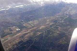
The Santa Clara River Valley is a rural, mainly agricultural valley in Ventura County, California that has been given the moniker Heritage Valley by the namesake tourism bureau. The valley includes the communities of Santa Paula, Fillmore, Piru and the national historic landmark of Rancho Camulos. Named for the Santa Clara River, which winds through the valley before emptying into the Pacific Ocean between the cities of Ventura and Oxnard, the tourist bureau describes it as ".... Southern California's last pristine agricultural valley nestled along the banks of the free-flowing Santa Clara River."

Area codes 805 and 820 area codes in the United States

Area codes 805 and 820 are California telephone area codes that were originally split from area code 213 in 1957. They include most or all of the California counties of San Luis Obispo, Santa Barbara, Ventura, plus southernmost portions of Monterey County.

California State Route 126 highway in California

State Route 126 is a highway in Ventura and Los Angeles counties, California. The route runs from U.S. Route 101 in Ventura to Interstate 5 in Santa Clarita through the Santa Clara River Valley. The highway is an important connector highway in Ventura County, and serves as an alternate route into the Santa Clarita and San Fernando valleys, the High Desert of Antelope Valley, and Los Angeles.
California State Route 23 highway in California

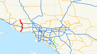
State Route 23 is a state highway which runs roughly from Fillmore to Malibu.

Fillmore and Western Railway heritage railroad in Ventura County, California, USA

The Fillmore and Western Railway is a railroad owned by the Fillmore and Western Railway Company. The company operates on track owned by the Ventura County Transportation Commission. The majority of F&W rolling stock was acquired from three major studios: 20th Century Fox, Paramount, Warner Bros, and MGM. The rolling stock and right-of-way are frequently used for the filming of television series, motion pictures and commercials and as a locale for private and commercial still photography, Visitors to Fillmore often see filming activity as well as sets and support equipment at the company's rail yard and along the tracks between Santa Paula and Piru.

The Santa Barbara Pastoral Region is a pastoral region of the Archdiocese of Los Angeles in the Roman Catholic Church. It covers Santa Barbara and Ventura counties in the state of California, USA. The region has 37 parishes, 6 high schools, 18 elementary schools, 4 hospitals, and 4 Spanish Missions. The current Episcopal Vicar for the region is Bishop Robert E. Barron.

Coast Line (UP) railroad line in California along the Pacific coast

The Coast Line is a railroad line between Burbank, California and the San Francisco Bay Area, roughly along the Pacific Coast. It is the shortest rail route from Los Angeles to the Bay Area.

Oxnard Plain Over 200-square-mile alluvial coastal plain in southwest Ventura County, California, United States

The Oxnard Plain is a large coastal plain in southwest Ventura County, California, United States surrounded by the mountains of the Transverse ranges. The cities of Oxnard, Camarillo, Port Hueneme and much of Ventura as well as the unincorporated communities of Hollywood Beach, El Rio, Saticoy, Silver Strand Beach, and Somis lie within the over 200-square-mile alluvial plain (520 km2). The population within the plain comprises a majority of the western half of the Oxnard-Thousand Oaks-Ventura Metro Area and includes the largest city along the Central Coast of California. The 16.5-mile-long coastline (26.6 km) is among the longest stretches of continuous, linear beaches in the state.
Oxnard Transit Center Passenger rail and bus station in historic downtown Oxnard, California

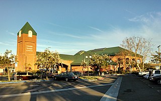
The Oxnard Transit Center, originally known as the Oxnard Transportation Center, is an intermodal transit center in historic downtown Oxnard, California. As a transit hub, the station serves Amtrak and Metrolink trains as well as local and regional buses. Amtrak's Pacific Surfliner from San Luis Obispo to San Diego, Amtrak's Coast Starlight from Los Angeles to Seattle, Washington, and Metrolink's Ventura County Line from Los Angeles Union Station to East Ventura stop here. Ten Pacific Surfliner trains serve the station daily, and six Metrolink trains serve the station each weekday. The Coast Starlight operates one train daily in each direction.

Gold Coast Transit District, formerly known as South Coast Area Transit (SCAT), is a local bus operator in western Ventura County, California, serving Ventura, Oxnard, Port Hueneme, Ojai, and the adjoining areas of unincorporated Ventura County.
Ventura County Council

Ventura County Council of the Boy Scouts of America was officially chartered as Council 57 on June 23, 1921, after a series of meetings that followed a proposal put forward at a County Chamber of Commerce meeting on March 28, 1921, in the Masonic Hall. Mr. C. H. Whipple, then of Moorpark and later Oxnard, became the president; and Col. J.L. Howland became commissioner. Harvey R. Cheesman, an assistant scout executive in the Los Angeles Council, became the first Scout Executive, assuming his duties on July 11).

The Ventura County Transportation Commission (VCTC) is the public sector transportation planning body for Ventura County, California. The VCTC oversees highway, bus, aviation, rail and bicycle activity and controls the use of government funds for transportation projects. The commission was created by state legislation in 1988 and began operation in 1989, when it assumed the transportation responsibilities of the Ventura County Association of Governments.

The Ventura County Historic Landmarks & Points of Interest consist of buildings, sites, and neighborhoods designated by Ventura County, California, Cultural Heritage Board as historic landmarks and points of interest.

Calleguas Creek is the terminus of a river system in Ventura County, California. It drains the Calleguas Creek Watershed, an area 30 miles long and 14 miles wide, which includes Simi Valley, Moorpark, Camarillo and a large portion of Thousand Oaks. Tributaries include Arroyo Simi, Arroyo Santa Rosa, Revolon Slough and Arroyo Conejo. It discharges into the Pacific Ocean, the Santa Barbara Channel, at Mugu Lagoon on Naval Base Ventura County, just north of Point Mugu, where the Santa Monica Mountains meet the ocean, marking the southern/eastern boundary of the Oxnard Plain.

References

  1. 1 2 Harris, Mike (December 5, 2014). "Transit agency previews new bus fleet". Ventura County Star. E.W. Scripps Company. Retrieved June 20, 2018.
  2. 1 2 Mosk, Matthew (November 24, 1993). "County OKs Bus Expansion to Link 8 Cities". Los Angeles Times (Ventura West ed.). p. 1. Retrieved June 20, 2018.
  3. Harris, Mike (July 25, 2014). "Camarillo company awarded $67 million bus contract". Ventura County Star. E.W. Scripps Company. Retrieved June 20, 2018.
  4. Wenzke, Marissa (November 14, 2014). "End of the road: Family business loses bus contract". Pacific Coast Business Times. Retrieved June 20, 2018.
  5. Martinez, Arlene (March 3, 2015). "Valley Express offering free bus rides today in Santa Paula, Fillmore, Piru". Ventura County Star. E.W. Scripps Company.

General references

See also