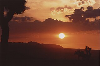
San Bernardino County, officially the County of San Bernardino, is a county located in the southern portion of the U.S. state of California, and is located within the Inland Empire area. As of the 2020 U.S. Census, the population was 2,181,654, making it the fifth-most populous county in California and the 14th-most populous in the United States. The county seat is San Bernardino.

Yucca Valley is an incorporated town in San Bernardino County, California, United States. The population was 20,700 as of the 2010 census. Yucca Valley lies 17 miles (27 km) west of Twentynine Palms, 27 miles (43 km) north of Palm Springs, 62 miles (100 km) south of Barstow via State Route 247 and 55 miles (89 km) east of San Bernardino.

Twentynine Palms is a city in San Bernardino County, California. Twentynine Palms serves as one of the entry points to Joshua Tree National Park.

The Coachella Valley is an arid rift valley in the Colorado Desert of Southern California's Riverside County. The valley may also be referred to as Greater Palm Springs due to the prominence of the city of Palm Springs. The valley extends approximately 45 mi (72 km) southeast from the San Gorgonio Pass to the northern shore of the Salton Sea and the neighboring Imperial Valley, and is approximately 15 mi (24 km) wide along most of its length. It is bounded on the northeast by the San Bernardino and Little San Bernardino Mountains, and on the southwest by the San Jacinto and Santa Rosa Mountains.

Area code 760 is a California telephone area code that was split from area code 619 on March 22, 1997. Area code 442 is an overlay of 760 that became effective on November 21, 2009. It encompasses much of the southeastern and southernmost portions of California. The area includes Imperial, Inyo, and Mono counties, as well as portions of San Diego, Riverside, San Bernardino, Los Angeles and Kern counties.

State Route 247 is a state highway in the U.S. state of California. The road passes through the Mojave Desert in San Bernardino County, connecting SR 62 in Yucca Valley to Interstate 15 (I-15) in Barstow. SR 247 was designated by the California State Legislature in 1969; the county roads along that route were given to the state in 1972.

The San Bernardino Valley is a valley in Southern California located at the south base of the Transverse Ranges. It is bordered on the north by the eastern San Gabriel Mountains and the San Bernardino Mountains; on the east by the San Jacinto Mountains; on the south by the Temescal Mountains and Santa Ana Mountains; and on the west by the Pomona Valley. Elevation varies from 590 feet (180 m) on valley floors near Chino to 1,380 feet (420 m) near San Bernardino and Redlands. The valley floor is home to over 80% of the more than 4 million people of the Inland Empire region.

State Route 62 is a state highway in the U.S. state of California that cuts across the Little San Bernardino Mountains in Riverside and San Bernardino counties. It runs from Interstate 10 near White Water to the Arizona state line, passing through the city of Twentynine Palms and along the northern boundary of the Joshua Tree National Park.

Landers is an unincorporated community in the High Desert region of the Mojave Desert, in San Bernardino County, Southern California. Landers' population, as of 2017, is 2,982 people. Its residents are sometimes referred to as "Landroids"—an allusion to the popular UFO culture in the area—and its official slogan is "Beautiful Skies, Miles of Smiles," adopted pursuant to a contest held by the Landers Association in early 2014. It was submitted by Ms. McCall's 3rd and 4th grade class at Landers Elementary School and was unveiled on June 10, 2014. However, for almost half a century, Landers has been known to its residents as "the land of 1000 vistas".

The Morongo Basin is an endorheic basin and valley region located in eastern San Bernardino County, in Southern California.

The Morongo Unified School District (MUSD) is a public education governing body in the Mojave high desert of Southern California. MUSD has more than 1,100 employees who provide educational services to 9,301 students.

High Desert is a vernacular region with non-discrete boundaries applying to areas of the western Mojave Desert in southern California. The "High Desert" region is an area that generally is situated between 2,000 feet (610 m) and 4,000 feet (1,200 m) in elevation, and located just north of the San Gabriel, San Bernardino, and Little San Bernardino Mountains.
Mountain Transit is the third largest regional transit agency in San Bernardino County, California. Mountain Transit serves the San Bernardino Mountain communities of Crestline, Lake Arrowhead, Running Springs, and Big Bear Lake, providing local service for more than 163,000 passengers each year.

Victor Valley Transit Authority (VVTA), the second largest transit operator in San Bernardino County, is a transit agency providing bus service in the Victor Valley, California area. In 2021, the system had a ridership of 1,012,700.

San Bernardino Associated Governments was an association of the San Bernardino County local governments and the regional transportation planning agency Including also regional planning organization for the county, with policy makers consisting of mayors, councilmembers, and county supervisors. It was also the funding agency for the county's transit systems, which include Omnitrans, Victor Valley Transit Authority, Morongo Basin Transit Authority, Mountain Area Regional Transit Authority, Barstow Area Transport, and Needles Area Transit.

Many of the existing freeways in Southern California's Inland Empire were completed in the late 1970s. The only exception is the segment of the Foothill Freeway, State Route 210 between San Dimas and San Bernardino, completed in July 2007. In general, most of the higher paying jobs are located in Los Angeles and Orange County. Thus, workers must commute daily up to two hours in each direction on the existing network. As the population increases, traffic congestion is also projected to increase. In 2007, Forbes magazine ranked the area first in its list of America's most unhealthy commutes, beating every other major metropolitan area in the country, as Inland area drivers breathe the unhealthiest air and have the highest rate of fatal auto accidents per capita.

The Desert Star Weekly is a community newspaper covering local news, government, arts and entertainment in the Palm Springs area of California.
The San Bernardino County Transportation Authority (SBCTA) is the successor to San Bernardino Associated Governments which is responsible for administering the Measure I half-cent tax which San Bernardino County voters passed most recently in 2004. SBCTA conducts transportation planning, construction, and operation in San Bernardino County, California. SBCTA is a joint powers authority comprising all the cities in the county and the county itself. Every city and county supervisor is provided one seat on the board and it also includes a nonvoting member from Caltrans District 8.

Wonder Valley is a sparsely populated unincorporated community in the Morongo Basin of Southern California's High Desert region, straddling Amboy Road and State Route 62 in San Bernardino County, California, United States, approximately 10 miles (16 km) east of the city of Twentynine Palms.


