
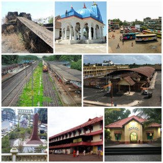
Kasaragod is a municipal town and administrative headquarters of Kasaragod district in the state of Kerala, India. Established in 1966, Kasaragod was the first municipal town in the district. It is the northernmost district of Kerala and is also known as Sapta Bhasha Sangama Bhumi.
Kanhangad is a major town, located in the Kasaragod District, state of Kerala, India.
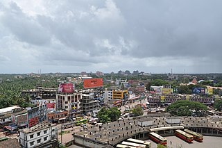
Kannur, formerly known in English as Cannanore, is a city and a municipal corporation in the state of Kerala, India. It is the administrative headquarters of the Kannur district and situated 274 kilometres (170 mi) north of the major port city and commercial hub Kochi and 137 kilometres (85 mi) south of the major port city and a commercial hub, Mangalore. During the period of British colonial rule in India, when Kannur was a part of the Malabar District, the city was known as Cannanore. Kannur is the fifth largest urban agglomeration in Kerala. As of 2011 census, Kannur Municipal Corporation, the local body which administers mainland area of city, had a population of 232,486.
Nileshwaram or Nileshwar or Neeleswaram is a municipality and a major town in Kasaragod District, state of Kerala, India. It is one of the three municipalities in Kasaragod district; the others are Kasaragod and Kanhangad. Nileshwaram is located on the estuary of Kavvayi Backwaters and Neeleshwaram River. Nileshwaram is referred to as the cultural capital of Kasaragod, the northernmost district of Kerala. "The first Chief Minister of Kerala and communist leader E. M. S. Namboodiripad had contested elections to the Assembly from the Neeleswaram segment."

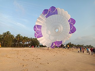
Bekal is a small town in the Kasaragod district on the West coast of the state of Kerala, India.
Talapady is a village near Mangaluru city in Ullal taluk of Dakshina Kannada district of Karnataka state in India. Talapady borders the states of Karnataka and Kerala. National Highway 66 passes through Talapady which is 14 km (9 mi) south of Mangalore city. The Karnataka-Kerala checkpost border is situated at Talapady. Another village Thalapady, Kasargod which is situated near Talapady in Manjeswar crossing Kerala border.

Uppala is a town and Headquarters of Manjeshwaram Taluk in Kasaragod district, Kerala, India. It is geographically located midway from Kasaragod to Mangalore. Easy geographical access and lack of major towns nearby are the key reasons for the town to develop exponentially, especially in the past decade. The population of Manjeshwaram Taluk alone was over 268,642 as of 2011. Uppala is 22 km north of Kasaragod and one of the fastest growing urban settlements in Kasaragod district. It is well known as an important trade hub in the northernmost part of Kerala state.

Kasaragod (Malayalam:[kaːsɐrɡoːɖɨ̆] is one of the 14 districts in the southern Indian state of Kerala. Its northern border Thalappady is located just 9 km south to Ullal, which is the southernmost portion of the major port city Mangalore, on the southwestern Malabar coast of India.

Cherupuzha is a town in Kannur district, Kerala, India. It is the headquarters of the Cherupuzha Panchayat which is a special grade panchayat in Kerala.
Kuttikole is a village and Gram Panchayat in the Kasaragod district in the Indian state of Kerala.

Badiyadka officially known as "Badiadka" is a town and gram panchayat in the Kasaragod district, state of Kerala, India.
Bayar is a village in Kasaragod district in the state of Kerala, India. Bayar is 12 km (7.5 mi) far from the Uppala town.
Periya is a small township in Kasaragod District, Kerala State, India.
Pallikkara is a census town and a grama panchayat in Hosdurg Taluk of Kasargod district in the state of Kerala, India. This place was once famous for its Tobacco plants until the late 1980s and the Historical landmark Bekal Fort lies in this Village. A beach park near to the fort also attracts tourists to this place.

Perla is an administrative capital of Enmakaje Panchayat, which is in Kasaragod district, Kerala, India.
Deenar Nagar is a small town in Kasaragod district, Kerala, India. Deenar Nagar is located about 3 km inwards to Bandiyod, a small town between Kasaragod and Mangalore. It is around 19.7 km north to the Kasaragod town and 39 km south to Mangalore.

Dharmashala is a small town and headquarters of the Anthoor Municipality in Kannur district of the North Malabar region in the Indian state of Kerala. It is located near National Highway 66 between Kannur and Taliparamba. It is located about 16 kilometres (9.9 mi) north of Kannur. Dharmashala is an important educational and industrial hub in the Kannur district and also an important tourism destination of Malabar region. Dharmashala is a major government officials settlement area in Kannur. A large number of migrant labourers from various other states are working in the industrial development area in Dharmashala. Students from various parts of country study at institutes such as NIFT. Nearby important institutions and attractions are the Kerala Armed Police (KAP) 4th Battalion Mangattuparamba, Government College of Engineering Kannur, Kannur University, KELTRON, Vismaya water theme park, Parassinikkadavu Shree Muthappan temple, Doordarshan kendra, Parassinikkadavu Snake Park, Industrial Development Plot, Central School, EK Nayanar memorial women and child hospital, Si-met college of nursing, M.V.R memorial Ayurveda Medical College, Institute of Co-operative Management (ICM), National Institute of Fashion Technology, Vellikkeel eco tourism park, Hi-Five sports indoor stadium, Kerala Clays and Ceramics Ltd. etc.

Mulleria is a small town located in Karadka Panchayath, Kasaragod district in Kerala, India.
Adoor is a village in Kasaragod district in the Indian state of Kerala. Adoor is located 38 km east of Kasaragod town and 7 km away from State Highway 55 or Cherkala-Jalsoor road.
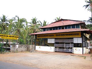
Kallar is a village in Kasaragod district in the Indian state of Kerala. Kallar is located on Kanhangad-Panathur road of 40 km south east of Kasaragod town and 27 km north east of Kanhangad.
