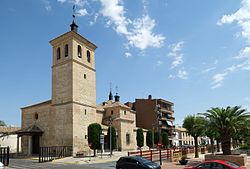
Villaluenga de la Sagra | |
|---|---|
 | |
 Coat of arms | |
 Villaluenga de la Sagra Location in Spain | |
| Coordinates: 40°1′49″N3°54′37″W / 40.03028°N 3.91028°W | |
| Country | |
| Autonomous community | Castile-La Mancha |
| Province | Toledo |
| Municipality | Villaluenga de la Sagra |
| Area | |
• Total | 27 km2 (10 sq mi) |
| Elevation | 520 m (1,710 ft) |
| Population (2024-01-01) [1] | |
• Total | 4,171 |
| • Density | 150/km2 (400/sq mi) |
| Time zone | UTC+1 (CET) |
| • Summer (DST) | UTC+2 (CEST) |
Villaluenga de la Sagra is a municipality located in the province of Toledo, Castile-La Mancha, Spain. According to the 2006 census (INE), the municipality had a population of 3,216 inhabitants.