
The arrondissement of Cholet is an arrondissement of France in the Maine-et-Loire department in the Pays de la Loire region. It has 32 communes. Its population is 224,581 (2016), and its area is 2,102.5 km2 (811.8 sq mi).
The following is a list of the 21 cantons of the Maine-et-Loire department, in France, following the French canton reorganisation which came into effect in March 2015:
Canton of Beaupréau-en-Mauges is a canton of France, located in the Maine-et-Loire department, in the Pays de la Loire region. At the French canton reorganisation which came into effect in March 2015, the canton was expanded from 12 to 22 communes :

Beaupréau is a former commune in the Maine-et-Loire department in western France.
Andrezé is a former commune in the Maine-et-Loire department in western France.
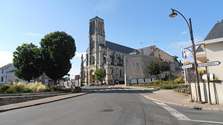
La Boissière-sur-Èvre is a former commune in the Maine-et-Loire department in western France.
La Chapelle-du-Genêt is a former commune in the Maine-et-Loire department of western France.
Chaudron-en-Mauges is a former commune in the Maine-et-Loire department of western France.

Gesté is a former commune in the Maine-et-Loire department in western France.
Jallais is a former commune in the Maine-et-Loire department in western France.
La Jubaudière is a former commune in the Maine-et-Loire department in western France.
Le Pin-en-Mauges is a former commune in the Maine-et-Loire department in western France.
La Poitevinière is a former commune in the Maine-et-Loire department in western France.
Saint-Philbert-en-Mauges is a former commune in the Maine-et-Loire department in western France. Its population was 400 in 2019.
Saint-Quentin-en-Mauges is a former commune in the Maine-et-Loire department in western France.

Saint-Rémy-en-Mauges is a former commune in the Maine-et-Loire department in western France.

The Èvre is a 91.8 km (57.0 mi) long river in western France, left tributary of the Loire. Its source is at Vezins, 1.5 km (0.93 mi) northeast of the village. It flows into the Loire at Le Marillais, 3 km (1.9 mi) east of the village.

Beaupréau-en-Mauges is a commune in the Maine-et-Loire department in western France.
Mauges-sur-Loire is a commune in the Maine-et-Loire department of western France. La Pommeraye is the municipal seat.
Mauges Communauté is a Communauté d'agglomération, an intercommunal structure, in the Maine-et-Loire department, in the Pays de la Loire region, western France. It was created in January 2016. Its seat is in Beaupréau-en-Mauges. Its area is 1314.6 km2. Its population was 120,590 in 2017.


