
Interstate 64 (I-64) is an east–west Interstate Highway in the Eastern United States. Its western terminus is at I-70, U.S. Route 40 (US 40), and US 61 in Wentzville, Missouri. Its eastern terminus is at the Bowers Hill Interchange with I-264 and I-664 at Bower's Hill in Chesapeake, Virginia. I-64 connects Greater St. Louis, the Louisville metropolitan area, the Lexington–Fayette metropolitan area, the Charleston metropolitan area, the Greater Richmond Region, and Hampton Roads.
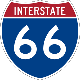
Interstate 66 (I-66) is a 76.32 mile east–west Interstate Highway in the eastern United States. The highway runs from an interchange with I-81 near Middletown, Virginia, on its western end to an interchange with U.S. Route 29 (US 29) in Washington, D.C., at the eastern terminus. The route parallels State Route 55 (SR 55) from its western terminus at I-81 to Gainesville, and US 29 from Gainesville to its eastern terminus in Washington. I-66 has no physical or historical connection to US 66, which was located in a different region of the United States.

U.S. Route 11 or U.S. Highway 11 (US 11) is a major north–south United States Numbered Highway extending 1,645 miles (2,647 km) across the eastern U.S. The southern terminus of the route is at US 90 in Bayou Sauvage National Wildlife Refuge in eastern New Orleans, Louisiana. The northern terminus is at the Rouses Point–Lacolle 223 Border Crossing in Rouses Point, New York. The route continues across the border into Canada as Route 223. US 11, created in 1926, maintains most of its original route. The route north of Knoxville, Tennessee, follows a route similar to Interstate 81 (I-81). While it is signed as a north–south route, it physically travels in a northeast–southwest direction.

U.S. Route 35 (US 35) is a United States Highway that runs southeast-northwest for approximately 412 miles (663 km) from the western suburbs of Charleston, West Virginia to northern Indiana. Although the highway is physically southeast-northwest, it is nominally north–south. The highway's southern terminus is in Teays Valley, West Virginia, near Scott Depot, at Interstate 64 (I-64). Its northern terminus is near Michigan City, Indiana, at US 20. The West Virginia portion of the highway is mostly expressway, becoming a freeway shortly before it crosses the Ohio River into Ohio. The Ohio portion has been upgraded to a four-lane highway/freeway between the West Virginia state line and Trotwood, west of Dayton.

U.S. Route 522 is a spur route of US 22 in the states of Virginia, West Virginia, Maryland, and Pennsylvania. The U.S. Highway travels in a north-south direction, and runs 308.59 miles (496.63 km) from US 60 near Powhatan, Virginia, to its northern terminus at US 11 and US 15 near Selinsgrove, Pennsylvania. US 522 serves many small cities and towns in the Piedmont, Blue Ridge Mountains, and northern Shenandoah Valley of Virginia. The highway serves the Virginia communities of Goochland, Mineral, Culpeper, the town of Washington, and Front Royal and the independent city of Winchester. US 522 then follows the Ridge-and-Valley Appalachians north and then east through the Eastern Panhandle of West Virginia, a 2-mile-wide (3.2 km) stretch of Western Maryland, and South Central Pennsylvania to its terminus in the Susquehanna Valley. The highway serves Berkeley Springs, West Virginia; Hancock, Maryland; and the Pennsylvania communities of McConnellsburg, Mount Union, Lewistown, and Middleburg.

U.S. Route 340 is a spur route of US 40, and runs from Greenville, Virginia, to Frederick, Maryland. In Virginia, it runs north–south, parallel and east of US 11, from US 11 north of Greenville via Waynesboro, Grottoes, Elkton, Luray, Front Royal, and Berryville to the West Virginia state line. A short separate piece crosses northern Loudoun County on its way from West Virginia to Maryland.

Virginia State Route 7 (VA 7) is a major primary state highway and busy commuter route in northern Virginia, United States. It travels southeast from downtown Winchester to SR 400 in downtown Alexandria. Its route largely parallels those of the Washington & Old Dominion Trail and the Potomac River. Between its western terminus and Interstate 395 (I-395), SR 7 is part of the National Highway System. In 1968, the Virginia State Highway Commission designated the road as the "Harry Flood Byrd Highway" between Alexandria and Winchester to commemorate Harry F. Byrd Sr. (1887–1966).

U.S. Route 220 (US 220) is a spur route of US 20. It runs in a north–south layout in the eastern United States, unlike its parent route as well as conventionally even-numbered highways, which run east-west. US 220 extends for 678 miles (1,091 km) from an intersection with US 1 in Rockingham, North Carolina, to its interchange with the Southern Tier Expressway in South Waverly, Pennsylvania. Some sections of the route are part of the Appalachian Development Highway System's Corridor O as well as I-73 in North Carolina. US 220 is designated as a spur route of US 20 but the route does not intersect US 20 or connect to other spurs of US 20.
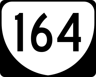
State Route 164 is a 7.27-mile-long (11.70 km) primary state highway in the U.S. state of Virginia that connects the northern parts of Suffolk and Portsmouth with Newport News and Hampton via Interstate 664 (I-664) with Downtown Portsmouth and Norfolk through either the Downtown or Midtown Tunnels.

Pennsylvania Route 283 (PA 283), officially State Route 0300 or SR 0300 due to the presence of Interstate 283 (I-283), is a 29-mile-long (47 km) freeway in the U.S. state of Pennsylvania. It connects Harrisburg to Lancaster, paralleling the old U.S. Route 230. The route follows a generally northwest–southeast direction but is signed east–west. The number was assigned based on the function the route serves as a southeastern extension of I-283, but I-283 and PA 283 are not the same roadway; the two intersect at a partial cloverleaf interchange.

Interstate 70 (I-70) is an Interstate Highway that is located in the Commonwealth of Pennsylvania in the United States. It runs east to west across the southwest part of Pennsylvania and serves the southern fringe of the Pittsburgh metropolitan area.
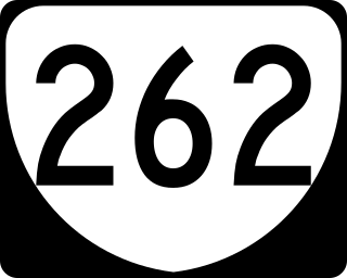
State Route 262 is a primary state highway in the U.S. state of Virginia. Known as Woodrow Wilson Parkway or the Staunton Beltway, the state highway runs 13.70 miles (22.05 km) from Interstate 64 (I-64) and I-81 near Jolivue west, north, and east in a clockwise loop to SR 254 east of Staunton. SR 262 is a three-quarter circumferential highway around Staunton and adjacent portions of Augusta County. The highway contains two- and four-lane freeway and controlled-access segments and interchanges with several major highways, including U.S. Route 11, SR 252, and SR 254 south of Staunton, US 250 on the west side of the city, and I-81 east of Staunton.

U.S. Route 460 (US 460) in Virginia runs west-east through the southern part of the Commonwealth. The road has two separate pieces in Virginia, joined by a relatively short section in West Virginia. Most of US 460 is a four-lane divided highway and is a major artery in the southern third of the state. From Petersburg to Suffolk, US 460 is a four-lane non-divided highway. It is a popular alternative to Interstate 64 (I-64) when going from Richmond and other points in central Virginia to the Currituck Sound and Outer Banks of North Carolina, avoiding the congestion and tunnels of the more northerly I-64 corridor. The road passes through several small towns that built up at stops along the railroad line.

U.S. Route 17 (US 17) is a part of the United States Numbered Highway System that runs from Punta Gorda, Florida, to Winchester, Virginia. In Virginia, the U.S. Highway runs 255.83 miles (411.72 km) from the North Carolina state line in Chesapeake north to its northern terminus at US 11, US 50, and US 522 in Winchester. US 17 is a major highway in the eastern half of Virginia. The U.S. Highway connects the Albemarle Region of North Carolina with the Hampton Roads metropolitan area. Within the urban area, US 17 passes through the South Hampton Roads cities of Chesapeake, Portsmouth, and Suffolk and the Virginia Peninsula city of Newport News. Between Yorktown and Fredericksburg, the U.S. Highway serves as the primary highway of the Middle Peninsula. At Fredericksburg, US 17 leaves the Atlantic Plain; the highway passes through the Piedmont town of Warrenton and crosses the Blue Ridge Mountains on its way to Winchester in the Shenandoah Valley. The route from Tappahannock to Winchester roughly follows the Confederate march during the Civil War to Gettysburg.

State Route 55 is a primary state highway in the U.S. state of Virginia. Known for most of its length as John Marshall Highway, the state highway runs 64.71 miles (104.14 km) from the West Virginia state line, where the highway continues as West Virginia Route 55, east to U.S. Route 29 in Gainesville. West of its interchange with Interstate 81 (I-81) in Strasburg, SR 55 runs concurrently with the easternmost portion of US 48 as part of Corridor H. East of Front Royal, the state highway serves as the local complement of I-66 as it passes through the towns of Marshall, The Plains, and Haymarket.

U.S. Route 22 (US 22) is an east–west United States Numbered Highway that stretches from Cincinnati, Ohio, in the west, to Newark, New Jersey, in the east. In Pennsylvania, the route runs for 338.20 miles (544.28 km) between the West Virginia state line in Washington County, where it is a freeway through the western suburbs of Pittsburgh, and then runs east to Easton and the Pennsylvania–New Jersey state line in the Lehigh Valley region of eastern Pennsylvania.

Interstate 81 (I-81) is an 855.02-mile-long (1,376.02 km) Interstate Highway. In the US state of Virginia, I-81 runs for 324.92 miles (522.91 km), making the portion in Virginia longer than any other state's portion of the route. It is also the longest Interstate Highway within the borders of Virginia. It stretches from the Tennessee state line near Bristol to the West Virginia state line near Winchester. It enters Virginia from Bristol, Tennessee, and leaves Virginia into Berkeley County, West Virginia. The route passes through the cities of Bristol, Roanoke, Salem, Lexington, Staunton, and Harrisonburg.
Interstate 81 (I-81) is a part of the Interstate Highway System that runs from Dandridge, Tennessee, to Fishers Landing, New York. In Maryland, the Interstate Highway runs 12.08 miles (19.44 km) from the West Virginia state line at the Potomac River in Williamsport north to the Pennsylvania state line near Maugansville. I-81 is the primary north–south Interstate Highway in Washington County, connecting Hagerstown with Chambersburg and Harrisburg to the north and Martinsburg, Winchester, and Roanoke to the south.
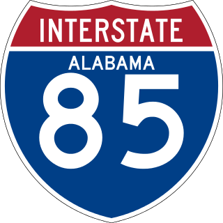
Interstate 85 (I-85) is a part of the Interstate Highway System that runs from Montgomery, Alabama, to Petersburg, Virginia. In Alabama, the Interstate Highway runs 80 miles (130 km) from I-65 in Montgomery northeast to the Georgia state line near Valley. Although it is nominally north–south as it carries an odd number, I-85 travels east–west through the state. It is the primary highway between Montgomery and Atlanta. The Interstate also connects Montgomery with Tuskegee, Auburn, Opelika, and, indirectly, Phenix City and Columbus, Georgia.

U.S. Route 322 is a spur of US 22, running from Cleveland, Ohio, east to Atlantic City, New Jersey. In the U.S. state of Pennsylvania, the route runs from the Ohio state line in West Shenango Township southeast to the Commodore Barry Bridge over the Delaware River in Chester, at which point the route crosses into New Jersey, meeting the New Jersey Turnpike at exit 2. The route passes near or through several cities, including Meadville, DuBois, State College, and Harrisburg. US 322 in Pennsylvania is named the 28th Division Highway in honor of the 28th Infantry Division.


