Opequon, Virginia

Last updated

Opequon, Virginia
Second Opequon Presbyterian Church 2.JPG
Second Opequon Presbyterian Church
USA Virginia location map.svg
Red pog.svg
Opequon
Usa edcp location map.svg
Red pog.svg
Opequon
Coordinates: 39°9′26″N78°14′48″W / 39.15722°N 78.24667°W / 39.15722; -78.24667
CountryUnited States
State Virginia
County Frederick
Time zone UTC−5 (Eastern (EST))
  Summer (DST) UTC−4 (EDT)
GNIS feature ID1499825 [1]

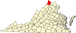
Opequon is an unincorporated community along Opequon Creek in Frederick County, northwestern Virginia. Also known as Kernstown, the community center is served by Cedar Creek Grade (VA 622) at Miller Road (VA 620).

The community of Opequon was designated as a National Historic District in 2002. Opequon School, [2] which operated from 1884 to 1934, still stands on Glass Spring Road in town. Also on this road is the Second Opequon Presbyterian Church. [3]

The Opequon Quaker Camp (OQC) is a sleep-away, coed summer camp for children ages nine to fourteen; it is located just north of Winchester, Virginia. It as a part of the Baltimore Yearly Meeting Camps. While it is a Quaker camp, it is open to non-Quaker children and has attracted campers from other regions and countries. Camping trips and activities feature canoeing, backpacking on the Appalachian Trail, rock climbing, and chores.

Related Research Articles

<span class="mw-page-title-main">Newport, Michigan</span> Unincorporated community in Michigan, United States

Newport is an unincorporated community in Monroe County in the U.S. state of Michigan. The community is located within Berlin Charter Township. As an unincorporated community, Newport has no legally defined boundaries or population statistics of its own but does have its own post office with the 48166 ZIP Code.

Gainesboro is an unincorporated community in Frederick County, Virginia. Gainesboro is located northwest of Winchester off the North Frederick Pike on Gainesboro Road. Gainesboro is the northernmost community in Virginia.

Egypt is an unincorporated community in Jefferson County, West Virginia, United States. It is located between Opequon Creek and Leetown off Sulphur Spring Road on Egypt Road.

<span class="mw-page-title-main">White Hall, Frederick County, Virginia</span> Unincorporated community in Virginia, United States

White Hall is an unincorporated farming community in northern Frederick County, Virginia, established in the late 1810s and located near the crossroads of Apple Pie Ridge Road with Green Spring and White Hall Roads, astride Apple Pie Ridge.

Green Spring is an unincorporated community in northern Frederick County, Virginia, United States of America. Green Spring lies on the southern flank of North Mountain along Green Spring Run, a tributary stream of Back Creek. The community is located on Green Spring Road at its junction with Cedar Grove Road.

Bartonsville is an unincorporated community located along Opequon Creek in Frederick County, Virginia between Winchester and Stephens City. Bartonsville is on Springdale Road to the west of Valley Pike. Historically, it has been referred to as Barton's Mill and Bartonville. The area of Bartonsville was first settled by the Hite Family in 1733. During the American Civil War, the village was garrisoned with a small stone fort of unknown location held by the Union Army.

De Haven is an unincorporated community in northern Frederick County, Virginia. Originally known as Duck Race, De Haven sprang up as a farming community on Back Creek at its confluence with Babbs Run. De Haven is located on Green Spring Road at Hodges Lane.

Mill Creek is a 14.5-mile-long (23.3 km) tributary of Opequon Creek, belonging to the Potomac River and Chesapeake Bay watersheds, located in Berkeley County in West Virginia's Eastern Panhandle. Its name reflects its past as a popular site for various types of mills, beginning with one constructed by Morgan Morgan in the mid-18th century near his cabin in present-day Bunker Hill.

<span class="mw-page-title-main">Tuscarora Creek (Opequon Creek tributary)</span>

Tuscarora Creek in Berkeley County, West Virginia, is an 11.4-mile-long (18.3 km) tributary of Opequon Creek, which drains into the Potomac River in the Chesapeake Bay watershed.

<span class="mw-page-title-main">Brucetown, Virginia</span> Unincorporated community in Virginia, United States

Brucetown is an unincorporated community and census-designated place (CDP) in northern Frederick County, Virginia, United States. It was first listed as a CDP in the 2020 census with a population of 274. Brucetown lies at the intersection of Brucetown and Sir John Roads. A post office was established in the community in 1819. Brucetown also had its own school in operation from 1871 to 1941.

Burnt Factory is an unincorporated community in Frederick County, Virginia, United States. Burnt Factory lies to the northeast of Winchester along Opequon Creek. The community is centered at the intersection of Burnt Factory and Jordan Springs Roads.

Kernstown is an unincorporated community within the independent city of Winchester, Virginia. Parts of Kernstown also lie within Frederick County. It is centered along the Valley Pike U.S. Route 11. During the American Civil War, the first and second Battles of Kernstown were fought here.

Leetown is an unincorporated community in northern Frederick County, Virginia, United States. Leetown is located on Old Charles Town Road at its intersection with Gun Club Road to the west of Opequon Creek. According to the Geographic Names Information System, Leetown has also been known throughout its history as Opequon Hill.

Parkins Mills is an unincorporated community in Frederick County, Virginia. Parkins Mills lies southeast of Winchester on the Front Royal Pike at Opequon Creek.

<span class="mw-page-title-main">Seneca Creek (North Fork South Branch Potomac River tributary)</span> River in West Virginia, United States

Seneca Creek is a 19.6-mile-long (31.5 km) tributary of the North Fork of the South Branch of the Potomac River located entirely within Pendleton County, West Virginia, USA.

Abrams Creek is an 11.2-mile-long (18.0 km) tributary stream of Opequon Creek in Frederick County and the independent city of Winchester in Virginia. Abrams Creek rises north of Round Hill and flows in a southeasterly direction through Winchester. From Winchester, Abrams Creek flows east into Opequon Creek. The stream was originally known as Abraham's Creek.

<span class="mw-page-title-main">Sigma, Virginia</span> Unincorporated community in Virginia, United States

Sigma is a small community near Sandbridge in the independent city of Virginia Beach, Virginia, United States. Sigma lies just south of Lago Mar on Ashville Bridge Creek along Sandbridge Road at its intersection with New Bridge Road.

Baywood is an unincorporated community and census-designated place (CDP) in Grayson County, in the southwestern part of the U.S. state of Virginia. It was first listed as a CDP in the 2020 census with a population of 414.

<span class="mw-page-title-main">Quick, West Virginia</span> Unincorporated community in West Virginia, United States

Quick is a small unincorporated community in Kanawha County, West Virginia, United States. It is located along Indian Creek Road. The community is where Whitoak Fork and Blue Creek come together and meet. It is also where the abandoned railroad that follows Blue Creek joins the road, and follows it all the way to the community of Hitop, along Pond Fork. Its post office is closed.

Deatonville is a rural unincorporated community in the western part of Amelia County in the U.S. state of Virginia. It is located in Leigh District along SR 616 at its junctions with SR 617. Deatonville straddles the boundary between ZIP codes 23083 (Jetersville) and 23966 (Rice). One segment of U.S. Bicycle Route 1 runs southwest from Richmond; this segment follows the entire length of SR 616 through Amelia County and passes through Deatonville.

References