Cross Junction, Virginia

Last updated

Cross Junction, Virginia
USA Virginia location map.svg
Red pog.svg
Cross Junction
Usa edcp location map.svg
Red pog.svg
Cross Junction
Coordinates: 39°19′13″N78°17′36″W / 39.32028°N 78.29333°W / 39.32028; -78.29333
CountryUnited States
State Virginia
County Frederick
Time zone UTC−5 (Eastern (EST))
  Summer (DST) UTC−4 (EDT)
ZIP codes
22625
GNIS feature ID1477234 [1]

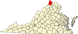
Cross Junction is an unincorporated community in northern Frederick County, Virginia, United States. Cross Junction is located on the North Frederick Pike (U.S. Highway 522) at its intersection with Collinsville Road. Cross Junction also encompasses the residential communities at Lake Holiday to the south.

History and terrain

Cross Junction and its environs consist of rain-fed streams and springs. It is the traditional home of the indigenous Shawnee, who had a settlement and court at Shawnee Springs. A few old farms in the area are owned mostly descendants of the founders of the European-American community, which dated from the 18th century. Some date back to the days when George Washington first visited the land and surveyed it.

Related Research Articles

<span class="mw-page-title-main">Frederick County, Virginia</span> County in Virginia, United States

<span class="mw-page-title-main">Berkeley County, West Virginia</span> County in West Virginia, United States

Berkeley County is located in the Shenandoah Valley in the Eastern Panhandle region of West Virginia in the United States. The county is part of the Hagerstown-Martinsburg, MD-WV Metropolitan Statistical Area. As of the 2020 census, the county population was 122,076, making it the second-most populous of West Virginia's 55 counties, behind Kanawha County. The City of Martinsburg is the county seat.

<span class="mw-page-title-main">Winchester, Virginia</span> Independent city in Virginia, United States

Winchester is the northwesternmost independent city in the Commonwealth of Virginia, United States. It is the county seat of Frederick County, although the two are separate jurisdictions. As of the 2020 census, the city's population was 28,120. It is the principal city of the Winchester metropolitan area extending into West Virginia, which is a part of the Washington–Baltimore combined statistical area. Winchester is home to Shenandoah University and the Museum of the Shenandoah Valley.

<span class="mw-page-title-main">Point of Rocks, Maryland</span> Census-designated place in Maryland, United States

Point of Rocks is an unincorporated community and census-designated place (CDP) in Frederick County, Maryland, United States. As of the 2010 census it had a population of 1,466. It is named for the striking rock formation on the adjacent Catoctin Mountain, which was formed by the Potomac River cutting through the ridge in a water gap, a typical formation in the Appalachian Mountains. The formation is not visible from the town and can only be seen from boats on the river, or from the southern bank of the river in Virginia.

<span class="mw-page-title-main">Shawnee</span> Indigenous peoples of the Northeastern Woodlands

The Shawnee are an Indigenous people of the Northeastern Woodlands. Their language, Shawnee is an Algonquian language.

<span class="mw-page-title-main">U.S. Route 522</span> Highway in the United States

U.S. Route 522 is a spur route of US 22 in the states of Virginia, West Virginia, Maryland, and Pennsylvania. The U.S. Highway travels in a north-south direction, and runs 308.59 miles (496.63 km) from US 60 near Powhatan, Virginia, to its northern terminus at US 11 and US 15 near Selinsgrove, Pennsylvania. US 522 serves many small cities and towns in the Piedmont, Blue Ridge Mountains, and northern Shenandoah Valley of Virginia. The highway serves the Virginia communities of Goochland, Mineral, Culpeper, the town of Washington, and Front Royal and the independent city of Winchester. US 522 then follows the Ridge-and-Valley Appalachians north and then east through the Eastern Panhandle of West Virginia, a 2-mile-wide (3.2 km) stretch of Western Maryland, and South Central Pennsylvania to its terminus in the Susquehanna Valley. The highway serves Berkeley Springs, West Virginia; Hancock, Maryland; and the Pennsylvania communities of McConnellsburg, Mount Union, Lewistown, and Middleburg.

<span class="mw-page-title-main">U.S. Route 340</span> US Numbered Highway in Virginia, West Virginia and Maryland, United States

U.S. Route 340 is a spur route of US 40, and runs from Greenville, Virginia, to Frederick, Maryland. In Virginia, it runs north–south, parallel and east of US 11, from US 11 north of Greenville via Waynesboro, Grottoes, Elkton, Luray, Front Royal, and Berryville to the West Virginia state line. A short separate piece crosses northern Loudoun County on its way from West Virginia to Maryland.

<span class="mw-page-title-main">Winchester, VA–WV MSA</span> Metropolitan area in the United States

Winchester, VA–WV MSA is a U.S. metropolitan statistical area (MSA) as defined by the United States Office of Management and Budget (OMB) as of June, 2003. This should not be confused with the City of Winchester, Virginia, the most populous community within this MSA. The population of the MSA as the 2015 U.S. Census Bureau estimates is 133,836.

<span class="mw-page-title-main">Yellow Spring, West Virginia</span> Unincorporated community in West Virginia, United States

Yellow Spring is an unincorporated community in Hampshire County in the U.S. state of West Virginia. According to the 2000 census, the Yellow Spring community has a population of 296. Yellow Spring is named after the "Yellow Spring" located there on the Cacapon River. The community lies at the junction of West Virginia Route 259 and Cacapon River Road. Yellow Spring is sometimes incorrectly listed or referred to as Yellowspring or Yellow Springs.

<span class="mw-page-title-main">West Virginia Route 259</span>

West Virginia Route 259 is a state highway in the U.S. state of West Virginia. The state highway runs 45.6 miles (73.4 km) from the Virginia state line near Mathias north to the Virginia state line at High View. At both termini, the road continues as Virginia State Route 259. WV 259 passes through Hardy and Hampshire counties and runs concurrently with WV 55 on Corridor H between Baker and Wardensville.

<span class="mw-page-title-main">Virginia State Route 127</span>

State Route 127 is a primary state highway in the U.S. state of Virginia. The state highway begins at the West Virginia state line at Good, West Virginia, where the highway continues west as West Virginia Route 127. SR 127 heads east 3.55 miles (5.71 km) to U.S. Route 522 near Cross Junction in northwestern Frederick County. SR 127 is the easternmost portion of Bloomery Pike, a turnpike that connected Winchester with the namesake iron smelting center.

Back Creek is a 59.5-mile-long (95.8 km) tributary of the Potomac River that flows north from Frederick County, Virginia, to Berkeley County in West Virginia's Eastern Panhandle. Back Creek originates along Frederick County's border with Hampshire County, West Virginia, at Farmer's Gap in the Great North Mountain. Its name reflects its location to the west of North Mountain. The perspective of colonists from the east in the 18th century led them to call it "Back Creek", because it lay to the back of North Mountain.

Green Spring is an unincorporated community in northern Frederick County, Virginia, United States of America. Green Spring lies on the southern flank of North Mountain along Green Spring Run, a tributary stream of Back Creek. The community is located on Green Spring Road at its junction with Cedar Grove Road.

Reynolds Store is an unincorporated community in northern Frederick County, Virginia. Reynolds Store is located along the North Frederick Pike at its crossroads with Cumberland Trail Road and Reynolds Road. The post office of neighboring Cross Junction serves the community.

<span class="mw-page-title-main">Whitacre, Virginia</span> Unincorporated community in Virginia, United States

Whitacre is an unincorporated community in northern Frederick County, Virginia, United States. Whitacre lies on the old Braddock Road on the eastern flanks of Timber Ridge between Good and Cross Junction. Whitacre is located north of Lake Holiday. The community takes its name from the Whitacre family that owned land in its vicinity.

Mill Creek is a 14.5-mile-long (23.3 km) tributary of Opequon Creek, belonging to the Potomac River and Chesapeake Bay watersheds, located in Berkeley County in West Virginia's Eastern Panhandle. Its name reflects its past as a popular site for various types of mills, beginning with one constructed by Morgan Morgan in the mid-18th century near his cabin in present-day Bunker Hill.

Institute is an unincorporated community on the Kanawha River in Kanawha County, West Virginia, United States. Interstate 64 and West Virginia Route 25 pass by the community, which has grown to intermingle with nearby Dunbar. As of 2018, the community had a population of 1,489, 54% of whom were African American.

Shawnee Land is a residential community in Frederick County, Virginia, United States. Shawnee Land is located on the eastern slopes of Great North Mountain. The U.S. Census Bureau defines it as a census-designated place, with a population of 1,873 as of 2010. In its past, Shawnee Land was a ski resort, with a number of slopes located on the eastern side of Great North Mountain. Shawnee Land thrived for a few years, but eventually the investors abandoned the project and the ski slopes were closed.

<span class="mw-page-title-main">Great Indian Warpath</span> Part of network of trails in eastern North America used by Native Americans

The Great Indian Warpath (GIW)—also known as the Great Indian War and Trading Path, or the Seneca Trail—was that part of the network of trails in eastern North America developed and used by Native Americans which ran through the Great Appalachian Valley. The system of footpaths extended from what is now upper New York to deep within Alabama. Various Native peoples traded and made war along the trails, including the Catawba, numerous Algonquian tribes, the Cherokee, and the Iroquois Confederacy. The British traders' name for the route was derived from combining its name among the northeastern Algonquian tribes, Mishimayagat or "Great Trail", with that of the Shawnee and Delaware, Athawominee or "Path where they go armed".

Bacova Junction is an unincorporated community in Bath County, Virginia, in the United States. Bacova Junction is situated 2.9 miles (4.7 km) west of Hot Springs, and Virginia State Route 615 and Virginia State Route 687 converge at the community. Historically, Bacova Junction was known for its timber industry.

References