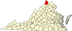
De Haven, Virginia

Last updated
De Haven, Virginia
USA Virginia location map.svg
Red pog.svg
De Haven
Usa edcp location map.svg
Red pog.svg
De Haven
Coordinates: 39°20′59″N78°11′9″W / 39.34972°N 78.18583°W / 39.34972; -78.18583
CountryUnited States
State Virginia
County Frederick
Time zone UTC−5 (Eastern (EST))
  Summer (DST) UTC−4 (EDT)
GNIS feature ID1499329 [1]

De Haven is an unincorporated community in northern Frederick County, Virginia. Originally known as Duck Race, De Haven sprang up as a farming community on Back Creek at its confluence with Babbs Run. De Haven is located on Green Spring Road (VA 671) at Hodges Lane (VA 741).

Historic sites

Related Research Articles

<span class="mw-page-title-main">Frederick County, Virginia</span> County in Virginia, United States

Pine Grove or pinegrove may refer to:

Scouting in Delaware has a long history, from the 1910s to the present day, serving thousands of youth in programs that suit the environment in which they live.

<span class="mw-page-title-main">Pine Grove Township, Michigan</span> Township in Michigan, United States

Pine Grove Township is a civil township of Van Buren County in the U.S. state of Michigan. The population was 2,773 at the 2000 census.

<span class="mw-page-title-main">Sandston, Virginia</span> Census-designated place in Virginia, United States

Sandston is a census-designated place (CDP) in Henrico County, Virginia, United States, just outside the state capital of Richmond. The population as of the 2010 Census was 7,571. It was designated a Historic District by Henrico County in 2021.

<span class="mw-page-title-main">George Washington Memorial Parkway</span> 7,142-acre parkway maintained by the National Park Service

The George Washington Memorial Parkway, colloquially the G.W. Parkway, is a 25-mile-long (40 km) parkway that runs along the south bank of the Potomac River from Mount Vernon, Virginia, northwest to McLean, Virginia, and is maintained by the National Park Service (NPS). It is located almost entirely within Virginia, except for a short portion of the parkway northwest of the Arlington Memorial Bridge that passes over Columbia Island within the District of Columbia.

Back Creek is a 59.5-mile-long (95.8 km) tributary of the Potomac River that flows north from Frederick County, Virginia, to Berkeley County in West Virginia's Eastern Panhandle. Back Creek originates along Frederick County's border with Hampshire County, West Virginia, at Farmer's Gap in the Great North Mountain. Its name reflects its location to the west of North Mountain. The perspective of colonists from the east in the 18th century led them to call it "Back Creek", because it lay to the back of North Mountain.

Sugar Grove is an unincorporated community in Montgomery County, Virginia, United States. Sugar Grove is part of the Blacksburg-Christiansburg metropolitan area. Sugar Grove at one time hosted a school, a post office, two stores, a vegetable canning facility, and a little less than one hundred families.

Green Spring is an unincorporated community in northern Frederick County, Virginia, United States of America. Green Spring lies on the southern flank of North Mountain along Green Spring Run, a tributary stream of Back Creek. The community is located on Green Spring Road at its junction with Cedar Grove Road.

Pine Grove is an unincorporated community in Marion County, West Virginia, United States. Pine Groves lies to the west of Barrackville along Buffalo Creek.

<span class="mw-page-title-main">Pine Grove, Fayette County, West Virginia</span> Unincorporated community in West Virginia, United States

Pine Grove is an unincorporated community in Fayette County, West Virginia, United States. It lies off U.S. Highway 19 on County Route 5/3.

<span class="mw-page-title-main">Virginia State Route 205</span>

State Route 205 is a primary state highway in the U.S. state of Virginia. The state highway runs 18.47 miles (29.72 km) from SR 3 at Purkins Corner east to SR 3 at Oak Grove. SR 205 connects several small communities in eastern King George County and northwestern Westmoreland County. The state highway also passes through the Potomac River resort of Colonial Beach, where the highway has a spur, State Route 205Y.

<span class="mw-page-title-main">Virginia State Route 218</span>

State Route 218 is a primary state highway in the U.S. state of Virginia. The state highway runs 30.00 miles (48.28 km) from U.S. Route 1 and US 17 Business in Falmouth east to SR 205 in Tetotum. SR 218 connects suburban communities in Stafford County east of Fredericksburg with rural areas in northern and eastern King George County.

<span class="mw-page-title-main">Pennsylvania Route 443</span> State highway in Pennsylvania, US

Pennsylvania Route 443 is an 80-mile-long (130 km) east–west state highway in the US state of Pennsylvania. The western terminus is at an intersection with State Route 3009 at North Front Street on the east bank of the Susquehanna River in the community of Fort Hunter in Middle Paxton Township, just west of an interchange with the U.S. Route 22 /US 322 freeway. The eastern terminus is at US 209 in Lehighton. The route runs through rural areas in the Ridge-and-Valley Appalachians in Dauphin, Lebanon, Schuylkill, and Carbon counties, serving Fort Indiantown Gap, Pine Grove, Schuylkill Haven, Orwigsburg, New Ringgold, and South Tamaqua. PA 443 intersects several major roads, including US 22/US 322 near its western terminus, PA 72 in Union Township, Interstate 81 (I-81) near Pine Grove, PA 61 between Schuylkill Haven and Orwigsburg, and PA 309 in South Tamaqua.

Dale Enterprise is an unincorporated community in Rockingham County, Virginia, United States. The name dates to 1872, when it was time to name the village's post office. The place was previously known as Millersville, after the Miller family who ran an early store there. After the Civil War, Mr. J. W. Minnick started a new mercantile “enterprise” at the crossroads of Silver Lake Road and Route 33. Minnick’s store was located near a “dale,” so the chosen name became Dale Enterprise.

Pine Grove is an unincorporated community in Page County, in the U.S. state of Virginia.

The Rennie Memorial Presbyterian Church is a Presbyterian Church congregation in Amelia, Virginia, US. It was established on April 23, 1950 and sits on grounds that were previously occupied by the Amelia Presbyterian Church.

<span class="mw-page-title-main">Big Woods State Forest</span> State forest in Virginia, United States

Big Woods State Forest is a 2,188-acre (8.85 km2) state forest in Sussex County, Virginia. It was the first state forest property to be established in southeast Virginia.

<span class="mw-page-title-main">Big Woods Wildlife Management Area</span> Protected area of Virginia, United States

Big Woods Wildlife Management Area is a 4,173-acre (16.89 km2) Wildlife Management Area (WMA) in Sussex County, Virginia. It comprises two tracts of land; the 2,208-acre (8.94 km2) main tract, located immediately adjacent Big Woods State Forest, and the 1,965-acre (7.95 km2) Parker's Branch tract, located nearby.

References