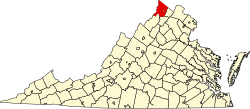
Gravel Springs, Virginia | |
---|---|
Coordinates: 39°4′30″N78°26′25″W / 39.07500°N 78.44028°W | |
Country | United States |
State | Virginia |
County | Frederick |
Time zone | UTC−5 (Eastern (EST)) |
• Summer (DST) | UTC−4 (EDT) |
GNIS feature ID | 1495609 [1] |
Gravel Springs is an unincorporated community in Frederick County, Virginia, United States. Gravel Springs was established in 1872. It lies south of Star Tannery at the intersection of Brill, Star Tannery, and Gravel Springs Roads.
Buena Vista is an independent city located in the Blue Ridge Mountains region of Virginia in the United States. As of the 2020 census, the population was 6,641. The Bureau of Economic Analysis combines the independent cities of Buena Vista and Lexington, along with surrounding Rockbridge County, for statistical purposes.
White Sulphur Springs is a city in Greenbrier County in southeastern West Virginia, United States. The population was 2,231 at the 2020 census. The city emblem consists of five dandelion flowers and the citizens celebrate spring with an annual Dandelion Festival.
Conglomerate is a clastic sedimentary rock that is composed of a substantial fraction of rounded to subangular gravel-size clasts. A conglomerate typically contains a matrix of finer-grained sediments, such as sand, silt, or clay, which fills the interstices between the clasts. The clasts and matrix are typically cemented by calcium carbonate, iron oxide, silica, or hardened clay.
Boulder clay is an unsorted agglomeration of clastic sediment that is unstratified and structureless and contains gravel of various sizes, shapes, and compositions distributed at random in a fine-grained matrix. The fine-grained matrix consists of stiff, hard, pulverized clay or rock flour. Boulder clay is also known as either known as drift clay; till; unstratified drift, geschiebelehm (German); argile á blocaux (French); and keileem (Dutch).
Star Tannery is an unincorporated community in southwestern Frederick County, Virginia on the Shenandoah County line. Star Tannery is located on Star Tannery Road off Wardensville Pike along Cedar Creek. The Zip Code for Star Tannery is 22654.
Tannery is an unincorporated community in Hardy County, West Virginia, United States. Tannery is located south of Moorefield on the South Fork South Branch Potomac River.
Devil's Backbone State Forest is a 705.5-acre (285.5 ha) state forest in Shenandoah County, Virginia. It lies on the slope of North Mountain in the drainage area of Cedar Creek near Star Tannery west of Strasburg. The forest was established by a grant by John and Bernice Hoffman, who owned the land since 1950.
Cedar Creek is a 40.5-mile-long (65.2 km) tributary stream of the North Fork Shenandoah River in northern Virginia in the United States. It forms the majority of the boundary between Frederick and Shenandoah counties. Cedar Creek's confluence with the North Fork Shenandoah is located at Strasburg.
State Route 91 is a primary state highway in the U.S. state of Virginia. The state highway runs 55.12 miles (88.71 km) from the Tennessee state line near Damascus, where the highway continues as Tennessee State Route 91, north to U.S. Route 19 Business and US 460 Business at Frog Level. SR 91 connects Damascus in southeastern Washington County with the northeastern county town Glade Spring, where the highway has junctions with US 11 and Interstate 81 (I-81). The state highway also indirectly connects Saltville in northwestern Smyth County and Tazewell, the county seat of Tazewell County. SR 91 is the only primary state highway in Virginia with an unpaved section; this gravel section is in southern Tazewell County.
Telegraph Spring is an unincorporated community in Loudoun County, Virginia. Telegraph Spring lies to the south of Hamilton.
Big Spring State Park is a 45-acre (18 ha) Pennsylvania state park in Toboyne Township, Perry County, Pennsylvania in the United States. The park is on Pennsylvania Route 274, 5.5 miles (8.9 km) southwest of New Germantown. Big Spring State Park is a hiking and picnic area. A partially completed railroad tunnel in Conococheague Mountain is a feature of the park.
Sleepy Creek Wildlife Management Area is located in Morgan and Berkeley Counties in West Virginia's Eastern Panhandle. It encompasses 22,928 acres (92.79 km2), mostly covered with mixed oak and pine forest, although about 3,500 acres (14 km2) are covered with mixed hardwoods. The 205-acre (83 ha) Sleepy Creek Lake is located entirely within the WMA.
Fort Spring is an unincorporated community and town in Greenbrier County, West Virginia, United States. It is situated along the Greenbrier River within the Greenbrier River Watershed. It was once a substantial portion of the Chesapeake and Ohio railway by way of the Gravel Girtie route from Hinton in Summers County to Clifton Forge, Virginia. The name is derived from its main export; Mississippian limestone from Snowflake Quarry sent to Clifton Forge. The main road going through the small town was once the original rail line, but was moved.
Brabson's Ferry Plantation is a Pioneer Century farm and former antebellum plantation near the U.S. city of Sevierville, Tennessee. Located at what was once a strategic crossing of the French Broad River, by 1860 the plantation had become one of the largest in East Tennessee, and one of the few in the region that rivalled the large plantations of the Deep South in size and influence. The farm remains in operation, and several of its historic structures— including two plantation houses and an 18th-century plank house— have been added to the National Register of Historic Places.
Mousetail Landing State Park is a 1,247-acre (5.05 km2) state park located on the eastern bank of the Tennessee River in Perry County, Tennessee near Linden. The park was established in 1979, making it one of the more recent additions to the Tennessee State Parks system. The name is thought to have been derived from an event during the American Civil War in which a tannery located at a river landing on the site of the present day state park caught fire. The tannery was infested with an unusually large number of mice which fled the burning tannery in the direction of the landing, giving the landing its present name.
John Brown Farm, Tannery & Museum, 17620 John Brown Rd., Guys Mills, PA 16327, is a historic archaeological site located in Richmond Township, Crawford County, Pennsylvania. The tannery was built in 1825 by famed abolitionist John Brown (1800–1859), who lived on the site from 1825 to 1835. The tannery was about 0.25 miles (0.40 km) from the new Pennsylvania and Ohio Canal.
The Ruffner House, also known as Luray Tannery Farm, is a historic home and farm complex located at Luray, Page County, Virginia. It was built in two phases, about 1825 and about 1851. It is a two-story, Federal / Greek Revival style brick dwelling with a hipped with deck roof, a stone foundation, and one-story porches on the two fronts. The house was remodeled in the 1920s. Also on the property are the contributing rambling two-story frame residence known as The Cottage; a stone spring house with attached brick pumphouse that served an adjacent tannery; schoolhouse and shop; root cellar; secondary barn; dairy; machinery shed; chicken house; a swimming pool; an 1890s bank barn, and the small Ruffner Cemetery.