Marlboro, Virginia | |
---|---|
Coordinates: 39°4′53″N78°19′20″W / 39.08139°N 78.32222°W | |
Country | United States |
State | Virginia |
County | Frederick |
Time zone | UTC−5 (Eastern (EST)) |
• Summer (DST) | UTC−4 (EDT) |
GNIS feature ID | 1495901 [1] |
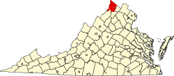
Marlboro is an unincorporated community in Frederick County, Virginia, United States. It is located at the intersection of Middle Road (VA 628) and Cedar Creek Grade (VA 622) on Cedar Creek. Marlboro was originally known as Marlborough and Marlboroughtown.
The Shenandoah River is the principal tributary of the Potomac River, 55.6 miles (89.5 km) long with two forks approximately 100 miles (160 km) long each, in the U.S. states of Virginia and West Virginia. The river and its tributaries drain the central and lower Shenandoah Valley and the Page Valley in the Appalachians on the west side of the Blue Ridge Mountains, in northwestern Virginia and the Eastern Panhandle of West Virginia. There is a hydroelectric plant along the Shenandoah river constructed in 2014 by Dominion.
The Army of West Virginia served in the Union Army during the American Civil War and was the primary field army of the Department of West Virginia. It campaigned primarily in West Virginia, Southwest Virginia and in the Shenandoah Valley. It is noted for having two future U.S. presidents serve in its ranks: Rutherford B. Hayes and William McKinley, both from the 23rd Ohio Infantry. With fighting in the Valley ended, the Army of West Virginia's designation was discontinued.
The James River and Kanawha Canal was a partially built canal in Virginia intended to facilitate shipments of passengers and freight by water between the western counties of Virginia and the coast. Ultimately its towpath became the roadbed for a rail line following the same course.
Green Spring is an unincorporated community in northern Frederick County, Virginia, United States of America. Green Spring lies on the southern flank of North Mountain along Green Spring Run, a tributary stream of Back Creek. The community is located on Green Spring Road at its junction with Cedar Grove Road.
Opequon is an unincorporated community along Opequon Creek in Frederick County, Virginia. Opequon is located on Cedar Creek Grade at Miller Road and also known as Kernstown, Virginia. The community of Opequon was designated a National Historic District in 2002. Opequon School, which was in operation from 1884 to 1934, remains standing on Glass Spring Road in town. Also on Glass Spring Road is the Second Opequon Presbyterian Church. Home to Opequon Quaker Camp on brucetown road.
Schoolhouse Creek is a creek which flows through the city of Berkeley, California in the San Francisco Bay Area.
Devil's Backbone State Forest is a 705.5-acre (285.5 ha) state forest in Shenandoah County, Virginia. It lies on the slope of North Mountain in the drainage area of Cedar Creek near Star Tannery west of Strasburg. The forest was established by a grant by John and Bernice Hoffman, who owned the land since 1950.
Cedar Creek and Belle Grove National Historical Park became the 388th unit of the United States National Park Service when it was authorized on December 19, 2002. The National Historical Park was created to protect several historically significant locations in the Shenandoah Valley of Northern Virginia, notably the site of the American Civil War Battle of Cedar Creek and the Belle Grove Plantation.
Cedar Creek is a 40.5-mile-long (65.2 km) tributary stream of the North Fork Shenandoah River in northern Virginia in the United States. It forms the majority of the boundary between Frederick and Shenandoah counties. Cedar Creek's confluence with the North Fork Shenandoah is located at Strasburg.
Potomac Creek is a 16.7-mile-long (26.9 km) tidal tributary of the Potomac River in King George and Stafford counties, Virginia. Potomac Creek's source lies between the communities of Glendie and Paynes Corner in Stafford County. It empties into the Potomac River at Marlboro Point. Potomac Creek forms as a dam to form Abel Lake.
The 5th West Virginia Infantry Regiment was an infantry regiment that served in the Union Army during the American Civil War.
Chotank Creek Natural Area Preserve is a 1,108-acre (4.48 km2) Natural Area Preserve located in King George County, Virginia. The preserve is situated east of Caledon State Park, and borders the Potomac River to which the preserve's namesake, Chotank Creek, is tributary. It is part of the larger Cedar Grove farm, which is protected by a conservation easement. The preserve was dedicated in 2001 through an agreement with the property's private landowner.
The 13th Virginia Infantry Regiment was an infantry regiment raised in central and western Virginia for service in the Confederate States Army during the American Civil War. It fought mostly with the Army of Northern Virginia.
The 123rd Ohio Infantry Regiment, sometimes 123rd Ohio Volunteer Infantry was an infantry regiment in the Union Army during the American Civil War.
The 34th Regiment Massachusetts Volunteer Infantry was an infantry regiment that served in the Union Army during the American Civil War.
The Eastern Magisterial District is one of three magisterial districts in Jackson County, West Virginia, United States. It was established during a process of redistricting undertaken in the 1990s. In 2010, 9,882 people lived in the district.